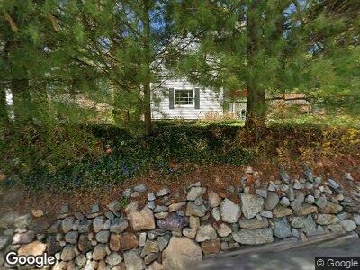
1292 Westbrook Rd West Milford, NJ 07480
Estimated Value: $390,201 - $456,000
--
Bed
--
Bath
1,389
Sq Ft
$311/Sq Ft
Est. Value
About This Home
This home is located at 1292 Westbrook Rd, West Milford, NJ 07480 and is currently estimated at $431,800, approximately $310 per square foot. 1292 Westbrook Rd is a home located in Passaic County with nearby schools including Macopin Middle School and West Milford High School.
Ownership History
Date
Name
Owned For
Owner Type
Purchase Details
Closed on
Sep 9, 1997
Sold by
Hill Thomas R and Hill Janeen A
Bought by
Moore Thomas A
Current Estimated Value
Purchase Details
Closed on
Aug 31, 1995
Sold by
Moore Thomas
Bought by
Hill Thomas
Home Financials for this Owner
Home Financials are based on the most recent Mortgage that was taken out on this home.
Original Mortgage
$140,000
Interest Rate
7.6%
Create a Home Valuation Report for This Property
The Home Valuation Report is an in-depth analysis detailing your home's value as well as a comparison with similar homes in the area
Home Values in the Area
Average Home Value in this Area
Purchase History
| Date | Buyer | Sale Price | Title Company |
|---|---|---|---|
| Moore Thomas A | $166,500 | -- | |
| Hill Thomas | $167,000 | -- |
Source: Public Records
Mortgage History
| Date | Status | Borrower | Loan Amount |
|---|---|---|---|
| Previous Owner | Hill Thomas | $140,000 |
Source: Public Records
Tax History Compared to Growth
Tax History
| Year | Tax Paid | Tax Assessment Tax Assessment Total Assessment is a certain percentage of the fair market value that is determined by local assessors to be the total taxable value of land and additions on the property. | Land | Improvement |
|---|---|---|---|---|
| 2024 | $7,790 | $197,300 | $86,400 | $110,900 |
| 2022 | $7,632 | $197,300 | $86,400 | $110,900 |
| 2021 | $7,468 | $197,300 | $86,400 | $110,900 |
| 2020 | $7,389 | $197,300 | $86,400 | $110,900 |
| 2019 | $7,290 | $197,300 | $86,400 | $110,900 |
| 2018 | $7,272 | $197,300 | $86,400 | $110,900 |
| 2017 | $7,306 | $197,300 | $86,400 | $110,900 |
| 2016 | $7,068 | $197,300 | $86,400 | $110,900 |
| 2015 | $6,983 | $197,300 | $86,400 | $110,900 |
| 2014 | $6,807 | $197,300 | $86,400 | $110,900 |
Source: Public Records
Map
Nearby Homes
- 23 Ridge Rd
- 1455 MacOpin Rd
- 41 Vreeland Rd
- 9 Carteret St
- 97 Wesley Dr
- 61 Virginia Ln
- 28 Bisset Dr
- 220 Rockburn Pass
- 1547 MacOpin Rd
- 104 Vreeland Rd
- 61 Lindys Dr
- 160 Rockburn Pass
- 28 Bradrick Ln
- 0 MacOpin Rd
- 00 MacOpin Rd
- 0 Laurel Hollow
- 75 Lindys Dr
- 10 Rolling Ridge Rd
- 202/207 Rockburn Pass
- 55 Alvin Rd
- 1292 Westbrook Rd
- 1293 Westbrook Rd
- 1286 Westbrook Rd
- 1282 Westbrook Rd
- 1282 W Brook Rd
- 1278 Westbrook Rd
- 1306 Westbrook Rd
- 1274 Westbrook Rd
- 1316 Westbrook Rd
- 1330 Westbrook Rd
- 3 Red Barn Ln
- 33 Holiday Ln
- 9 Red Barn Ln
- 1254 Westbrook Rd
- 19 Holiday Ln
- 23 Holiday Ln
- 19 Red Barn Ln
- 13 Holiday Ln
- 1331 Westbrook Rd
- 18 Red Barn Ln