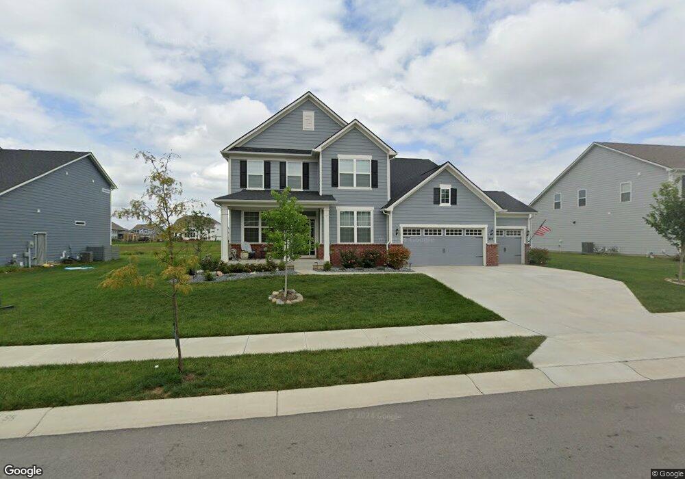
12920 Deer Bank Rd Fishers, IN 46037
Estimated Value: $540,000 - $581,000
3
Beds
4
Baths
3,076
Sq Ft
$181/Sq Ft
Est. Value
About This Home
This home is located at 12920 Deer Bank Rd, Fishers, IN 46037 and is currently estimated at $557,812, approximately $181 per square foot. 12920 Deer Bank Rd is a home with nearby schools including Southeastern Elementary School, Hamilton Southeastern Intermediate / Junior High, and Hamilton Southeastern High School.
Ownership History
Date
Name
Owned For
Owner Type
Purchase Details
Closed on
Dec 9, 2022
Sold by
Rice Peter
Bought by
Rice Peter and Rice Krista
Current Estimated Value
Purchase Details
Closed on
Dec 1, 2022
Sold by
Rice Peter
Bought by
Rice Peter and Rice Krista
Purchase Details
Closed on
Mar 28, 2022
Sold by
Pulte Homes Of Indiana Llc
Bought by
Rice Peter
Home Financials for this Owner
Home Financials are based on the most recent Mortgage that was taken out on this home.
Original Mortgage
$343,000
Interest Rate
3.69%
Mortgage Type
New Conventional
Purchase Details
Closed on
Mar 22, 2022
Sold by
Pulte Homes Of Indiana Llc
Bought by
Rice Peter
Home Financials for this Owner
Home Financials are based on the most recent Mortgage that was taken out on this home.
Original Mortgage
$343,000
Interest Rate
3.69%
Mortgage Type
New Conventional
Create a Home Valuation Report for This Property
The Home Valuation Report is an in-depth analysis detailing your home's value as well as a comparison with similar homes in the area
Home Values in the Area
Average Home Value in this Area
Purchase History
| Date | Buyer | Sale Price | Title Company |
|---|---|---|---|
| Rice Peter | -- | -- | |
| Rice Peter | -- | None Listed On Document | |
| Rice Peter | $491,870 | Chicago Title | |
| Rice Peter | -- | Chicago Title |
Source: Public Records
Mortgage History
| Date | Status | Borrower | Loan Amount |
|---|---|---|---|
| Previous Owner | Rice Peter | $343,000 | |
| Previous Owner | Rice Peter | $343,000 |
Source: Public Records
Tax History Compared to Growth
Tax History
| Year | Tax Paid | Tax Assessment Tax Assessment Total Assessment is a certain percentage of the fair market value that is determined by local assessors to be the total taxable value of land and additions on the property. | Land | Improvement |
|---|---|---|---|---|
| 2024 | $5,328 | $486,800 | $64,500 | $422,300 |
| 2023 | $5,363 | $460,800 | $64,500 | $396,300 |
| 2022 | $3,141 | $264,800 | $64,500 | $200,300 |
| 2021 | $49 | $600 | $600 | $0 |
Source: Public Records
Map
Nearby Homes
- 12853 Cyntheanne Rd
- 15498 Alperton Rd
- 15419 Alperton Rd
- 15443 Alperton Rd
- 15435 Alperton Rd
- 15269 Staffordshire Way
- 12926 Venito Trail
- 15104 Downham Dr
- 15163 Farrington Way
- 15472 Cardonia Rd
- 15131 Farrington Way
- 15198 Swallow Falls Way
- 15464 Cardonia Rd
- 15147 Farrington Way
- 15444 Postman Rd
- 15935 Lambrusco Way
- 16001 Marsala Dr
- 15983 Lambrusco Way
- 16022 Lambrusco Way
- 16003 Malbec St
- 12928 Deer Bank Rd
- 12912 Deer Bank Rd
- 12936 Deer Bank Rd
- 12921 Deer Bank Rd
- 12913 Deer Bank Rd
- 12896 Deer Bank Rd
- 12929 Deer Bank Rd
- 12905 Deer Bank Rd
- 12944 Deer Bank Rd
- 12937 Deer Bank Rd
- 12897 Deer Bank Rd
- 12867 Corydon Dr
- 12976 Deer Bank Rd
- 12959 Gilmour Dr
- 12889 Deer Bank Rd
- 12945 Deer Bank Rd
- 12984 Deer Bank Rd
- 12945 Gilmour Dr
- 12973 Gilmour Dr
- 12881 Deer Bank Rd