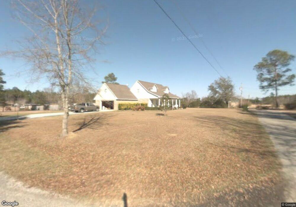
12921 Dixie Hill Dr Moss Point, MS 39562
Estimated Value: $194,911 - $309,000
Studio
2
Baths
2,330
Sq Ft
$103/Sq Ft
Est. Value
About This Home
This home is located at 12921 Dixie Hill Dr, Moss Point, MS 39562 and is currently estimated at $240,478, approximately $103 per square foot. 12921 Dixie Hill Dr is a home located in Jackson County with nearby schools including East Central Lower Elementary School, East Central Upper Elementary School, and East Central Middle School.
Ownership History
Date
Name
Owned For
Owner Type
Purchase Details
Closed on
Jul 29, 2014
Sold by
Robin K Robin K and Blackledge Sonja J
Bought by
Davis Robyn S and Bennett Tony R
Current Estimated Value
Home Financials for this Owner
Home Financials are based on the most recent Mortgage that was taken out on this home.
Original Mortgage
$168,367
Outstanding Balance
$127,117
Interest Rate
4.16%
Mortgage Type
New Conventional
Estimated Equity
$113,361
Create a Home Valuation Report for This Property
The Home Valuation Report is an in-depth analysis detailing your home's value as well as a comparison with similar homes in the area
Purchase History
| Date | Buyer | Sale Price | Title Company |
|---|---|---|---|
| Davis Robyn S | -- | Signature Title Of Ms. |
Source: Public Records
Mortgage History
| Date | Status | Borrower | Loan Amount |
|---|---|---|---|
| Open | Davis Robyn S | $168,367 |
Source: Public Records
Tax History
| Year | Tax Paid | Tax Assessment Tax Assessment Total Assessment is a certain percentage of the fair market value that is determined by local assessors to be the total taxable value of land and additions on the property. | Land | Improvement |
|---|---|---|---|---|
| 2025 | $1,165 | $12,330 | $1,599 | $10,731 |
| 2024 | $1,165 | $11,757 | $1,553 | $10,204 |
| 2023 | $1,111 | $11,757 | $1,553 | $10,204 |
| 2022 | $1,071 | $11,757 | $1,553 | $10,204 |
| 2021 | $1,078 | $11,816 | $1,553 | $10,263 |
| 2020 | $1,007 | $10,818 | $1,215 | $9,603 |
| 2019 | $993 | $10,818 | $1,215 | $9,603 |
| 2018 | $1,018 | $10,818 | $1,215 | $9,603 |
| 2017 | $1,040 | $10,818 | $1,215 | $9,603 |
| 2016 | $987 | $10,818 | $1,215 | $9,603 |
| 2015 | $905 | $100,730 | $12,150 | $88,580 |
| 2014 | $926 | $10,432 | $1,215 | $9,217 |
| 2013 | $979 | $11,261 | $1,215 | $10,046 |
Source: Public Records
Map
Nearby Homes
- 4432 Lily Patch Ln
- 13875 Wolf Ridge Rd Unit LotWP001
- 3601 Sandy Bayou Rd
- 14004 Timber Ridge Dr
- 3700 Dowlwood Rd
- 3724 Dowlwood Rd
- 0 Perry St
- 6312 Bond Hill Rd
- 11213 Easley Rd
- 10 Ac Donniebrook Ln
- 3225 Riverbend Rd
- 10428 Riverbend Cir
- 3016 Ed Parker Rd
- 10401 Dawnridge Dr
- 0 Mississippi 613
- 6400 Hans Rd
- 13111 Maida Hurd Rd
- 10132 Graystone Dr
- 9621 Donchester Cir
- 9504 Kimberly Cir
- 12920 McNeese Ln
- 12924 McNeese Ln
- 12920 Dixie Hill Dr
- 12908 Dixie Hill Dr
- 12900 McNeese Ln
- 12904 Dixie Hill Dr
- 13000 McNeese Ln
- 4420 Rainwater St
- 12820 McNeese Ln
- 12901 Dixie Hill Dr
- 4416 Rainwater St
- 12921 McNeese Ln
- 14004 McNeese Ln
- 12900 Dixie Hill Dr
- 12900 Dixie Hill Dr
- 12901 Wintergreen Dr
- 12909 McNeese Ln
- 12808 McNeese Ln
- 13015 McNeese Ln
- 4312 Rainwater St
Your Personal Tour Guide
Ask me questions while you tour the home.