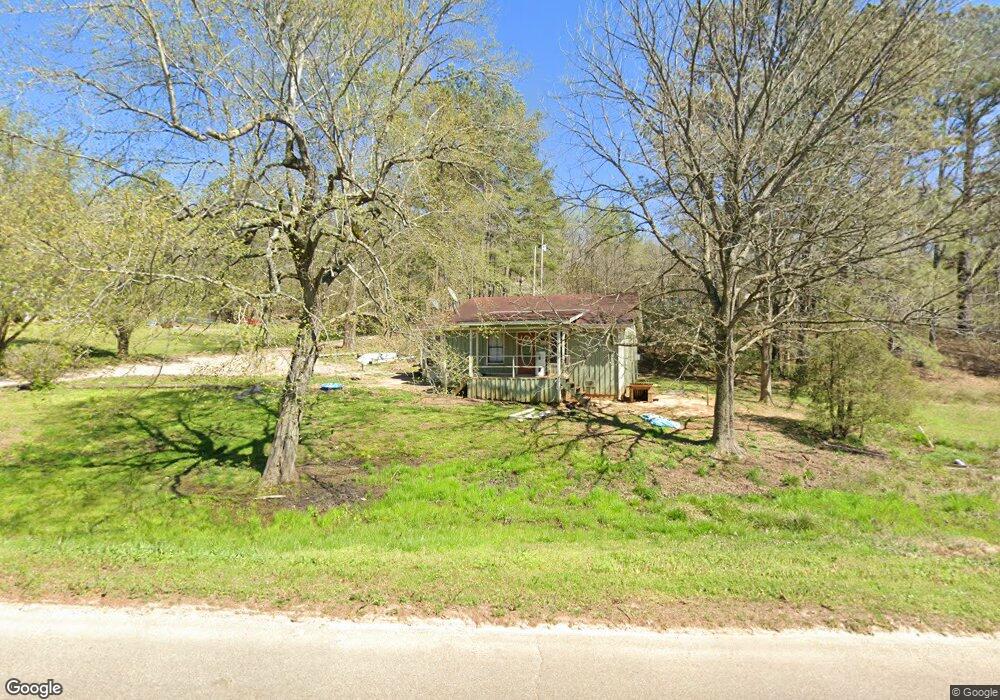
1293 Vernie Kirk Rd Pocahontas, TN 38061
Estimated Value: $69,052 - $286,000
2
Beds
1
Bath
1,080
Sq Ft
$127/Sq Ft
Est. Value
About This Home
This home is located at 1293 Vernie Kirk Rd, Pocahontas, TN 38061 and is currently estimated at $137,513, approximately $127 per square foot. 1293 Vernie Kirk Rd is a home located in McNairy County with nearby schools including Ramer Elementary School, Bethel Springs Elementary School, and Michie Elementary School.
Ownership History
Date
Name
Owned For
Owner Type
Purchase Details
Closed on
Oct 24, 2011
Sold by
Federal Home Loan Mortgage Corporation
Bought by
Goolsby Wayne
Current Estimated Value
Purchase Details
Closed on
May 16, 2011
Sold by
King Ella M
Bought by
Federal Home Loan Mortgage Corporation
Purchase Details
Closed on
Aug 4, 2009
Sold by
King Ella M
Bought by
State Of Tennessee
Create a Home Valuation Report for This Property
The Home Valuation Report is an in-depth analysis detailing your home's value as well as a comparison with similar homes in the area
Home Values in the Area
Average Home Value in this Area
Purchase History
| Date | Buyer | Sale Price | Title Company |
|---|---|---|---|
| Goolsby Wayne | $14,500 | -- | |
| Federal Home Loan Mortgage Corporation | $30,035 | -- | |
| State Of Tennessee | -- | -- |
Source: Public Records
Tax History Compared to Growth
Tax History
| Year | Tax Paid | Tax Assessment Tax Assessment Total Assessment is a certain percentage of the fair market value that is determined by local assessors to be the total taxable value of land and additions on the property. | Land | Improvement |
|---|---|---|---|---|
| 2025 | $298 | $18,900 | $0 | $0 |
| 2024 | $298 | $18,900 | $975 | $17,925 |
| 2023 | $298 | $18,900 | $975 | $17,925 |
| 2022 | $298 | $18,900 | $975 | $17,925 |
| 2021 | $268 | $13,100 | $1,250 | $11,850 |
| 2020 | $268 | $13,100 | $1,250 | $11,850 |
| 2019 | $268 | $13,100 | $1,250 | $11,850 |
| 2018 | $268 | $13,100 | $1,250 | $11,850 |
| 2017 | $268 | $13,100 | $1,250 | $11,850 |
| 2016 | $263 | $13,100 | $1,250 | $11,850 |
| 2015 | $274 | $13,100 | $1,250 | $11,850 |
| 2014 | -- | $12,575 | $1,375 | $11,200 |
Source: Public Records
Map
Nearby Homes
- 0 Wolf Pen Rd
- 4496 Vernie Kirk Rd
- 0 Carlins Rd
- 00 Dan Head Rd
- 155 Carlins Rd
- 214 Arthur Byrd Rd
- 7775 Pea Vine Rd
- 7120 Powell Chapel Rd
- 7675 Pea Vine Rd
- 822 Chandler Ln
- 7000 Wolf Pen Rd
- 0 Bass Rd
- 0 Oscar Ln
- 110 Reaves Rd
- 0 Reaves Rd Unit 10207865
- 0 Reaves Rd
- 0 Peavine Rd
- 7705 Peavine Rd
- 12.63 +/- ACRES Peavine Rd
- 2395 Pocahontas Rd
- 1343 Vernie Kirk Rd
- 75 Edwards Ln
- 1398 Vernie Kirk Rd
- 1442 Vernie Kirk Rd
- 156 Boyette Ln
- 161 Boyette Ln
- 261 Edwards Ln
- 1591 Vernie Kirk Rd
- 983 Vernie Kirk Rd
- 201 Edwards Ln
- 0 Coal Chute Rd Unit 10149060
- 0 Coal Chute Rd Unit 10149045
- 0 Coal Chute Rd Unit 10149033
- 0 Coal Chute Rd Unit 10121287
- 21905 57 Hwy
- 755 Vernie Kirk Rd
- 2167 Vernie Kirk Rd
- 337 Dixie Ln
- 398 Dixie Ln
- 419 Dixie Ln