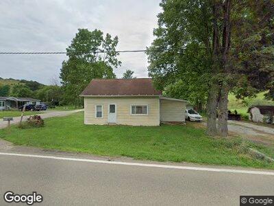
12933 Us Route 62 Unit 24 Killbuck, OH 44637
Estimated Value: $81,000 - $187,000
--
Bed
--
Bath
952
Sq Ft
$126/Sq Ft
Est. Value
About This Home
This home is located at 12933 Us Route 62 Unit 24, Killbuck, OH 44637 and is currently estimated at $119,569, approximately $125 per square foot. 12933 Us Route 62 Unit 24 is a home located in Holmes County with nearby schools including West Holmes High School, Baddow Pass, and Gospel Haven Academy.
Ownership History
Date
Name
Owned For
Owner Type
Purchase Details
Closed on
Apr 11, 2019
Sold by
Mackey Brant A
Bought by
Hawkins Fred P
Current Estimated Value
Home Financials for this Owner
Home Financials are based on the most recent Mortgage that was taken out on this home.
Original Mortgage
$48,000
Outstanding Balance
$42,707
Interest Rate
4.4%
Mortgage Type
Purchase Money Mortgage
Estimated Equity
$76,862
Purchase Details
Closed on
Oct 20, 1998
Bought by
Mackey Brant A
Purchase Details
Closed on
Jan 1, 1990
Bought by
Eltringham Doris E
Create a Home Valuation Report for This Property
The Home Valuation Report is an in-depth analysis detailing your home's value as well as a comparison with similar homes in the area
Home Values in the Area
Average Home Value in this Area
Purchase History
| Date | Buyer | Sale Price | Title Company |
|---|---|---|---|
| Hawkins Fred P | $60,000 | -- | |
| Mackey Brant A | -- | -- | |
| Eltringham Doris E | -- | -- |
Source: Public Records
Mortgage History
| Date | Status | Borrower | Loan Amount |
|---|---|---|---|
| Open | Hawkins Fred P | $48,000 |
Source: Public Records
Tax History Compared to Growth
Tax History
| Year | Tax Paid | Tax Assessment Tax Assessment Total Assessment is a certain percentage of the fair market value that is determined by local assessors to be the total taxable value of land and additions on the property. | Land | Improvement |
|---|---|---|---|---|
| 2024 | $739 | $20,080 | $4,750 | $15,330 |
| 2023 | $739 | $20,080 | $4,750 | $15,330 |
| 2022 | $769 | $20,080 | $4,750 | $15,330 |
| 2021 | $682 | $16,680 | $5,720 | $10,960 |
| 2020 | $666 | $16,680 | $5,720 | $10,960 |
| 2019 | $666 | $16,680 | $5,720 | $10,960 |
| 2018 | $622 | $15,110 | $5,310 | $9,800 |
| 2017 | $623 | $15,150 | $5,310 | $9,840 |
| 2016 | $615 | $15,150 | $5,310 | $9,840 |
| 2015 | $637 | $15,270 | $5,080 | $10,190 |
| 2014 | $635 | $15,270 | $5,080 | $10,190 |
| 2013 | $328 | $15,270 | $5,080 | $10,190 |
Source: Public Records
Map
Nearby Homes
- 34383 Township Road 351
- 13975 Township Road 14
- 3535 Township Road 29
- 33107 Township Road 325
- 319 Galation St
- 10913 U S 62
- 38069 County Road 33
- 0 Hunter Rd
- 4042 Township Road 55
- 0 County Road 35
- 0 Township Road 341
- 29575 Hoover Rd
- 225 Allison Ave
- 4015 Township Road 271
- 9877 County Road 292
- 28015 County Road 22
- 0 Township Road 80
- 109 Hillcrest Dr
- 0 County Road 292 Unit 5109291
- 308 S Cedar St