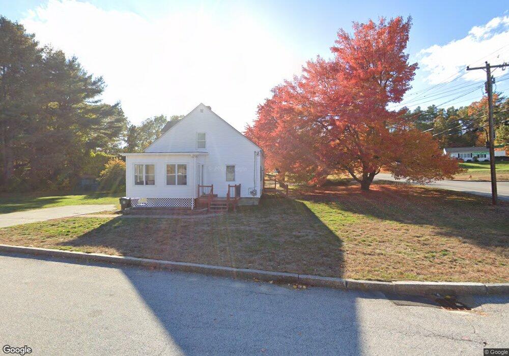
1294 Goffstown Rd Unit 3 Manchester, NH 03102
Northwest Manchester NeighborhoodEstimated Value: $297,543 - $337,000
2
Beds
1
Bath
960
Sq Ft
$330/Sq Ft
Est. Value
About This Home
This home is located at 1294 Goffstown Rd Unit 3, Manchester, NH 03102 and is currently estimated at $316,636, approximately $329 per square foot. 1294 Goffstown Rd Unit 3 is a home located in Hillsborough County with nearby schools including Northwest Elementary School, Middle School at Parkside, and Manchester West High School.
Ownership History
Date
Name
Owned For
Owner Type
Purchase Details
Closed on
Aug 25, 2005
Sold by
Morrissette Lorraine A
Bought by
Lesage Gerard L
Current Estimated Value
Home Financials for this Owner
Home Financials are based on the most recent Mortgage that was taken out on this home.
Original Mortgage
$124,000
Outstanding Balance
$65,630
Interest Rate
5.68%
Estimated Equity
$251,006
Create a Home Valuation Report for This Property
The Home Valuation Report is an in-depth analysis detailing your home's value as well as a comparison with similar homes in the area
Home Values in the Area
Average Home Value in this Area
Purchase History
| Date | Buyer | Sale Price | Title Company |
|---|---|---|---|
| Lesage Gerard L | $155,000 | -- |
Source: Public Records
Mortgage History
| Date | Status | Borrower | Loan Amount |
|---|---|---|---|
| Open | Lesage Gerard L | $124,000 |
Source: Public Records
Tax History Compared to Growth
Tax History
| Year | Tax Paid | Tax Assessment Tax Assessment Total Assessment is a certain percentage of the fair market value that is determined by local assessors to be the total taxable value of land and additions on the property. | Land | Improvement |
|---|---|---|---|---|
| 2024 | $4,120 | $210,400 | $0 | $210,400 |
| 2023 | $3,968 | $210,400 | $0 | $210,400 |
| 2022 | $3,838 | $210,400 | $0 | $210,400 |
| 2021 | $3,720 | $210,400 | $0 | $210,400 |
| 2020 | $2,769 | $112,300 | $0 | $112,300 |
| 2019 | $2,731 | $112,300 | $0 | $112,300 |
| 2018 | $2,659 | $112,300 | $0 | $112,300 |
| 2017 | $2,619 | $112,300 | $0 | $112,300 |
| 2016 | $2,599 | $112,300 | $0 | $112,300 |
| 2015 | $3,066 | $130,800 | $0 | $130,800 |
| 2014 | $3,074 | $130,800 | $0 | $130,800 |
| 2013 | $2,965 | $130,800 | $0 | $130,800 |
Source: Public Records
Map
Nearby Homes
- 1306 Goffstown Rd Unit 9
- 1021 Goffstown Rd
- 2 Shore Dr
- 115 Moose Club Park Rd
- 127 English Village Rd Unit 302
- 186 Dunbarton Rd Unit 13
- 46 Moose Club Park Rd
- 426 Goffstown Rd
- 5 Pinedale St
- 16 Larch St
- 6 Brookline St
- 11-1 Chatel Rd
- 4 Chip St
- 245 Laval St
- 389 Front St
- 11 Timberwood Dr Unit 206
- 333 Front St
- 509 Kelley St
- 329 Front St
- 53 Rachael Cir
- 1292 Goffstown Rd Unit 2
- 1296 Goffstown Rd Unit 4
- 1298 Goffstown Rd Unit 5
- 1300 Goffstown Rd Unit 6
- 1324 Goffstown Rd Unit 18
- 1322 Goffstown Rd Unit 17
- 1302 Goffstown Rd Unit 7
- 1320 Goffstown Rd Unit 16
- 1318 Goffstown Rd Unit 15
- 1308 Goffstown Rd Unit 10
- 1316 Goffstown Rd Unit 14
- 1314 Goffstown Rd Unit 13
- 1310 Goffstown Rd Unit 11
- 1290 Goffstown Rd Unit 1
- 1312 Goffstown Rd Unit 12
- 46 Duncan Farms
- 28 Duncan Farms
- 60 Duncan Farms
- 1280 Goffstown Rd
- 66 Duncan Farms