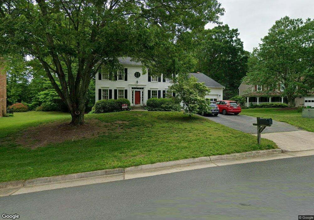
12941 Morning Dew Dr Woodbridge, VA 22192
Old Bridge NeighborhoodEstimated Value: $671,310 - $755,000
--
Bed
2
Baths
2,400
Sq Ft
$304/Sq Ft
Est. Value
About This Home
This home is located at 12941 Morning Dew Dr, Woodbridge, VA 22192 and is currently estimated at $729,828, approximately $304 per square foot. 12941 Morning Dew Dr is a home located in Prince William County with nearby schools including Springwoods Elementary School, Gar-Field High School, and Woodbridge Middle School.
Ownership History
Date
Name
Owned For
Owner Type
Purchase Details
Closed on
Jan 27, 2012
Sold by
Ragghianti Adolph P and Ragghianti Dana M
Bought by
Ragghianti Adolph P
Current Estimated Value
Home Financials for this Owner
Home Financials are based on the most recent Mortgage that was taken out on this home.
Original Mortgage
$230,000
Interest Rate
4.25%
Mortgage Type
New Conventional
Create a Home Valuation Report for This Property
The Home Valuation Report is an in-depth analysis detailing your home's value as well as a comparison with similar homes in the area
Home Values in the Area
Average Home Value in this Area
Purchase History
| Date | Buyer | Sale Price | Title Company |
|---|---|---|---|
| Ragghianti Adolph P | -- | Justice Title & Escrow Llc |
Source: Public Records
Mortgage History
| Date | Status | Borrower | Loan Amount |
|---|---|---|---|
| Closed | Ragghianti Adolph P | $230,000 |
Source: Public Records
Tax History Compared to Growth
Tax History
| Year | Tax Paid | Tax Assessment Tax Assessment Total Assessment is a certain percentage of the fair market value that is determined by local assessors to be the total taxable value of land and additions on the property. | Land | Improvement |
|---|---|---|---|---|
| 2025 | $6,323 | $634,400 | $222,500 | $411,900 |
| 2024 | $6,323 | $635,800 | $222,500 | $413,300 |
| 2023 | $6,522 | $626,800 | $218,200 | $408,600 |
| 2022 | $6,467 | $583,900 | $202,100 | $381,800 |
| 2021 | $5,874 | $481,400 | $166,000 | $315,400 |
| 2020 | $7,015 | $452,600 | $156,600 | $296,000 |
| 2019 | $6,989 | $450,900 | $156,600 | $294,300 |
| 2018 | $5,348 | $442,900 | $153,600 | $289,300 |
| 2017 | $5,005 | $405,700 | $139,800 | $265,900 |
| 2016 | $5,525 | $453,200 | $155,200 | $298,000 |
| 2015 | $4,817 | $429,300 | $146,400 | $282,900 |
| 2014 | $4,817 | $385,600 | $130,800 | $254,800 |
Source: Public Records
Map
Nearby Homes
- 12820 Misty Ln
- 3642 Woodhaven Ct
- 12899 Bjork Ln
- 12743 Purdham Dr
- 3901 Leaf Lawn Ln
- 12804 Evansport Place
- 12948 Augustus Ct
- 13352 Smoketown Rd
- 3493 Wainscott Place
- 3341 Bybrook Ln
- 3988 Cressida Place
- 3349 Wyndale Ct
- 12871 Valleywood Dr
- 12734 Silvia Loop
- 12758 Silvia Loop
- 4104 Churchman Way
- 4309 Kentland Dr
- 13209 Hawthorn Ln
- 13304 Hardy Ct
- 12517 Hedges Run Dr
- 12943 Morning Dew Dr
- 12939 Morning Dew Dr
- 3674 Russell Rd
- 12945 Morning Dew Dr
- 12949 Morning Dew Dr
- 12937 Morning Dew Dr
- 12938 Morning Dew Dr
- 12940 Morning Dew Dr
- 12936 Morning Dew Dr
- 12951 Morning Dew Dr
- 12942 Morning Dew Dr
- 12935 Morning Dew Dr
- 12934 Morning Dew Dr
- 3684 Russell Rd
- 12953 Morning Dew Dr
- 3711 Beaver Ford Rd
- 3713 Beaver Ford Rd
- 12933 Morning Dew Dr
- 12944 Morning Dew Dr
- 3709 Beaver Ford Rd