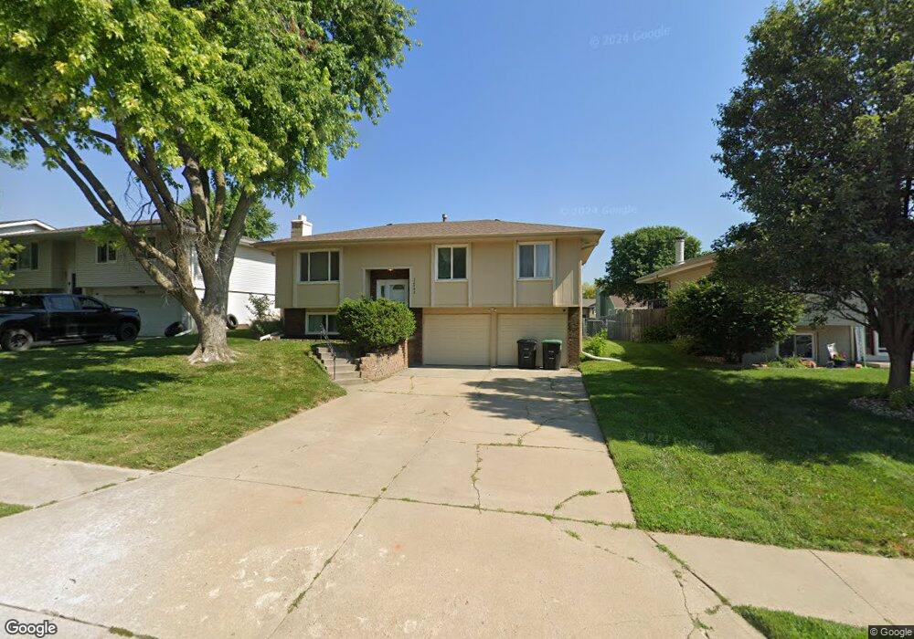
12942 Browne St Omaha, NE 68164
Greentree-Iron Ridge-Tranq NeighborhoodEstimated Value: $238,891 - $254,000
3
Beds
47
Baths
1,336
Sq Ft
$184/Sq Ft
Est. Value
About This Home
This home is located at 12942 Browne St, Omaha, NE 68164 and is currently estimated at $245,723, approximately $183 per square foot. 12942 Browne St is a home located in Douglas County with nearby schools including Fullerton Magnet Center, Alice Buffett Magnet Middle School, and St Vincent De Paul School.
Ownership History
Date
Name
Owned For
Owner Type
Purchase Details
Closed on
May 22, 2008
Sold by
Lebakken Eric
Bought by
Mainor Anthony
Current Estimated Value
Purchase Details
Closed on
Dec 10, 2001
Sold by
Neuberger Paul and Neuberger Jodi
Bought by
Lundquist Kenneth D
Home Financials for this Owner
Home Financials are based on the most recent Mortgage that was taken out on this home.
Original Mortgage
$94,905
Interest Rate
8.75%
Mortgage Type
Purchase Money Mortgage
Create a Home Valuation Report for This Property
The Home Valuation Report is an in-depth analysis detailing your home's value as well as a comparison with similar homes in the area
Home Values in the Area
Average Home Value in this Area
Purchase History
| Date | Buyer | Sale Price | Title Company |
|---|---|---|---|
| Mainor Anthony | $111,000 | -- | |
| Lundquist Kenneth D | $100,000 | -- |
Source: Public Records
Mortgage History
| Date | Status | Borrower | Loan Amount |
|---|---|---|---|
| Previous Owner | Lundquist Kenneth D | $94,905 |
Source: Public Records
Tax History Compared to Growth
Tax History
| Year | Tax Paid | Tax Assessment Tax Assessment Total Assessment is a certain percentage of the fair market value that is determined by local assessors to be the total taxable value of land and additions on the property. | Land | Improvement |
|---|---|---|---|---|
| 2025 | $3,163 | $220,300 | $19,500 | $200,800 |
| 2024 | $4,127 | $195,600 | $19,500 | $176,100 |
| 2023 | $4,127 | $195,600 | $19,500 | $176,100 |
| 2022 | $3,535 | $165,600 | $19,500 | $146,100 |
| 2021 | $3,071 | $145,100 | $19,500 | $125,600 |
| 2020 | $2,903 | $135,600 | $19,500 | $116,100 |
| 2019 | $2,628 | $122,400 | $19,500 | $102,900 |
| 2018 | $2,632 | $122,400 | $19,500 | $102,900 |
| 2017 | $2,500 | $115,700 | $19,500 | $96,200 |
| 2016 | $2,393 | $111,500 | $12,800 | $98,700 |
| 2015 | $2,206 | $104,200 | $12,000 | $92,200 |
| 2014 | $2,206 | $104,200 | $12,000 | $92,200 |
Source: Public Records
Map
Nearby Homes
- 12933 Camden Ave
- 5022 N 128th St
- 12805 Ogden St
- 12729 Fowler Cir
- 4723 N 134th Ave
- 4912 N 134th St
- 4636 N 126th Ave
- 4614 N 126th Ave
- 5417 N 134th Ave
- 13222 Ellison Ave
- 5127 N 135th Ave
- 4910 N 136th St
- 4210 N 130th Cir
- 13318 Hillsborough Dr
- 12946 Himebaugh Ave
- 5121 N 137th St
- 4714 N 136th St
- 13708 Camden Ave
- 12821 Glenvale Plaza Unit 178
- 12620 Manderson Plaza Unit 304
- 12954 Browne Cir
- 12936 Browne St
- 12958 Browne Cir
- 12930 Browne St
- 12939 Camden Ave
- 12927 Camden Street St
- 12927 Camden Ave
- 12962 Browne Cir
- 12941 Browne St
- 12945 Camden Ave
- 12924 Browne St
- 12935 Browne St
- 12955 Browne Cir
- 12966 Browne Cir
- 12959 Browne Cir
- 12959 Browne Cir
- 12951 Camden Ave
- 12929 Browne St
- 12918 Browne St
- 12915 Camden Ave