Estimated Value: $235,756 - $277,000
--
Bed
--
Bath
--
Sq Ft
0.43
Acres
About This Home
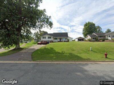
This home is located at 12945 Main St, Osseo, WI 54758 and is currently estimated at $264,439. 12945 Main St is a home with nearby schools including Whitehall Memorial Elementary School and Whitehall Memorial Jr./Sr. High School.
Ownership History
Date
Name
Owned For
Owner Type
Purchase Details
Closed on
May 24, 2019
Sold by
Kopp Douglas E and Kopp Elizabeth A
Bought by
Nichols Travis J and Nichols Lyndsay R
Current Estimated Value
Home Financials for this Owner
Home Financials are based on the most recent Mortgage that was taken out on this home.
Original Mortgage
$1,790,000
Outstanding Balance
$1,586,640
Interest Rate
4.2%
Mortgage Type
New Conventional
Estimated Equity
-$1,328,346
Create a Home Valuation Report for This Property
The Home Valuation Report is an in-depth analysis detailing your home's value as well as a comparison with similar homes in the area
Home Values in the Area
Average Home Value in this Area
Purchase History
| Date | Buyer | Sale Price | Title Company |
|---|---|---|---|
| Nichols Travis J | $193,000 | -- |
Source: Public Records
Mortgage History
| Date | Status | Borrower | Loan Amount |
|---|---|---|---|
| Open | Nichols Travis J | $1,790,000 |
Source: Public Records
Tax History Compared to Growth
Tax History
| Year | Tax Paid | Tax Assessment Tax Assessment Total Assessment is a certain percentage of the fair market value that is determined by local assessors to be the total taxable value of land and additions on the property. | Land | Improvement |
|---|---|---|---|---|
| 2024 | $3,089 | $134,400 | $11,300 | $123,100 |
| 2023 | $2,856 | $134,400 | $11,300 | $123,100 |
| 2022 | $2,700 | $134,400 | $11,300 | $123,100 |
| 2021 | $2,695 | $134,400 | $11,300 | $123,100 |
| 2020 | $2,762 | $23,610 | $11,300 | $12,310 |
| 2019 | $2,782 | $134,400 | $11,300 | $123,100 |
| 2018 | $2,458 | $134,400 | $11,300 | $123,100 |
| 2017 | $2,551 | $134,400 | $11,300 | $123,100 |
| 2016 | $2,683 | $134,400 | $11,300 | $123,100 |
| 2015 | $2,579 | $134,400 | $11,300 | $123,100 |
| 2014 | $2,601 | $134,400 | $11,300 | $123,100 |
| 2011 | $2,595 | $134,400 | $11,300 | $123,100 |
Source: Public Records
Map
Nearby Homes
- 12953 E Main St
- N41731 Steig Coulee Rd
- N38871 Us Hwy 51
- 0 Haug Rd
- W16574 Schroeder Rd
- N35182 Weverstad Rd
- 14490 W Thompson Rd
- N35209 County Rd S
- N43922 County Road O
- N8554 Curran Rd
- N34855 County Rd S
- Tbd County Rd S
- N43922 Cr-O
- XX Vold Rd
- N11370 Gilbertson Rd
- 0 Section 1 Rd
- 0000 U S 53
- 36281 Mill St
- 18374 Melby St
- N35687 Richter Rd