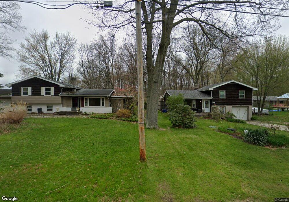
1295 1297 Howe Rd Brimfield, OH 44240
Estimated Value: $201,000 - $249,757
4
Beds
2
Baths
1,739
Sq Ft
$134/Sq Ft
Est. Value
About This Home
This home is located at 1295 1297 Howe Rd, Brimfield, OH 44240 and is currently estimated at $232,439, approximately $133 per square foot. 1295 1297 Howe Rd is a home located in Portage County with nearby schools including Brimfield Elementary School, Field Middle School, and Field High School.
Ownership History
Date
Name
Owned For
Owner Type
Purchase Details
Closed on
Sep 28, 2020
Sold by
Kline Charles R
Bought by
Pavlak Sean A and Schnell Joanna F
Current Estimated Value
Home Financials for this Owner
Home Financials are based on the most recent Mortgage that was taken out on this home.
Original Mortgage
$179,193
Outstanding Balance
$159,383
Interest Rate
2.9%
Mortgage Type
New Conventional
Estimated Equity
$73,056
Purchase Details
Closed on
Dec 23, 2019
Sold by
Griggy Portia Dale and The Griggy Family Trust
Bought by
Kline Charles R
Purchase Details
Closed on
Jun 20, 2014
Sold by
Griggy Thomas Edward and Griggy Portia Dale
Bought by
Kline Charles R
Purchase Details
Closed on
May 1, 2000
Sold by
Griggy Thomas Edward and Griggy Portia Dale
Bought by
Griggy Thomas Edward and Griggy Portia Dale
Purchase Details
Closed on
Sep 22, 1988
Bought by
Griggy Thomas E and Griggy Portia
Create a Home Valuation Report for This Property
The Home Valuation Report is an in-depth analysis detailing your home's value as well as a comparison with similar homes in the area
Home Values in the Area
Average Home Value in this Area
Purchase History
| Date | Buyer | Sale Price | Title Company |
|---|---|---|---|
| Pavlak Sean A | $730,000 | Golubski David M | |
| Kline Charles R | $104,000 | None Available | |
| Kline Charles R | $104,000 | None Available | |
| Griggy Thomas Edward | -- | -- | |
| Griggy Thomas E | -- | -- |
Source: Public Records
Mortgage History
| Date | Status | Borrower | Loan Amount |
|---|---|---|---|
| Open | Pavlak Sean A | $179,193 | |
| Closed | Kline Charles R | $0 |
Source: Public Records
Tax History Compared to Growth
Tax History
| Year | Tax Paid | Tax Assessment Tax Assessment Total Assessment is a certain percentage of the fair market value that is determined by local assessors to be the total taxable value of land and additions on the property. | Land | Improvement |
|---|---|---|---|---|
| 2024 | $3,400 | $70,250 | $18,270 | $51,980 |
| 2023 | $3,139 | $52,120 | $18,480 | $33,640 |
| 2022 | $3,215 | $52,120 | $18,480 | $33,640 |
| 2021 | $3,113 | $52,120 | $18,480 | $33,640 |
| 2020 | $2,880 | $43,580 | $18,480 | $25,100 |
| 2019 | $2,857 | $43,580 | $18,480 | $25,100 |
| 2018 | $2,314 | $40,990 | $18,480 | $22,510 |
| 2017 | $2,314 | $40,990 | $18,480 | $22,510 |
| 2016 | $2,268 | $40,990 | $18,480 | $22,510 |
| 2015 | $2,189 | $40,990 | $18,480 | $22,510 |
| 2014 | $2,115 | $40,990 | $18,480 | $22,510 |
| 2013 | $2,068 | $40,990 | $18,480 | $22,510 |
Source: Public Records
Map
Nearby Homes
- 4682 State Route 43
- 1354 Brimfield Dr
- Poplar Plan at Woodland Reserve
- Nassau Cove Plan at Woodland Reserve
- V/L Sherman Rd
- 4837 King Meadow Trail
- 847 Lakeview Ct
- 0 Meloy Rd Unit 5162435
- 1224 Cedar Ridge Rd
- 1236 Cedar Ridge Rd
- 1755 Honeychuck Ln
- 4649 Creekside Dr Unit 4649
- 4891 Edson Rd
- 1625 S Lincoln St
- 720 Ivan Dr
- 1587 Chadwick Rd
- 1024E Cedar Ridge Dr
- 1024A Cedar Ridge Dr
- 2092 Sugar Maple Dr
- 5123 Troyer Dr
- 1295 Howe Rd
- 1309 Howe Rd
- 1319 Howe Rd
- 0 State Route 43 Unit 3689740
- 1329 Howe Rd
- 0 Howe Rd Unit 4030772
- 0 Howe Rd Unit 4000914
- 0 Howe Rd Unit 5017764
- 0 Howe Rd Unit 4476294
- 0 Howe Rd Unit 4458234
- 0 Howe Rd Unit 4458229
- 0 Howe Rd Unit 4458227
- 0 Howe Rd Unit 4458225
- 0 Howe Rd Unit 4254181
- 0 Howe Rd Unit 4237788
- .635 AC Howe Rd
- .57 AC Howe Rd
- 4674 State Route 43
- 4727 State Route 43
- 4666 State Route 43