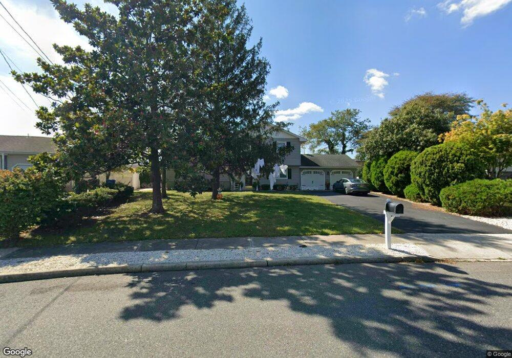
1295 Linda Dr Toms River, NJ 08753
Estimated Value: $521,000 - $658,000
4
Beds
2
Baths
2,156
Sq Ft
$276/Sq Ft
Est. Value
About This Home
This home is located at 1295 Linda Dr, Toms River, NJ 08753 and is currently estimated at $595,105, approximately $276 per square foot. 1295 Linda Dr is a home located in Ocean County with nearby schools including St Joseph Grade School and Donovan Catholic High School.
Ownership History
Date
Name
Owned For
Owner Type
Purchase Details
Closed on
Aug 30, 2005
Sold by
Estate Of Michael A Cantillo and Cantillo Rhonda
Bought by
Cantillo Rhonda
Current Estimated Value
Purchase Details
Closed on
Aug 19, 1994
Sold by
Gilibeti Emzio
Bought by
Christopher Joseph and Christopher Judith
Home Financials for this Owner
Home Financials are based on the most recent Mortgage that was taken out on this home.
Original Mortgage
$126,000
Interest Rate
8.56%
Create a Home Valuation Report for This Property
The Home Valuation Report is an in-depth analysis detailing your home's value as well as a comparison with similar homes in the area
Home Values in the Area
Average Home Value in this Area
Purchase History
| Date | Buyer | Sale Price | Title Company |
|---|---|---|---|
| Cantillo Rhonda | -- | -- | |
| Christopher Joseph | $133,000 | -- |
Source: Public Records
Mortgage History
| Date | Status | Borrower | Loan Amount |
|---|---|---|---|
| Closed | Christopher Joseph | $126,000 |
Source: Public Records
Tax History Compared to Growth
Tax History
| Year | Tax Paid | Tax Assessment Tax Assessment Total Assessment is a certain percentage of the fair market value that is determined by local assessors to be the total taxable value of land and additions on the property. | Land | Improvement |
|---|---|---|---|---|
| 2025 | $7,792 | $427,900 | $169,000 | $258,900 |
| 2024 | $7,407 | $427,900 | $169,000 | $258,900 |
| 2023 | $7,142 | $427,900 | $169,000 | $258,900 |
| 2022 | $7,142 | $427,900 | $169,000 | $258,900 |
| 2021 | $5,679 | $226,700 | $93,000 | $133,700 |
| 2020 | $5,654 | $226,700 | $93,000 | $133,700 |
| 2019 | $5,409 | $226,700 | $93,000 | $133,700 |
| 2018 | $5,337 | $226,700 | $93,000 | $133,700 |
| 2017 | $5,291 | $226,700 | $93,000 | $133,700 |
| 2016 | $5,153 | $226,700 | $93,000 | $133,700 |
| 2015 | $4,958 | $226,700 | $93,000 | $133,700 |
| 2014 | $4,720 | $226,700 | $93,000 | $133,700 |
Source: Public Records
Map
Nearby Homes
- 2570 Balfrey Dr
- 1309 Bay Ave
- 786 Garfield Ave
- 4 Jamaica Ave
- 657 Ellicott Ave Unit 101
- 1417 Delaware Ave
- 663 Beachwood Ave
- 6 Cayman Ave
- 213 Hamilton Dr
- 3158 Windsor Ave
- 103 Mermaid Rd
- 3138 Windsor Ave
- 3129 Windsor Ave
- 804 Neville St
- 19 Maryann Place
- 975 Hunt Dr
- 590 Garfield Ave
- 625 N End Ave
- 2023 Oak Dale Rd
- 914 Neville St
- 1293 Linda Dr
- 1297 Linda Dr
- 761 Tunney Point Dr
- 759 Tunney Point Dr
- 775 Tunney Point Dr
- 765 Tunney Point Dr
- 777 Tunney Point Dr
- 757 Tunney Point Dr
- 771 Tunney Point Dr
- 1291 Linda Dr
- 1299 Linda Dr
- 1294 Linda Dr
- 755 Tunney Point Dr
- 781 Tunney Point Dr
- 1000 Midwood Dr
- 753 Tunney Point Dr
- 783 Tunney Point Dr
- 1289 Linda Dr
- 1301 Linda Dr