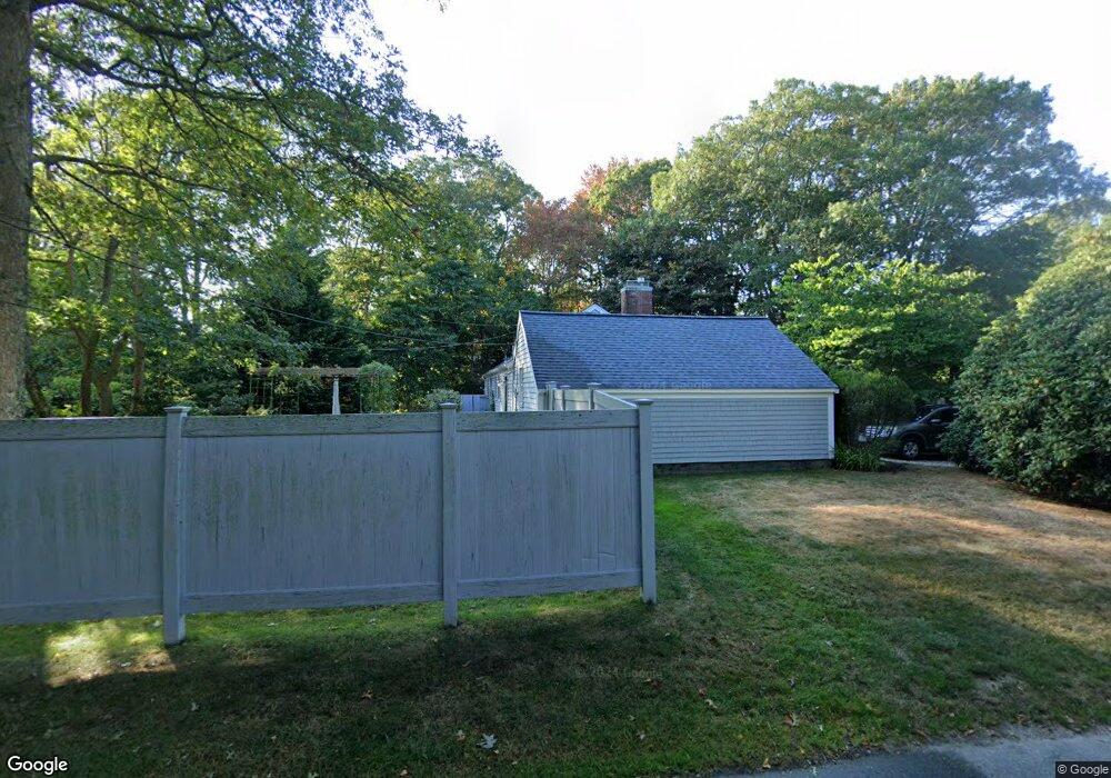
1295 Shootflying Hill Rd Centerville, MA 02632
Centerville NeighborhoodEstimated Value: $540,000 - $588,000
2
Beds
1
Bath
1,080
Sq Ft
$519/Sq Ft
Est. Value
About This Home
This home is located at 1295 Shootflying Hill Rd, Centerville, MA 02632 and is currently estimated at $560,853, approximately $519 per square foot. 1295 Shootflying Hill Rd is a home located in Barnstable County with nearby schools including Centerville Elementary School, Barnstable United Elementary School, and Barnstable Intermediate School.
Ownership History
Date
Name
Owned For
Owner Type
Purchase Details
Closed on
Dec 13, 2022
Sold by
Roche Linda A
Bought by
Roche Rt
Current Estimated Value
Purchase Details
Closed on
Dec 22, 2009
Sold by
Balthazard Karen C
Bought by
Roche Linda A
Home Financials for this Owner
Home Financials are based on the most recent Mortgage that was taken out on this home.
Original Mortgage
$110,000
Interest Rate
5%
Mortgage Type
Purchase Money Mortgage
Purchase Details
Closed on
Feb 28, 2005
Sold by
Mcnulty Maureen A
Bought by
Balthazard Karen C
Home Financials for this Owner
Home Financials are based on the most recent Mortgage that was taken out on this home.
Original Mortgage
$200,000
Interest Rate
5.73%
Mortgage Type
Purchase Money Mortgage
Create a Home Valuation Report for This Property
The Home Valuation Report is an in-depth analysis detailing your home's value as well as a comparison with similar homes in the area
Home Values in the Area
Average Home Value in this Area
Purchase History
| Date | Buyer | Sale Price | Title Company |
|---|---|---|---|
| Roche Rt | -- | None Available | |
| Roche Linda A | $230,000 | -- | |
| Balthazard Karen C | $270,000 | -- |
Source: Public Records
Mortgage History
| Date | Status | Borrower | Loan Amount |
|---|---|---|---|
| Previous Owner | Roche Linda A | $110,000 | |
| Previous Owner | Balthazard Karen C | $200,000 |
Source: Public Records
Tax History
| Year | Tax Paid | Tax Assessment Tax Assessment Total Assessment is a certain percentage of the fair market value that is determined by local assessors to be the total taxable value of land and additions on the property. | Land | Improvement |
|---|---|---|---|---|
| 2025 | $3,599 | $444,900 | $151,900 | $293,000 |
| 2024 | $3,444 | $441,000 | $151,900 | $289,100 |
| 2023 | $3,229 | $387,200 | $138,100 | $249,100 |
| 2022 | $3,090 | $320,500 | $102,300 | $218,200 |
| 2021 | $2,937 | $280,000 | $102,300 | $177,700 |
| 2020 | $2,984 | $272,300 | $102,300 | $170,000 |
| 2019 | $2,839 | $251,700 | $102,300 | $149,400 |
| 2018 | $2,624 | $233,900 | $107,700 | $126,200 |
| 2017 | $2,451 | $227,800 | $107,700 | $120,100 |
| 2016 | $2,492 | $228,600 | $108,500 | $120,100 |
| 2015 | $2,416 | $222,700 | $105,100 | $117,600 |
Source: Public Records
Map
Nearby Homes
- 19 Marrick Ct
- 82 Yacht Club Rd
- 53 Meadow Farm Rd
- 52 Meadow Farm Rd
- 51 Larch Ln
- 103 Pine Tree Dr
- 296 Buckskin Path
- 40 Sachem Dr
- 156 S Main St
- 83 Lake Dr
- 315 Prince Hinckley Rd
- 10 Sail a Way
- 10 Sail -A-way
- 200 Lumbert Mill Rd
- 900 Old Stage Rd
- 66 Tern Ln
- 180 Pond View Dr
- 290 Riverview Ln
- 481 Lakeside Dr W
- 169 Cedric Rd
- 1283 Shootflying Hill Rd
- 8 Highland Dr
- 52 Glenwood Ave
- 64 Glenwood Ave
- 36 Glenwood Ave
- 1271 Shootflying Hill Rd
- 24 Glenwood Ave
- 345 Old Stage Rd
- 1309 Shootflying Hill Rd
- 1309 Shootflying Hill Rd
- 190 Highland Dr
- 1309 Shootflying Hill Rd
- 6 Fox Hill Rd
- 17 Highland Dr
- 31 Highland Dr
- 6 Glenwood Ave
- 189 Highland Dr
- 189 Highland Dr Unit C
- 180 Highland Dr
- 354 Old Stage Rd
Your Personal Tour Guide
Ask me questions while you tour the home.