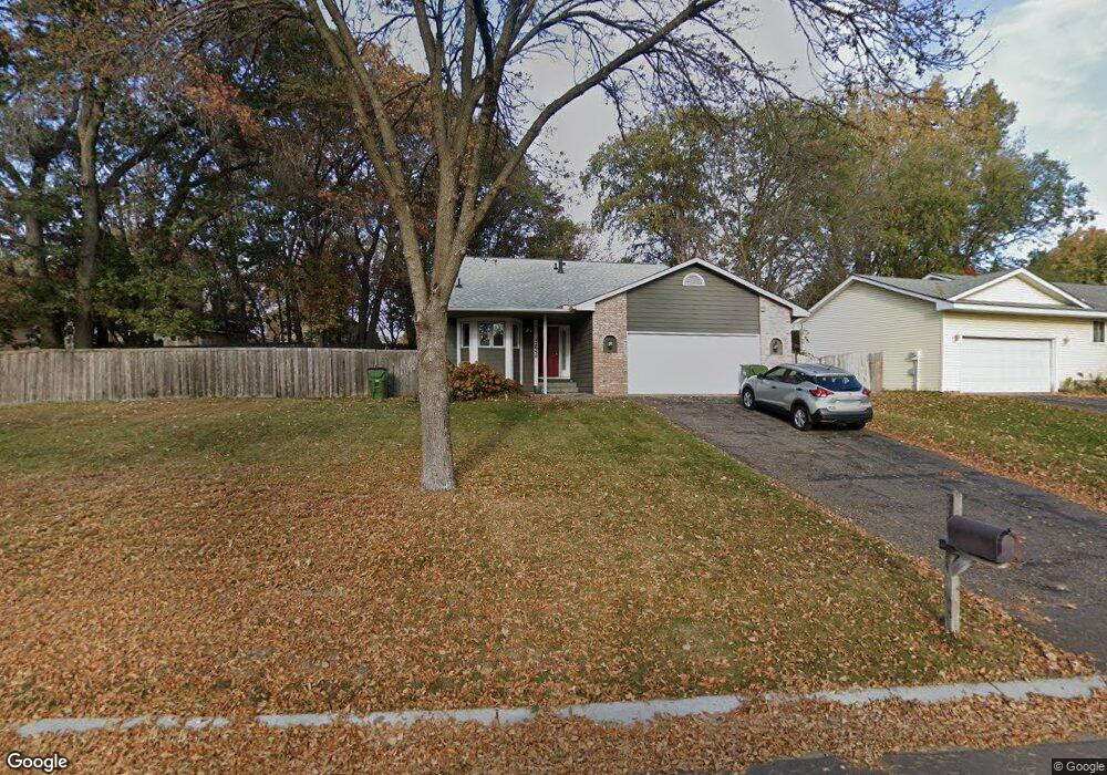
12950 Jay St NW Coon Rapids, MN 55448
Estimated Value: $365,997 - $411,000
4
Beds
2
Baths
1,102
Sq Ft
$351/Sq Ft
Est. Value
About This Home
This home is located at 12950 Jay St NW, Coon Rapids, MN 55448 and is currently estimated at $386,999, approximately $351 per square foot. 12950 Jay St NW is a home located in Anoka County with nearby schools including Lucile Bruner Elementary School, Morris Bye Elementary School, and Laughlin Junior/Senior High School.
Ownership History
Date
Name
Owned For
Owner Type
Purchase Details
Closed on
Jun 13, 2016
Sold by
Easton Michelle L and Easton Anthony R
Bought by
Williams Emmanuel B and Smith Wyada D
Current Estimated Value
Home Financials for this Owner
Home Financials are based on the most recent Mortgage that was taken out on this home.
Original Mortgage
$208,680
Outstanding Balance
$166,572
Interest Rate
3.66%
Mortgage Type
New Conventional
Estimated Equity
$220,427
Purchase Details
Closed on
Sep 5, 2003
Sold by
Douglas Lawrence C and Douglas Erin B I
Bought by
Easton Anthony R and Easton Michelle L
Purchase Details
Closed on
Mar 5, 1999
Sold by
Equity Lending Inc
Bought by
Douglas Lawrence C and Douglas Erin B I
Purchase Details
Closed on
Aug 1, 1996
Sold by
Acker Donald A and Acker Susan M
Bought by
Boland Michael L and Boland Deanna D
Create a Home Valuation Report for This Property
The Home Valuation Report is an in-depth analysis detailing your home's value as well as a comparison with similar homes in the area
Home Values in the Area
Average Home Value in this Area
Purchase History
| Date | Buyer | Sale Price | Title Company |
|---|---|---|---|
| Williams Emmanuel B | $222,000 | Attorney | |
| Easton Anthony R | $226,500 | -- | |
| Douglas Lawrence C | $126,200 | -- | |
| Boland Michael L | $114,900 | -- |
Source: Public Records
Mortgage History
| Date | Status | Borrower | Loan Amount |
|---|---|---|---|
| Open | Williams Emmanuel B | $208,680 |
Source: Public Records
Tax History Compared to Growth
Tax History
| Year | Tax Paid | Tax Assessment Tax Assessment Total Assessment is a certain percentage of the fair market value that is determined by local assessors to be the total taxable value of land and additions on the property. | Land | Improvement |
|---|---|---|---|---|
| 2025 | $3,619 | $328,700 | $90,000 | $238,700 |
| 2024 | $3,619 | $324,500 | $87,000 | $237,500 |
| 2023 | $3,308 | $314,500 | $72,000 | $242,500 |
| 2022 | $3,147 | $314,900 | $72,000 | $242,900 |
| 2021 | $2,659 | $251,200 | $56,000 | $195,200 |
| 2020 | $2,732 | $241,800 | $56,000 | $185,800 |
| 2019 | $2,629 | $238,100 | $56,000 | $182,100 |
| 2018 | $2,468 | $223,600 | $0 | $0 |
| 2017 | $2,160 | $205,400 | $0 | $0 |
| 2016 | $2,217 | $180,600 | $0 | $0 |
| 2015 | $2,165 | $180,600 | $50,000 | $130,600 |
| 2014 | -- | $150,800 | $35,400 | $115,400 |
Source: Public Records
Map
Nearby Homes
- 1687 131st Ln NW
- 1520 129th Ave NW
- 1930 127th Cir NW
- 1776 133rd Ave NW
- 12554 Grouse St NW
- 1593 126th Ln NW
- 12796 Bluebird St NW
- 1450 126th Ln NW
- 12760 Raven St NW
- 1234 128th Cir NW
- 12365 Jay St NW
- 2147 125th Ln NW
- 1625 124th Ave NW
- 13416 Swallow St NW
- 12463 Drake St NW
- 2068 124th Ln NW
- 13519 Partridge Cir NW
- 1727 121st Ln NW
- 13182 Zion St NW
- 12488 Unity St NW
- 12964 Jay St NW
- 1815 128th Ave NW
- 1831 128th Ave NW
- 12978 Jay St NW
- 12945 Jay St NW
- 12905 Jay St NW
- 1772 129th Ln NW
- 1847 128th Ave NW
- 1773 129th Ln NW
- 12992 Jay St NW
- 1757 129th Ln NW
- 1753 129th Ln NW
- 12855 Jay St NW
- 12993 Killdeer St NW
- 1756 129th Ln NW
- 1745 129th Ln NW
- 12985 Jay St NW
- 1750 129th Ln NW
- 1741 129th Ln NW
- 13006 Jay St NW