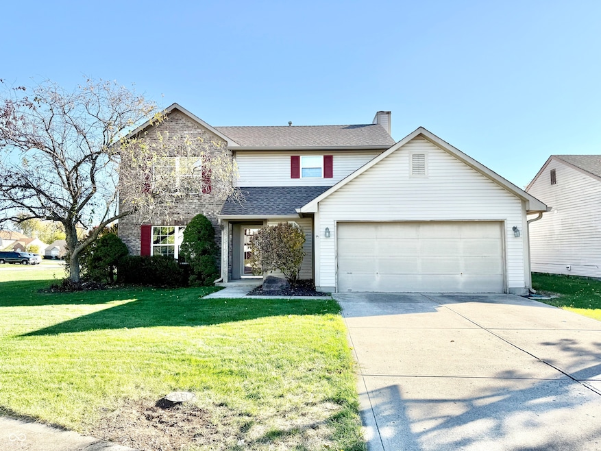
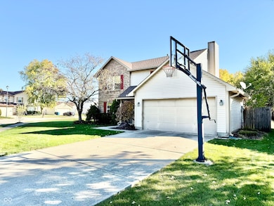
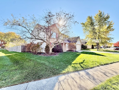
12959 Shandon Ln Fishers, IN 46038
Estimated payment $2,239/month
Highlights
- Vaulted Ceiling
- Wood Flooring
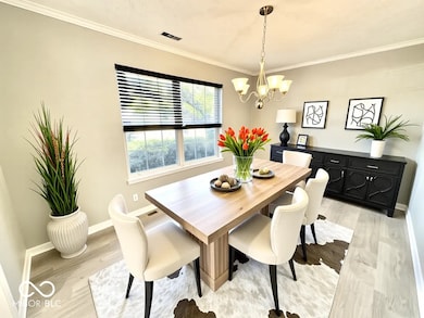
- Formal Dining Room
- Cumberland Road Elementary School Rated A
- Corner Lot
- 2 Car Attached Garage
About This Home
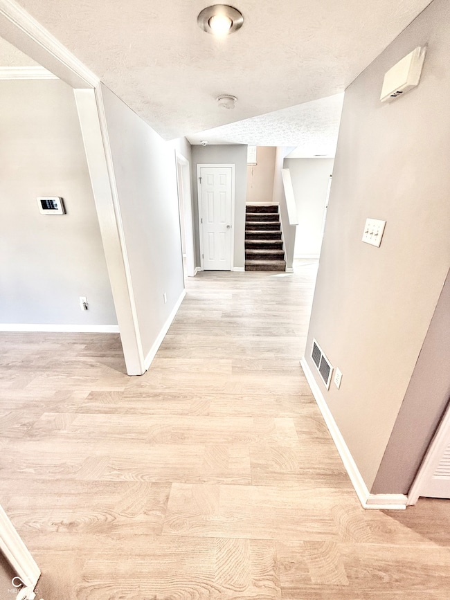
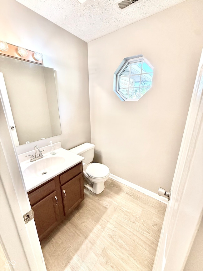
Welcome to this charming 3 bedroom, 2.5 bathroom home offering over 1,700 sq. ft. of comfortable living space in one of Fishers' most desirable areas! Conveniently located just minutes from SR 37, I-69, Hamilton Town Center, Fishers District, shopping, dining, and award-winning schools - this home truly has it all! Step inside to find LVP flooring throughout the spacious main level, featuring a flexible formal dining room or office, a convenient half bath, and a large living room with a cozy fireplace, perfect for relaxing or entertaining. The bright, open kitchen offers plenty of natural light through sliding glass doors that lead out to a deck and fully privacy-fenced backyard, ideal for gatherings or enjoying quiet evenings outdoors. Upstairs, the primary suite provides a peaceful retreat with a private full bath, while two additional bedrooms and another full bath complete the upper level. This home combines comfort, convenience, and location - all in the heart of Fishers!
Home Details
Home Type
- Single Family
Est. Annual Taxes
- $6,134
Year Built
- Built in 1994
Lot Details
- 6,970 Sq Ft Lot
- Corner Lot
HOA Fees
- $15 Monthly HOA Fees
Parking
- 2 Car Attached Garage
Home Design
- Slab Foundation
- Vinyl Construction Material
Interior Spaces
- 2-Story Property
- Vaulted Ceiling
- Family Room with Fireplace
- Formal Dining Room
- Attic Access Panel
- Laundry on upper level
Kitchen
- Eat-In Kitchen
- Electric Oven
- Built-In Microwave
- Dishwasher
- Disposal
Flooring
- Wood
- Carpet
- Vinyl Plank
Bedrooms and Bathrooms
- 3 Bedrooms
- Walk-In Closet
Utilities
- Forced Air Heating and Cooling System
- Gas Water Heater
Community Details
- Association fees include home owners, maintenance
- Sterling Green Subdivision
Listing and Financial Details
- Legal Lot and Block 216 / 1
- Assessor Parcel Number 291130002052000006
Map
Home Values in the Area
Average Home Value in this Area
Tax History
| Year | Tax Paid | Tax Assessment Tax Assessment Total Assessment is a certain percentage of the fair market value that is determined by local assessors to be the total taxable value of land and additions on the property. | Land | Improvement |
|---|---|---|---|---|
| 2024 | $6,134 | $287,000 | $77,000 | $210,000 |
| 2023 | $6,134 | $278,700 | $43,500 | $235,200 |
| 2022 | $5,392 | $244,800 | $43,500 | $201,300 |
| 2021 | $4,567 | $202,500 | $43,500 | $159,000 |
| 2020 | $4,085 | $179,700 | $43,500 | $136,200 |
| 2019 | $3,853 | $168,800 | $31,200 | $137,600 |
| 2018 | $3,579 | $157,200 | $31,200 | $126,000 |
| 2017 | $1,500 | $150,000 | $31,200 | $118,800 |
| 2016 | $1,349 | $140,400 | $31,200 | $109,200 |
| 2014 | $1,146 | $131,600 | $31,200 | $100,400 |
| 2013 | $1,146 | $126,200 | $31,200 | $95,000 |
Property History
| Date | Event | Price | List to Sale | Price per Sq Ft |
|---|---|---|---|---|
| 11/13/2025 11/13/25 | Pending | -- | -- | -- |
| 11/03/2025 11/03/25 | For Sale | $325,000 | -- | $187 / Sq Ft |
Purchase History
| Date | Type | Sale Price | Title Company |
|---|---|---|---|
| Warranty Deed | -- | None Available | |
| Special Warranty Deed | -- | Investors Titlecorp | |
| Sheriffs Deed | $139,500 | None Available | |
| Warranty Deed | -- | -- |
Mortgage History
| Date | Status | Loan Amount | Loan Type |
|---|---|---|---|
| Open | $141,811 | FHA | |
| Previous Owner | $130,625 | Purchase Money Mortgage |
Source: MIBOR Broker Listing Cooperative®
MLS Number: 22071605
APN: 29-11-30-002-052.000-006
Disclaimer: Certain information contained herein is derived from information provided by parties other than Homes.com. All information provided is deemed reliable, but is not guaranteed to be accurate and should be independently verified.
![]() Based on information submitted to the MLS GRID. All data is obtained from various sources and may not have been verified by broker or MLS GRID. Supplied Open House Information is subject to change without notice. All information should be independently reviewed and verified for accuracy. Properties may or may not be listed by the office/agent presenting the information. Some IDX listings have been excluded from this website.
Based on information submitted to the MLS GRID. All data is obtained from various sources and may not have been verified by broker or MLS GRID. Supplied Open House Information is subject to change without notice. All information should be independently reviewed and verified for accuracy. Properties may or may not be listed by the office/agent presenting the information. Some IDX listings have been excluded from this website.
- 12991 Wingstem Ct
- 9689 Barrhill Ct
- 11798 & 11842 E 131st St
- 12828 Ramsgate Ct
- 12677 Ladson St
- 9919 Commonwealth Dr
- 10066 Perlita Place
- 13068 Lamarque Place
- 10150 Beresford Ct
- 13125 Zinfandel Place
- 9635 Shasta Dr
- 9085 Demarest Dr
- 13048 Ross Crossing
- 10175 Pamona Ct
- 12966 Pleasant View Ln
- 9050 Sparta Dr
- 9058 Mercer Dr
- 13068 Raritan Dr
- 9899 Brightwater Dr
- 9009 Mercer Dr
