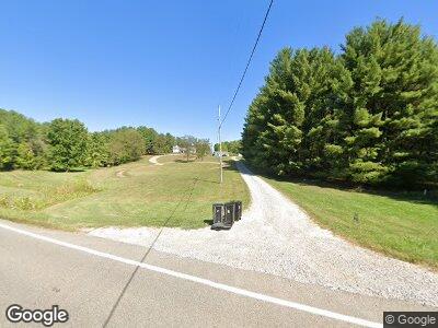
12959 State Route 550 Fleming, OH 45729
Estimated Value: $224,000 - $559,280
3
Beds
4
Baths
1,301
Sq Ft
$277/Sq Ft
Est. Value
About This Home
This home is located at 12959 State Route 550, Fleming, OH 45729 and is currently estimated at $360,070, approximately $276 per square foot. 12959 State Route 550 is a home with nearby schools including Warren High School.
Ownership History
Date
Name
Owned For
Owner Type
Purchase Details
Closed on
Dec 30, 2014
Sold by
Anderson Benjamin B and Anderson Blythe A
Bought by
Anderson Benjamin B and The Benjamin B Anderson Estate Planning
Current Estimated Value
Purchase Details
Closed on
Jun 22, 2004
Bought by
Anderson Benjamin B and Anderson Bl
Purchase Details
Closed on
Nov 9, 1994
Bought by
Knick Fred Clair and Knick Betty
Create a Home Valuation Report for This Property
The Home Valuation Report is an in-depth analysis detailing your home's value as well as a comparison with similar homes in the area
Home Values in the Area
Average Home Value in this Area
Purchase History
| Date | Buyer | Sale Price | Title Company |
|---|---|---|---|
| Anderson Benjamin B | -- | Attorney | |
| Anderson Benjamin B | $135,000 | -- | |
| Knick Fred Clair | -- | -- |
Source: Public Records
Mortgage History
| Date | Status | Borrower | Loan Amount |
|---|---|---|---|
| Closed | Anderson Benjamin B | $200,000 | |
| Closed | Anderson Benjamin B | $75,000 |
Source: Public Records
Tax History Compared to Growth
Tax History
| Year | Tax Paid | Tax Assessment Tax Assessment Total Assessment is a certain percentage of the fair market value that is determined by local assessors to be the total taxable value of land and additions on the property. | Land | Improvement |
|---|---|---|---|---|
| 2024 | $5,774 | $147,510 | $40,410 | $107,100 |
| 2023 | $5,774 | $147,510 | $40,410 | $107,100 |
| 2022 | $5,705 | $147,510 | $40,410 | $107,100 |
| 2021 | $4,611 | $113,030 | $23,150 | $89,880 |
| 2020 | $4,607 | $113,030 | $23,150 | $89,880 |
| 2019 | $4,544 | $113,030 | $23,150 | $89,880 |
| 2018 | $4,323 | $104,390 | $18,520 | $85,870 |
| 2017 | $4,269 | $104,390 | $18,520 | $85,870 |
| 2016 | $5,313 | $104,390 | $18,520 | $85,870 |
| 2015 | $3,417 | $91,960 | $18,350 | $73,610 |
| 2014 | $4,733 | $91,960 | $18,350 | $73,610 |
| 2013 | $3,425 | $91,960 | $18,350 | $73,610 |
Source: Public Records
Map
Nearby Homes
- 164 Anderson Rd
- 240 Anderson Rd
- 0 Ln Unit 5104323
- 0 Fisher Ridge Rd
- 0 Barnett Ridge Rd
- 0 Fisher Ridge Rd Tract 1
- 6570 State Route 339
- 0 Fisher Ridge Rd Tract 2
- 40 Main St
- 16 Main St
- 0 Fisher Ridge Rd Tract 4
- 0 Fisher Ridge Rd Tract 5
- 0 Fisher Ridge Rd Tract 6
- 0 Fisher Ridge Rd Tract 7
- 0 Fisher Ridge Rd Tract 8
- 390 Wynncrest Dr
- 2732 Vickers Rd
- 2746 Vickers Rd
- 38 Radabaugh Rd
- 70 Northlake Ct
- 12959 State Route 550
- 1502 Stone Quarry Rd
- 12910 State Route 550
- 12916 State Route 550
- 12745 State Route 550
- 12745 Ohio 550
- 1530 Stone Quarry Rd
- 12700 Ohio 550
- 12700 State Route 550
- 13153 State Route 550
- 1460 Stone Quarry Rd
- 13020 State Route 550
- 1477 Stone Quarry Rd
- 1451 Stone Quarry Rd
- 1378 Stone Quarry Rd
- 12660 State Route 550
- 13189 State Route 550
- 13134 State Route 550
- 12640 State Route 550
- 254 Tresch Rd
