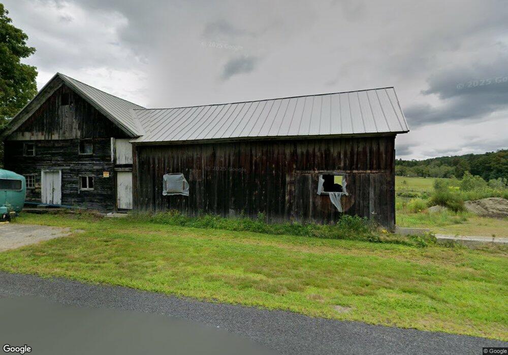
1296 Watson Spruce Corner Rd Ashfield, MA 01330
Ashfield NeighborhoodEstimated Value: $240,000 - $362,993
3
Beds
1
Bath
1,386
Sq Ft
$224/Sq Ft
Est. Value
About This Home
This home is located at 1296 Watson Spruce Corner Rd, Ashfield, MA 01330 and is currently estimated at $310,748, approximately $224 per square foot. 1296 Watson Spruce Corner Rd is a home located in Franklin County with nearby schools including Mohawk Trail Regional High School.
Ownership History
Date
Name
Owned For
Owner Type
Purchase Details
Closed on
Jul 20, 2018
Sold by
Haddad Christopher J
Bought by
Pantermehl Richard P
Current Estimated Value
Purchase Details
Closed on
Jun 10, 2004
Sold by
Lilly Margaret R
Bought by
Haddad Christopher J
Home Financials for this Owner
Home Financials are based on the most recent Mortgage that was taken out on this home.
Original Mortgage
$124,000
Interest Rate
5.99%
Mortgage Type
Purchase Money Mortgage
Purchase Details
Closed on
Jul 30, 2003
Sold by
Lil-Hi Farm Ptnshp
Bought by
Lilly Margaret R
Home Financials for this Owner
Home Financials are based on the most recent Mortgage that was taken out on this home.
Original Mortgage
$350,000
Interest Rate
5.28%
Mortgage Type
Purchase Money Mortgage
Create a Home Valuation Report for This Property
The Home Valuation Report is an in-depth analysis detailing your home's value as well as a comparison with similar homes in the area
Home Values in the Area
Average Home Value in this Area
Purchase History
| Date | Buyer | Sale Price | Title Company |
|---|---|---|---|
| Pantermehl Richard P | $115,000 | -- | |
| Haddad Christopher J | $158,000 | -- | |
| Lilly Margaret R | $162,500 | -- | |
| Lilly Margaret R | $100,000 | -- |
Source: Public Records
Mortgage History
| Date | Status | Borrower | Loan Amount |
|---|---|---|---|
| Previous Owner | Lilly Margaret R | $20,000 | |
| Previous Owner | Lilly Margaret R | $107,500 | |
| Previous Owner | Lilly Margaret R | $124,000 | |
| Previous Owner | Lilly Margaret R | $350,000 |
Source: Public Records
Tax History Compared to Growth
Tax History
| Year | Tax Paid | Tax Assessment Tax Assessment Total Assessment is a certain percentage of the fair market value that is determined by local assessors to be the total taxable value of land and additions on the property. | Land | Improvement |
|---|---|---|---|---|
| 2025 | $3,759 | $279,300 | $91,700 | $187,600 |
| 2024 | $3,904 | $267,200 | $91,700 | $175,500 |
| 2023 | $3,511 | $199,400 | $73,700 | $125,700 |
| 2022 | $3,297 | $189,700 | $70,200 | $119,500 |
| 2021 | $4,859 | $189,700 | $70,200 | $119,500 |
| 2020 | $3,160 | $189,700 | $70,200 | $119,500 |
| 2019 | $3,135 | $182,700 | $67,900 | $114,800 |
| 2018 | $3,032 | $176,500 | $67,900 | $108,600 |
| 2017 | $2,848 | $175,600 | $67,000 | $108,600 |
| 2016 | $2,750 | $167,300 | $67,000 | $100,300 |
| 2015 | $2,672 | $167,300 | $67,000 | $100,300 |
| 2014 | $2,867 | $177,400 | $62,800 | $114,600 |
Source: Public Records
Map
Nearby Homes
- 0 Old Stage Rd Unit 73326639
- 374 Watson Spruce Corner Rd
- 220 Hawley Rd
- 41 Buckland Rd
- 292 E Hawley Rd
- 0 Hunt Rd
- 0 John Ford Rd Unit 73403157
- 0 John Ford Rd Unit 73403156
- 29 Union St
- 333 Ranney Corner Rd
- 0 Ashfield Rd
- 0 Spruce Corner Rd Unit 73244975
- 153 E Hawley Rd
- 240 Beldingville Rd
- 0 Sears Rd Unit 73373850
- 0, Lot 7 East Rd
- Lot 3.2 East Rd
- 0 Upper St
- 10 Maple St
- 678 W Main St
- 3 Old Stage Rd
- 1710 Bug Hill Rd
- 1686 Bug Hill Rd
- 14 Watson Rd
- 1239 Watson Spruce Corner Rd
- 72 Watson Rd
- 1592 Bug Hill Rd
- 1144 Watson Spruce Corner Rd
- 130 Old Stage Rd
- 172 Old Stage Rd
- 15 Ford Rd
- 1411 Bug Hill Rd
- 0 Old Stage Rd Unit 71558291
- Lot 3B Old Stage Rd
- 0 Old Stage Rd Unit 71847271
- 0 Old Stage Rd Unit 73118454
- 0 Old Stage Rd Unit 72794556
- 4 Old Stage Rd
- 51+52 Ford Rd
- 966 Watson Spruce Corner Rd