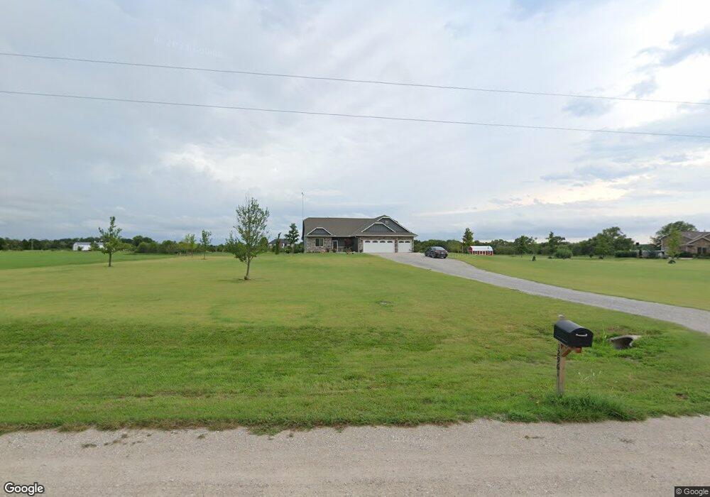
12961 SW 57th St Andover, KS 67002
Estimated Value: $618,000 - $945,000
5
Beds
3
Baths
2,502
Sq Ft
$290/Sq Ft
Est. Value
About This Home
This home is located at 12961 SW 57th St, Andover, KS 67002 and is currently estimated at $725,506, approximately $289 per square foot. 12961 SW 57th St is a home with nearby schools including Robert M. Martin Elementary School, Andover Middle School, and Andover High School.
Ownership History
Date
Name
Owned For
Owner Type
Purchase Details
Closed on
Oct 26, 2018
Sold by
Warren Brothers Quality Llc
Bought by
Ralston Michael J and Ralston Aubrey S
Current Estimated Value
Purchase Details
Closed on
May 4, 2018
Sold by
Ralston L James and Ralston Dabra A
Bought by
Warren Brothers Quality Homes Llc
Home Financials for this Owner
Home Financials are based on the most recent Mortgage that was taken out on this home.
Original Mortgage
$336,000
Interest Rate
4.44%
Mortgage Type
Construction
Create a Home Valuation Report for This Property
The Home Valuation Report is an in-depth analysis detailing your home's value as well as a comparison with similar homes in the area
Home Values in the Area
Average Home Value in this Area
Purchase History
| Date | Buyer | Sale Price | Title Company |
|---|---|---|---|
| Ralston Michael J | -- | Security 1St Title Llc | |
| Warren Brothers Quality Homes Llc | -- | None Available |
Source: Public Records
Mortgage History
| Date | Status | Borrower | Loan Amount |
|---|---|---|---|
| Previous Owner | Warren Brothers Quality Homes Llc | $336,000 |
Source: Public Records
Tax History Compared to Growth
Tax History
| Year | Tax Paid | Tax Assessment Tax Assessment Total Assessment is a certain percentage of the fair market value that is determined by local assessors to be the total taxable value of land and additions on the property. | Land | Improvement |
|---|---|---|---|---|
| 2025 | $93 | $74,635 | $6,718 | $67,917 |
| 2024 | $93 | $72,589 | $5,589 | $67,000 |
| 2023 | $8,828 | $68,004 | $5,616 | $62,388 |
| 2022 | $6,979 | $54,535 | $4,711 | $49,824 |
| 2021 | $6,979 | $50,747 | $3,664 | $47,083 |
| 2020 | $7,114 | $49,807 | $3,680 | $46,127 |
| 2019 | $6,979 | $48,271 | $3,327 | $44,944 |
| 2018 | $76 | $519 | $519 | $0 |
| 2017 | $69 | $474 | $474 | $0 |
Source: Public Records
Map
Nearby Homes
- 12838 SW 60th St
- 12550 SW 60th St
- 12750 SW 50th St
- 12707 SW Chisholm Trail Rd
- 14601 SW 60th St
- 4456 SW Tawakoni Rd
- 11601 SW 48th Terrace
- NW/c of SW 80th St & Sw Indianola Rd
- 7067 SW Meadowlark Rd
- North of SW 80th St & Sw Indianola Rd
- 4291 SW Prairie Creek Rd
- 1633 N Wildflower Ct
- 1627 N Wildflower Ct
- 000 SW Santa Fe Lake Rd
- 1548 N Quince Ct
- 1632 N Magnolia Ct
- 1542 N Quince Ct
- 1631 N Magnolia Ct
- 1603 N Wildflower Ct
- 1541 N Quince Ct
- 13029 SW 57th St
- 13026 SW 57th St
- 5709 SW Tumbleweed Rd
- 5843 SW Tumbleweed Rd
- 13110 SW 57th St
- 12938 SW 57th St
- 13148 SW 57th St
- 13010 SW 60th St
- 5947 SW Tumbleweed Rd
- 40 +/- Acres on SW Tumbleweed Rd
- 38 +/- Acres on SW Tumbleweed Rd
- 20 +/- Acres on SW Tumbleweed Rd
- 13300 SW 60th St
- 5339 SW Tumbleweed Rd
- 12629 SW 60th St
- 13432 SW 60th St
- 13440 SW 60th St
- 5205 SW Tumbleweed Rd
- 5123 SW Tumbleweed Rd
- 13718 SW 60th St