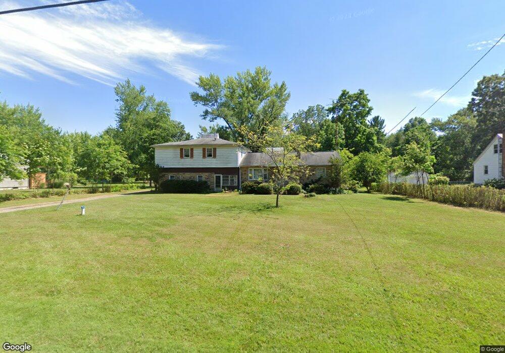
12966 Edison St NE Alliance, OH 44601
Estimated Value: $132,648 - $283,000
5
Beds
2
Baths
2,088
Sq Ft
$90/Sq Ft
Est. Value
About This Home
This home is located at 12966 Edison St NE, Alliance, OH 44601 and is currently estimated at $188,412, approximately $90 per square foot. 12966 Edison St NE is a home located in Stark County with nearby schools including Marlington High School and Regina Coeli/St Joseph School.
Ownership History
Date
Name
Owned For
Owner Type
Purchase Details
Closed on
Oct 1, 2009
Sold by
Us Bank National Association
Bought by
Brant Ii Ward W
Current Estimated Value
Home Financials for this Owner
Home Financials are based on the most recent Mortgage that was taken out on this home.
Original Mortgage
$62,200
Interest Rate
4.78%
Mortgage Type
New Conventional
Purchase Details
Closed on
Aug 27, 2009
Sold by
Wayne Nona L
Bought by
Us Bank National Association
Home Financials for this Owner
Home Financials are based on the most recent Mortgage that was taken out on this home.
Original Mortgage
$62,200
Interest Rate
4.78%
Mortgage Type
New Conventional
Purchase Details
Closed on
Sep 12, 2000
Sold by
King Wayne P & Nona L Trustee
Bought by
King Wayne P and King Nona L
Create a Home Valuation Report for This Property
The Home Valuation Report is an in-depth analysis detailing your home's value as well as a comparison with similar homes in the area
Home Values in the Area
Average Home Value in this Area
Purchase History
| Date | Buyer | Sale Price | Title Company |
|---|---|---|---|
| Brant Ii Ward W | $77,800 | None Available | |
| Us Bank National Association | $108,000 | None Available | |
| King Wayne P | -- | -- |
Source: Public Records
Mortgage History
| Date | Status | Borrower | Loan Amount |
|---|---|---|---|
| Previous Owner | Brant Ii Ward W | $62,200 |
Source: Public Records
Tax History Compared to Growth
Tax History
| Year | Tax Paid | Tax Assessment Tax Assessment Total Assessment is a certain percentage of the fair market value that is determined by local assessors to be the total taxable value of land and additions on the property. | Land | Improvement |
|---|---|---|---|---|
| 2025 | -- | $61,390 | $28,700 | $32,690 |
| 2024 | -- | $61,390 | $28,700 | $32,690 |
| 2023 | $1,910 | $53,000 | $23,070 | $29,930 |
| 2022 | $1,917 | $53,000 | $23,070 | $29,930 |
| 2021 | $1,923 | $53,000 | $23,070 | $29,930 |
| 2020 | $1,851 | $45,470 | $19,880 | $25,590 |
| 2019 | $1,840 | $45,480 | $19,890 | $25,590 |
| 2018 | $1,843 | $45,480 | $19,890 | $25,590 |
| 2017 | $1,685 | $38,900 | $13,830 | $25,070 |
| 2016 | $1,965 | $45,370 | $15,650 | $29,720 |
| 2015 | $1,878 | $45,370 | $15,650 | $29,720 |
| 2014 | $1,912 | $42,190 | $14,530 | $27,660 |
| 2013 | $951 | $42,190 | $14,530 | $27,660 |
Source: Public Records
Map
Nearby Homes
- 11940 Freshley Ave NE
- 13109 Edison St NE
- 12355 Edison St NE
- 12415 Snode St NE
- 12252 Snode St NE
- 11480 Aebi Ave NE
- 0 Meadow St NE
- 13334 Cindy St NE
- 10666 Wilma Ave NE
- 13061 Beeson St NE
- 0 Klinger Ave NE
- 14422 Sturbridge Rd NE
- 0 Johnson Ave NE Unit 5142926
- 000 Klinger Ave
- 0 Homestead Ave NE
- 14723 Bolton St NE
- 13975 Greenbower St NE
- 0 Meadowbrook Ave
- 000 Meadowbrook Ave
- 432 Johnson Ave
- 12930 Edison St NE
- 12980 Edison St NE
- 12904 Edison St NE
- 12951 Edison St NE
- 13004 Edison St NE
- 12890 Edison St NE
- 12931 Edison St NE
- 12971 Edison St NE
- 12991 Edison St NE
- 13032 Edison St NE
- 12899 Edison St NE
- 12861 Edison St NE
- 13050 Edison St NE
- 12844 Edison St NE
- 13023 Edison St NE
- 11960 Freshley Ave NE
- 13077 Edison St NE
- 11904 Freshley Ave NE
- 13104 Edison St NE
- 11830 Freshley Ave NE