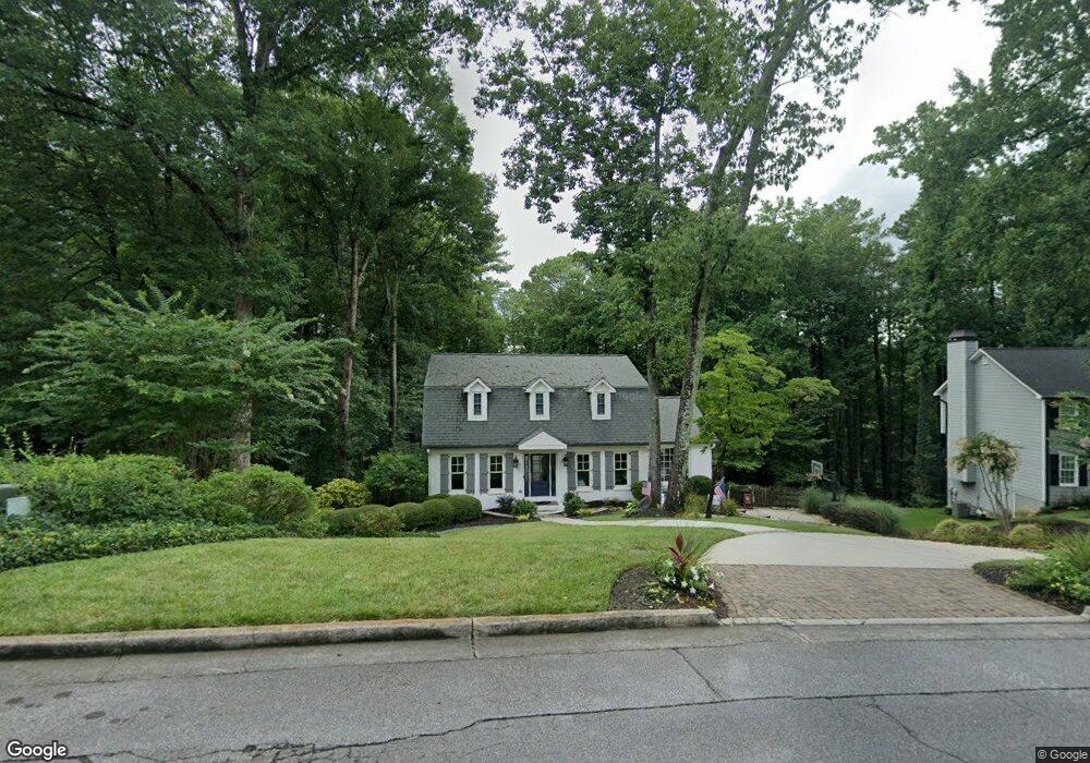
1297 Independence Way Unit 1 Marietta, GA 30062
East Cobb NeighborhoodEstimated Value: $613,839 - $732,000
4
Beds
4
Baths
2,510
Sq Ft
$273/Sq Ft
Est. Value
About This Home
This home is located at 1297 Independence Way Unit 1, Marietta, GA 30062 and is currently estimated at $686,210, approximately $273 per square foot. 1297 Independence Way Unit 1 is a home located in Cobb County with nearby schools including East Side Elementary School, Dodgen Middle School, and Walton High School.
Ownership History
Date
Name
Owned For
Owner Type
Purchase Details
Closed on
Nov 24, 1993
Sold by
Frank Morris A Caren C
Bought by
Jones Todd M Denise
Current Estimated Value
Home Financials for this Owner
Home Financials are based on the most recent Mortgage that was taken out on this home.
Original Mortgage
$121,611
Interest Rate
6.85%
Create a Home Valuation Report for This Property
The Home Valuation Report is an in-depth analysis detailing your home's value as well as a comparison with similar homes in the area
Home Values in the Area
Average Home Value in this Area
Purchase History
| Date | Buyer | Sale Price | Title Company |
|---|---|---|---|
| Jones Todd M Denise | $132,500 | -- |
Source: Public Records
Mortgage History
| Date | Status | Borrower | Loan Amount |
|---|---|---|---|
| Closed | Jones Todd M Denise | $121,611 |
Source: Public Records
Tax History Compared to Growth
Tax History
| Year | Tax Paid | Tax Assessment Tax Assessment Total Assessment is a certain percentage of the fair market value that is determined by local assessors to be the total taxable value of land and additions on the property. | Land | Improvement |
|---|---|---|---|---|
| 2025 | $5,446 | $234,720 | $54,000 | $180,720 |
| 2024 | $5,450 | $234,720 | $54,000 | $180,720 |
| 2023 | $4,343 | $208,676 | $42,000 | $166,676 |
| 2022 | $4,226 | $176,740 | $36,000 | $140,740 |
| 2021 | $4,226 | $176,740 | $36,000 | $140,740 |
| 2020 | $4,073 | $169,740 | $36,000 | $133,740 |
| 2019 | $3,925 | $162,984 | $36,000 | $126,984 |
| 2018 | $3,925 | $162,984 | $36,000 | $126,984 |
| 2017 | $3,265 | $137,204 | $36,000 | $101,204 |
| 2016 | $3,272 | $137,204 | $36,000 | $101,204 |
| 2015 | $2,869 | $116,308 | $36,000 | $80,308 |
| 2014 | $2,888 | $116,308 | $0 | $0 |
Source: Public Records
Map
Nearby Homes
- 1257 Independence Way
- 3570 Brighton Place
- 718 Trevett Way
- 3792 Raccoon Run
- 3700 Robinson Rd NE
- 1680 Bill Murdock Rd
- 3506 Clubland Dr Unit 6
- 1195 Fielding Way
- 3495 Mill Bridge Dr Unit 2
- 3825 Emerson St
- 3769 High Green Dr
- 0 Old Canton Rd NE Unit 10567243
- 0 Old Canton Rd NE Unit 7617214
- 3542 Clubland Dr
- 1164 Fairfield Dr
- 4121 Fawn Ct
- 1038 Seven Springs Cir
- 3999 Tall Pine Dr
- 1287 Independence Way
- 1304 Independence Way
- 1277 Independence Way Unit 1
- 1317 Independence Way
- 1284 Independence Way
- 1298 Bucks Ford Place Unit 1
- 3480 Brighton Place
- 1314 Independence Way
- 1327 Independence Way
- 1264 Independence Way
- 1430 Logan Cir Unit 2
- 1434 Logan Cir
- 1426 Logan Cir
- 3490 Brighton Place Unit 1
- 1438 Logan Cir
- 1308 Bucks Ford Place
- 1324 Independence Way
- 1337 Independence Way Unit 1
- 1442 Logan Cir Unit 2
- 1254 Independence Way