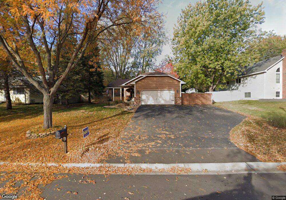
12978 Jay St NW Coon Rapids, MN 55448
Estimated Value: $360,000 - $391,000
3
Beds
2
Baths
1,643
Sq Ft
$229/Sq Ft
Est. Value
About This Home
This home is located at 12978 Jay St NW, Coon Rapids, MN 55448 and is currently estimated at $375,928, approximately $228 per square foot. 12978 Jay St NW is a home located in Anoka County with nearby schools including Lucile Bruner Elementary School, Morris Bye Elementary School, and Laughlin Junior/Senior High School.
Ownership History
Date
Name
Owned For
Owner Type
Purchase Details
Closed on
Jul 2, 2021
Sold by
Axelson Victoria Lorraine and Holst Missy
Bought by
Rodriguez Kevin M
Current Estimated Value
Home Financials for this Owner
Home Financials are based on the most recent Mortgage that was taken out on this home.
Original Mortgage
$336,590
Outstanding Balance
$305,403
Interest Rate
2.9%
Mortgage Type
New Conventional
Estimated Equity
$70,525
Create a Home Valuation Report for This Property
The Home Valuation Report is an in-depth analysis detailing your home's value as well as a comparison with similar homes in the area
Home Values in the Area
Average Home Value in this Area
Purchase History
| Date | Buyer | Sale Price | Title Company |
|---|---|---|---|
| Rodriguez Kevin M | $347,000 | Titlesmart Inc | |
| Rodriguez Kevin Kevin | $347,000 | -- |
Source: Public Records
Mortgage History
| Date | Status | Borrower | Loan Amount |
|---|---|---|---|
| Open | Rodriguez Kevin M | $336,590 | |
| Closed | Rodriguez Kevin Kevin | $336,590 |
Source: Public Records
Tax History Compared to Growth
Tax History
| Year | Tax Paid | Tax Assessment Tax Assessment Total Assessment is a certain percentage of the fair market value that is determined by local assessors to be the total taxable value of land and additions on the property. | Land | Improvement |
|---|---|---|---|---|
| 2025 | $3,404 | $331,500 | $94,500 | $237,000 |
| 2024 | $3,404 | $327,200 | $91,400 | $235,800 |
| 2023 | $3,252 | $316,400 | $75,600 | $240,800 |
| 2022 | $2,709 | $327,300 | $75,600 | $251,700 |
| 2021 | $2,665 | $251,400 | $58,800 | $192,600 |
| 2020 | $2,718 | $242,200 | $58,800 | $183,400 |
| 2019 | $2,595 | $237,000 | $58,800 | $178,200 |
| 2018 | $2,480 | $221,000 | $0 | $0 |
| 2017 | $2,205 | $206,300 | $0 | $0 |
| 2016 | $2,261 | $183,600 | $0 | $0 |
| 2015 | -- | $183,600 | $52,500 | $131,100 |
| 2014 | -- | $151,700 | $37,200 | $114,500 |
Source: Public Records
Map
Nearby Homes
- 1687 131st Ln NW
- 1520 129th Ave NW
- 1776 133rd Ave NW
- 1930 127th Cir NW
- 12554 Grouse St NW
- 12796 Bluebird St NW
- 1593 126th Ln NW
- 1450 126th Ln NW
- 12760 Raven St NW
- 1234 128th Cir NW
- 12365 Jay St NW
- 2147 125th Ln NW
- 13416 Swallow St NW
- 1625 124th Ave NW
- 13519 Partridge Cir NW
- 12463 Drake St NW
- 2068 124th Ln NW
- 13182 Zion St NW
- 1727 121st Ln NW
- 2270 137th Ln NW
- 12992 Jay St NW
- 12964 Jay St NW
- 13006 Jay St NW
- 12950 Jay St NW
- 1773 129th Ln NW
- 1757 129th Ln NW
- 12985 Jay St NW
- 1753 129th Ln NW
- 12993 Killdeer St NW
- 12999 Jay St NW
- 13020 Jay St NW
- 1745 129th Ln NW
- 13007 Killdeer St NW
- 12945 Jay St NW
- 1741 129th Ln NW
- 1831 128th Ave NW
- 1847 128th Ave NW
- 1815 128th Ave NW
- 13017 Jay St NW
- 1772 129th Ln NW