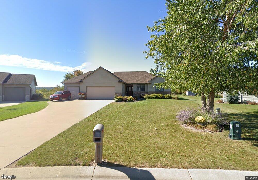
1298 Lone Stone Ct SE Chatfield, MN 55923
Estimated Value: $399,000 - $513,000
5
Beds
3
Baths
3,130
Sq Ft
$139/Sq Ft
Est. Value
About This Home
This home is located at 1298 Lone Stone Ct SE, Chatfield, MN 55923 and is currently estimated at $434,112, approximately $138 per square foot. 1298 Lone Stone Ct SE is a home located in Fillmore County with nearby schools including Chatfield Elementary School, Chatfield Secondary School, and St. Paul Lutheran School.
Ownership History
Date
Name
Owned For
Owner Type
Purchase Details
Closed on
Jul 21, 2017
Sold by
Thompson Joshua Gerald and Thompson Michele Leann
Bought by
Winslow James R and Winslow Gabrielle L
Current Estimated Value
Home Financials for this Owner
Home Financials are based on the most recent Mortgage that was taken out on this home.
Original Mortgage
$215,000
Outstanding Balance
$178,678
Interest Rate
3.9%
Mortgage Type
New Conventional
Estimated Equity
$255,434
Create a Home Valuation Report for This Property
The Home Valuation Report is an in-depth analysis detailing your home's value as well as a comparison with similar homes in the area
Home Values in the Area
Average Home Value in this Area
Purchase History
| Date | Buyer | Sale Price | Title Company |
|---|---|---|---|
| Winslow James R | $280,000 | Rochester Title & Escrow Com |
Source: Public Records
Mortgage History
| Date | Status | Borrower | Loan Amount |
|---|---|---|---|
| Open | Winslow James R | $215,000 |
Source: Public Records
Tax History Compared to Growth
Tax History
| Year | Tax Paid | Tax Assessment Tax Assessment Total Assessment is a certain percentage of the fair market value that is determined by local assessors to be the total taxable value of land and additions on the property. | Land | Improvement |
|---|---|---|---|---|
| 2025 | $5,246 | $370,600 | $45,000 | $325,600 |
| 2024 | $5,246 | $317,500 | $45,000 | $272,500 |
| 2023 | $4,574 | $317,500 | $45,000 | $272,500 |
| 2022 | $4,574 | $275,400 | $45,000 | $230,400 |
| 2021 | $4,574 | $256,200 | $43,800 | $212,400 |
| 2020 | $4,520 | $256,200 | $43,800 | $212,400 |
| 2019 | $4,164 | $227,100 | $43,800 | $183,300 |
| 2018 | $3,610 | $227,100 | $43,800 | $183,300 |
| 2017 | -- | $212,000 | $43,800 | $168,200 |
| 2016 | $3,198 | $212,000 | $43,800 | $168,200 |
| 2015 | $2,846 | $185,800 | $39,775 | $146,025 |
| 2014 | $2,846 | $175,400 | $39,377 | $136,023 |
| 2013 | $2,846 | $176,600 | $39,424 | $137,176 |
Source: Public Records
Map
Nearby Homes
- 1173 Lone Stone Ct SE
- 1534 Enterprise Dr
- 32337 Juniper Rd
- 1622 Enterprise Dr
- 1484 Enterprise Dr
- 1444 Enterprise Dr
- 32592 Juniper Rd
- 1406 Enterprise Dr
- 1427 AMcO Dr SE
- 1057 John and Mary Dr SE
- 1003 Grand St SE
- 824 Main St S
- 11251 Wisdom Ln
- 318 Hawley St SE
- 702 Twiford St SW
- 380 7th St SE
- 613 Winona St SE
- 135 6th St SW
- 26 Millhouse Ln SW
- 202 Winona St SE
- 1292 Lone Stone Ct SE
- 1302 Lone Stone Ct SE
- 1314 Lone Stone Ct SE
- 1263 Lone Stone Ct SE
- 1268 Lone Stone Ct SE
- 1326 Lone Stone Ct SE
- 1305 Lone Stone Ct SE
- 1251 Lone Stone Ct SE
- 1256 Lone Stone Ct SE
- 1239 Lone Stone Ct SE
- 1338 Lone Stone Ct SE
- 1327 Lone Stone Ct SE
- 1244 Lone Stone Ct SE
- 1227 Lone Stone Ct SE
- 1227 Lonestone Ct
- 1352 Lone Stone Ct SE
- 1339 Lone Stone Ct SE
- 1215 Lone Stone Ct SE
- 1232 Lone Stone Ct SE
- 1351 Lone Stone Ct SE