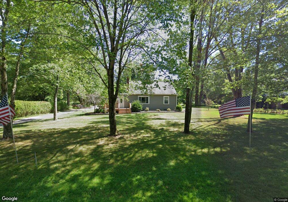
12980 Edison St NE Alliance, OH 44601
Estimated Value: $166,000 - $251,000
3
Beds
1
Bath
1,170
Sq Ft
$170/Sq Ft
Est. Value
About This Home
This home is located at 12980 Edison St NE, Alliance, OH 44601 and is currently estimated at $199,005, approximately $170 per square foot. 12980 Edison St NE is a home located in Stark County with nearby schools including Marlington High School and Regina Coeli/St Joseph School.
Ownership History
Date
Name
Owned For
Owner Type
Purchase Details
Closed on
Jan 26, 2011
Sold by
Federal National Mortgage Association
Bought by
Mccaulley Steven M
Current Estimated Value
Home Financials for this Owner
Home Financials are based on the most recent Mortgage that was taken out on this home.
Original Mortgage
$62,367
Outstanding Balance
$42,636
Interest Rate
4.76%
Mortgage Type
FHA
Estimated Equity
$156,369
Purchase Details
Closed on
Oct 13, 2010
Sold by
Tinley David S
Bought by
Federal National Mortgage Association
Purchase Details
Closed on
Apr 22, 2005
Sold by
Trieff Paul Theodore and Trieff Patricia Ann
Bought by
Tinley David S and Tinley Denise C
Home Financials for this Owner
Home Financials are based on the most recent Mortgage that was taken out on this home.
Original Mortgage
$107,100
Interest Rate
5.89%
Mortgage Type
Fannie Mae Freddie Mac
Create a Home Valuation Report for This Property
The Home Valuation Report is an in-depth analysis detailing your home's value as well as a comparison with similar homes in the area
Home Values in the Area
Average Home Value in this Area
Purchase History
| Date | Buyer | Sale Price | Title Company |
|---|---|---|---|
| Mccaulley Steven M | $65,000 | Sojourners Title | |
| Federal National Mortgage Association | $80,000 | Attorney | |
| Tinley David S | $119,000 | First American Title |
Source: Public Records
Mortgage History
| Date | Status | Borrower | Loan Amount |
|---|---|---|---|
| Open | Mccaulley Steven M | $62,367 | |
| Previous Owner | Tinley David S | $107,100 |
Source: Public Records
Tax History Compared to Growth
Tax History
| Year | Tax Paid | Tax Assessment Tax Assessment Total Assessment is a certain percentage of the fair market value that is determined by local assessors to be the total taxable value of land and additions on the property. | Land | Improvement |
|---|---|---|---|---|
| 2025 | -- | $65,100 | $27,930 | $37,170 |
| 2024 | -- | $62,550 | $28,810 | $33,740 |
| 2023 | $1,813 | $51,180 | $23,630 | $27,550 |
| 2022 | $1,820 | $51,180 | $23,630 | $27,550 |
| 2021 | $1,825 | $51,180 | $23,630 | $27,550 |
| 2020 | $1,767 | $44,140 | $20,410 | $23,730 |
| 2019 | $1,755 | $44,140 | $20,410 | $23,730 |
| 2018 | $1,758 | $44,140 | $20,410 | $23,730 |
| 2017 | $1,544 | $36,340 | $14,570 | $21,770 |
| 2016 | $1,445 | $33,930 | $16,250 | $17,680 |
| 2015 | $1,377 | $33,930 | $16,250 | $17,680 |
| 2014 | $1,401 | $31,540 | $15,120 | $16,420 |
| 2013 | $697 | $31,540 | $15,120 | $16,420 |
Source: Public Records
Map
Nearby Homes
- 11940 Freshley Ave NE
- 13109 Edison St NE
- 12355 Edison St NE
- 12415 Snode St NE
- 11480 Aebi Ave NE
- 12252 Snode St NE
- 0 Meadow St NE
- 13334 Cindy St NE
- 10666 Wilma Ave NE
- 0 Klinger Ave NE
- 13061 Beeson St NE
- 14422 Sturbridge Rd NE
- 0 Johnson Ave NE Unit 5142926
- 000 Klinger Ave
- 0 Homestead Ave NE
- 14723 Bolton St NE
- 13975 Greenbower St NE
- 0 Meadowbrook Ave
- 000 Meadowbrook Ave
- 432 Johnson Ave
- 12966 Edison St NE
- 13004 Edison St NE
- 12930 Edison St NE
- 12951 Edison St NE
- 13032 Edison St NE
- 12971 Edison St NE
- 12991 Edison St NE
- 12904 Edison St NE
- 13050 Edison St NE
- 12931 Edison St NE
- 12890 Edison St NE
- 13023 Edison St NE
- 12899 Edison St NE
- 13077 Edison St NE
- 12861 Edison St NE
- 13104 Edison St NE
- 12844 Edison St NE
- 11960 Freshley Ave NE
- 11904 Freshley Ave NE
- 13151 Edison St NE