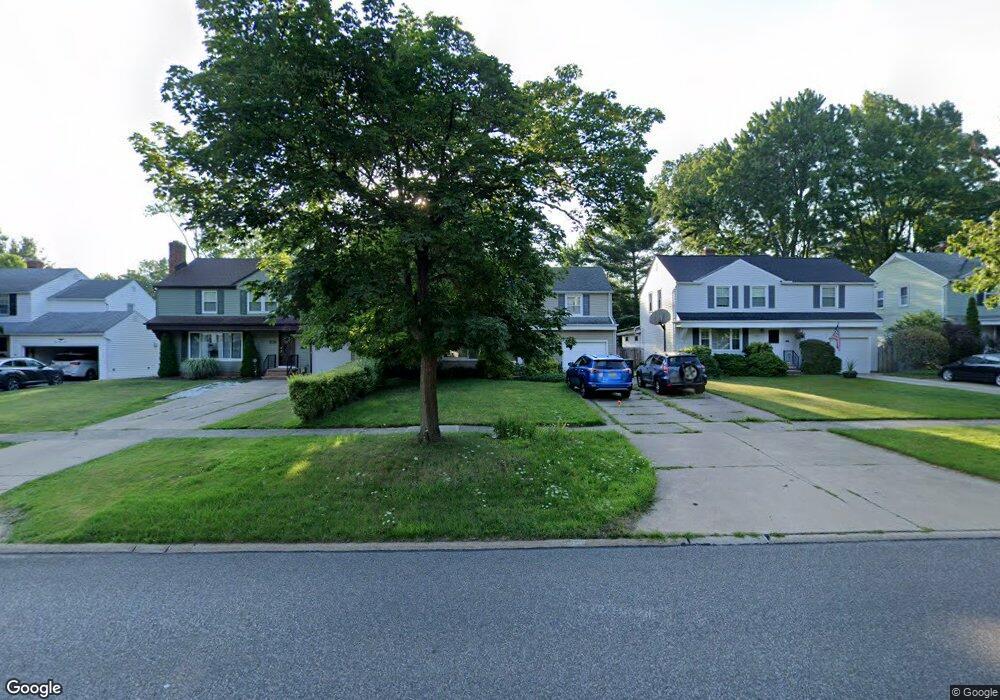
1299 Brainard Rd Cleveland, OH 44124
Estimated Value: $207,000 - $278,000
4
Beds
2
Baths
1,814
Sq Ft
$139/Sq Ft
Est. Value
About This Home
This home is located at 1299 Brainard Rd, Cleveland, OH 44124 and is currently estimated at $252,587, approximately $139 per square foot. 1299 Brainard Rd is a home located in Cuyahoga County with nearby schools including Sunview Elementary School, Greenview Upper Elementary School, and Memorial Junior High School.
Ownership History
Date
Name
Owned For
Owner Type
Purchase Details
Closed on
Aug 22, 2002
Sold by
Dirusso Ralph A and Dirusso Jennifer
Bought by
Caban David C and Caban Susan J
Current Estimated Value
Home Financials for this Owner
Home Financials are based on the most recent Mortgage that was taken out on this home.
Original Mortgage
$133,600
Outstanding Balance
$56,856
Interest Rate
6.63%
Estimated Equity
$195,731
Purchase Details
Closed on
Apr 13, 1994
Sold by
Dimperio Sandra Lee
Bought by
Dirusso Ralph A
Purchase Details
Closed on
Oct 27, 1989
Sold by
Dimperio Bernice B
Bought by
Dimperio Sandra Lee
Purchase Details
Closed on
Jan 1, 1975
Bought by
Dimperio Bernice B
Create a Home Valuation Report for This Property
The Home Valuation Report is an in-depth analysis detailing your home's value as well as a comparison with similar homes in the area
Home Values in the Area
Average Home Value in this Area
Purchase History
| Date | Buyer | Sale Price | Title Company |
|---|---|---|---|
| Caban David C | $167,000 | Guardian Title | |
| Dirusso Ralph A | $90,000 | -- | |
| Dimperio Sandra Lee | -- | -- | |
| Dimperio Bernice B | -- | -- |
Source: Public Records
Mortgage History
| Date | Status | Borrower | Loan Amount |
|---|---|---|---|
| Open | Caban David C | $133,600 |
Source: Public Records
Tax History Compared to Growth
Tax History
| Year | Tax Paid | Tax Assessment Tax Assessment Total Assessment is a certain percentage of the fair market value that is determined by local assessors to be the total taxable value of land and additions on the property. | Land | Improvement |
|---|---|---|---|---|
| 2024 | $4,905 | $70,455 | $11,130 | $59,325 |
| 2023 | $5,131 | $59,640 | $10,080 | $49,560 |
| 2022 | $5,101 | $59,640 | $10,080 | $49,560 |
| 2021 | $5,057 | $59,640 | $10,080 | $49,560 |
| 2020 | $4,740 | $48,900 | $8,260 | $40,640 |
| 2019 | $4,272 | $139,700 | $23,600 | $116,100 |
| 2018 | $4,250 | $48,900 | $8,260 | $40,640 |
| 2017 | $4,505 | $47,710 | $8,370 | $39,340 |
| 2016 | $4,471 | $47,710 | $8,370 | $39,340 |
| 2015 | $4,625 | $47,710 | $8,370 | $39,340 |
| 2014 | $4,625 | $48,690 | $8,540 | $40,150 |
Source: Public Records
Map
Nearby Homes
- 1307 Ford Rd
- 1291 Haverston Rd
- 1284 Haverston Rd
- 1194 Croyden Rd
- 1391 Iroquois Ave
- 1151 Brainard Rd
- 1151 Croyden Rd
- 1213 Eastwood Ave
- 1120 Croyden Rd
- 1218 Summit Dr
- 1233 Summit Dr
- 1192 Blanchester Rd
- 1201 Summit Dr
- 1363 Ranchland Dr
- 1430 Belrose Rd
- 1433 Churchill Rd
- 1443 Churchill Rd
- 1368 Irene Rd
- 1147 Irene Rd
- 1574 Hawthorne Dr
- 1303 Brainard Rd
- 1293 Brainard Rd
- 1287 Brainard Rd
- 1307 Brainard Rd
- 1302 Croyden Rd
- 1296 Croyden Rd
- 1283 Brainard Rd
- 1304 Croyden Rd
- 1317 Brainard Rd
- 1292 Croyden Rd
- 1277 Brainard Rd
- 1310 Croyden Rd
- 1300 Brainard Rd
- 1304 Brainard Rd
- 1294 Brainard Rd
- 1323 Brainard Rd
- 1320 Croyden Rd
- 1278 Croyden Rd
- 1273 Brainard Rd