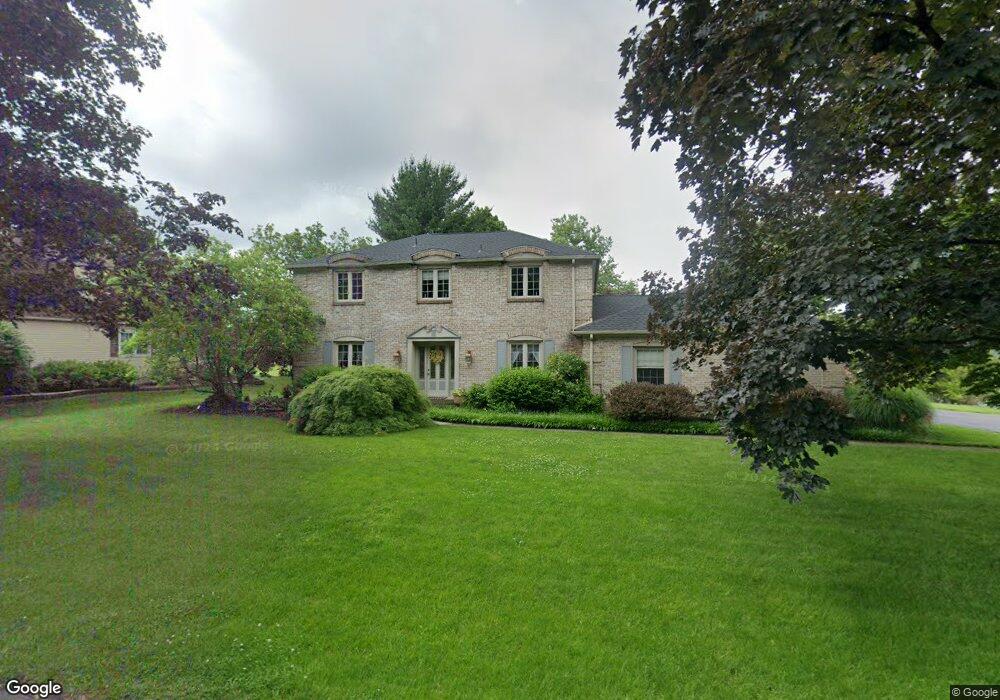
1299 Brassie St Allentown, PA 18106
Lower Macungie Township East NeighborhoodEstimated Value: $477,000 - $525,000
4
Beds
3
Baths
2,376
Sq Ft
$206/Sq Ft
Est. Value
About This Home
This home is located at 1299 Brassie St, Allentown, PA 18106 and is currently estimated at $489,436, approximately $205 per square foot. 1299 Brassie St is a home located in Lehigh County with nearby schools including Willow Lane Elementary School, Lower Macungie Middle School, and Emmaus High School.
Ownership History
Date
Name
Owned For
Owner Type
Purchase Details
Closed on
Apr 11, 2011
Sold by
Bridger Patrick O
Bought by
Powell Dix David A
Current Estimated Value
Home Financials for this Owner
Home Financials are based on the most recent Mortgage that was taken out on this home.
Original Mortgage
$272,902
Outstanding Balance
$187,925
Interest Rate
4.76%
Mortgage Type
FHA
Estimated Equity
$301,511
Purchase Details
Closed on
Apr 24, 2001
Sold by
Land Holding Corp Of Pa
Bought by
Williams Thomas P
Purchase Details
Closed on
Apr 7, 1999
Sold by
Kistler David C
Bought by
Land Holding Corp Of Pa
Purchase Details
Closed on
Nov 27, 1998
Sold by
Eggert Janet C and Eggert Edward F
Bought by
Eggert Janet C
Purchase Details
Closed on
Sep 3, 1991
Bought by
Kistler David C
Create a Home Valuation Report for This Property
The Home Valuation Report is an in-depth analysis detailing your home's value as well as a comparison with similar homes in the area
Home Values in the Area
Average Home Value in this Area
Purchase History
| Date | Buyer | Sale Price | Title Company |
|---|---|---|---|
| Powell Dix David A | $280,000 | -- | |
| Williams Thomas P | $115,000 | -- | |
| Land Holding Corp Of Pa | -- | -- | |
| Eggert Janet C | -- | -- | |
| Kistler David C | -- | -- |
Source: Public Records
Mortgage History
| Date | Status | Borrower | Loan Amount |
|---|---|---|---|
| Open | Powell Dix David A | $272,902 |
Source: Public Records
Tax History Compared to Growth
Tax History
| Year | Tax Paid | Tax Assessment Tax Assessment Total Assessment is a certain percentage of the fair market value that is determined by local assessors to be the total taxable value of land and additions on the property. | Land | Improvement |
|---|---|---|---|---|
| 2025 | $6,495 | $254,400 | $38,600 | $215,800 |
| 2024 | $6,284 | $254,400 | $38,600 | $215,800 |
| 2023 | $6,158 | $254,400 | $38,600 | $215,800 |
| 2022 | $6,012 | $254,400 | $215,800 | $38,600 |
| 2021 | $5,885 | $254,400 | $38,600 | $215,800 |
| 2020 | $5,829 | $254,400 | $38,600 | $215,800 |
| 2019 | $5,729 | $254,400 | $38,600 | $215,800 |
| 2018 | $5,654 | $254,400 | $38,600 | $215,800 |
| 2017 | $5,555 | $254,400 | $38,600 | $215,800 |
| 2016 | -- | $254,400 | $38,600 | $215,800 |
| 2015 | -- | $254,400 | $38,600 | $215,800 |
| 2014 | -- | $254,400 | $38,600 | $215,800 |
Source: Public Records
Map
Nearby Homes
- 5736 Greens Dr
- 5673 Wedge Ln
- 5619 Stonecroft Ln
- 6179 Fairway Ln
- 5524 Stonecroft Ln
- 6007 Timberknoll Dr
- 5475 Hamilton Blvd Unit 7
- 997 Village Round Unit K
- 997K Village Round Unit 104K
- 5300 Hanover Dr
- 5280 Townsquare Dr
- 1385 Brookside Rd
- 1675 Hamlet Dr
- 1991 Autumn Ridge Rd
- 5133 Meadow Ln
- 2056 Autumn Ridge Rd
- 6645 Stein Way Unit 6639-6661
- 6126 Palomino Dr
- 4881 Spruce Rd
- 5175 Meadowview Dr
- 1321 S Krocks Rd
- 1301 Brassie St
- 1288 Brassie St
- 1308 S Krocks Rd
- 1292 S Krocks Rd
- 1292 Brassie St
- 1307 Brassie St
- 1324 S Krocks Rd
- 1276 S Krocks Rd
- 1296 Brassie St
- 1250 Country Club Rd
- 1256 Country Club Rd
- 1346 S Krocks Rd
- 1311 Brassie St
- 1260 S Krocks Rd
- 1262 Country Club Rd
- 1302 Brassie St
- 1363 S Krocks Rd
- 1358 S Krocks Rd
- 1266 Country Club Rd