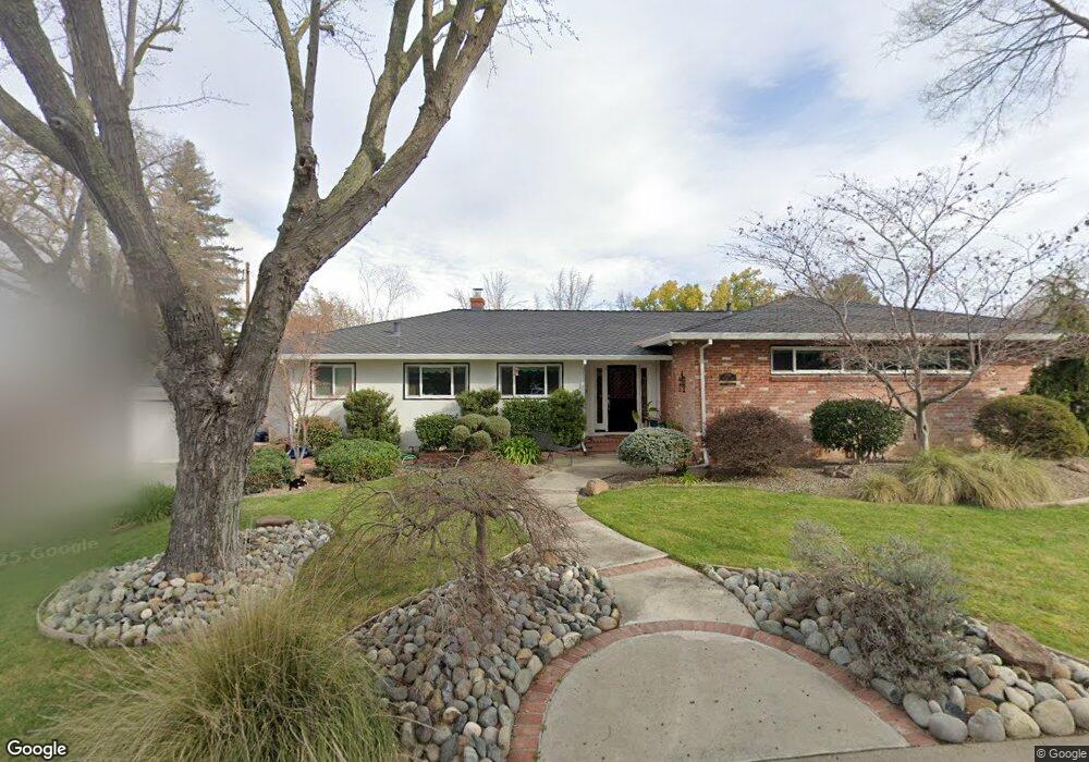
1299 Kennady Ln Sacramento, CA 95822
South Land Park NeighborhoodEstimated Value: $687,000 - $1,008,000
3
Beds
3
Baths
2,582
Sq Ft
$338/Sq Ft
Est. Value
About This Home
This home is located at 1299 Kennady Ln, Sacramento, CA 95822 and is currently estimated at $871,623, approximately $337 per square foot. 1299 Kennady Ln is a home located in Sacramento County with nearby schools including Sutterville Elementary School, California Middle, and C. K. McClatchy High.
Ownership History
Date
Name
Owned For
Owner Type
Purchase Details
Closed on
Dec 12, 2001
Sold by
Dupzyk Stephanie L
Bought by
Alvarado Sammy L and Alvarado Alicia M
Current Estimated Value
Home Financials for this Owner
Home Financials are based on the most recent Mortgage that was taken out on this home.
Original Mortgage
$368,000
Outstanding Balance
$143,797
Interest Rate
6.57%
Estimated Equity
$727,826
Purchase Details
Closed on
Jan 25, 1999
Sold by
Dupzyk Joel
Bought by
Dupzyk Stephanie L
Purchase Details
Closed on
Jun 18, 1998
Sold by
Schlachter David L
Bought by
Dupzyk Stephanie L
Home Financials for this Owner
Home Financials are based on the most recent Mortgage that was taken out on this home.
Original Mortgage
$204,000
Interest Rate
9.25%
Create a Home Valuation Report for This Property
The Home Valuation Report is an in-depth analysis detailing your home's value as well as a comparison with similar homes in the area
Home Values in the Area
Average Home Value in this Area
Purchase History
| Date | Buyer | Sale Price | Title Company |
|---|---|---|---|
| Alvarado Sammy L | $460,000 | Placer Title Company | |
| Dupzyk Stephanie L | -- | First American Title Ins Co | |
| Dupzyk Stephanie L | $240,000 | -- |
Source: Public Records
Mortgage History
| Date | Status | Borrower | Loan Amount |
|---|---|---|---|
| Open | Alvarado Sammy L | $368,000 | |
| Previous Owner | Dupzyk Stephanie L | $204,000 |
Source: Public Records
Tax History Compared to Growth
Tax History
| Year | Tax Paid | Tax Assessment Tax Assessment Total Assessment is a certain percentage of the fair market value that is determined by local assessors to be the total taxable value of land and additions on the property. | Land | Improvement |
|---|---|---|---|---|
| 2025 | $7,894 | $679,537 | $172,242 | $507,295 |
| 2024 | $7,894 | $666,214 | $168,865 | $497,349 |
| 2023 | $7,699 | $653,152 | $165,554 | $487,598 |
| 2022 | $7,583 | $640,346 | $162,308 | $478,038 |
| 2021 | $7,214 | $627,791 | $159,126 | $468,665 |
| 2020 | $7,273 | $621,355 | $157,495 | $463,860 |
| 2019 | $7,116 | $609,172 | $154,407 | $454,765 |
| 2018 | $6,929 | $597,229 | $151,380 | $445,849 |
| 2017 | $6,829 | $585,519 | $148,412 | $437,107 |
| 2016 | $6,625 | $574,039 | $145,502 | $428,537 |
| 2015 | $6,522 | $565,417 | $143,317 | $422,100 |
| 2014 | $6,347 | $554,342 | $140,510 | $413,832 |
Source: Public Records
Map
Nearby Homes
- 5200 Pleasant Dr
- 5440 Pleasant Dr
- 1220 Lucio Ln
- 1224 Nevis Ct
- 1428 Tradewinds Ave
- 1432 Oregon Dr
- 1433 32nd Ave
- 5779 Gloria Dr
- 1122 28th Ave
- 4801 da Rosa Dr
- 4500 Crestwood Way
- 5081 Karbet Way
- 1621 Fruitridge Rd
- 5716 Lonsdale Dr
- 1436 Sterling St
- 5880 Gloria Dr
- 5875 Gloria Dr Unit 4
- 1050 Appollo Way
- 1810 Opper Ave
- 4271 Warren Ave
- 5210 Pleasant Dr
- 1295 Kennady Ln
- 5300 Pleasant Dr
- 1291 Kennady Ln
- 5221 Pleasant Dr
- 1294 Kennady Ln
- 1294 Noonan Dr
- 5231 Pleasant Dr
- 5211 Pleasant Dr
- 5201 Pleasant Dr
- 1290 Kennady Ln
- 5301 Pleasant Dr
- 5310 Pleasant Dr
- 1287 Kennady Ln
- 1290 Noonan Dr
- 1286 Kennady Ln
- 5311 Pleasant Dr
- 5400 Pleasant Dr
- 1310 Noonan Dr
- 5220 Del Rio Rd