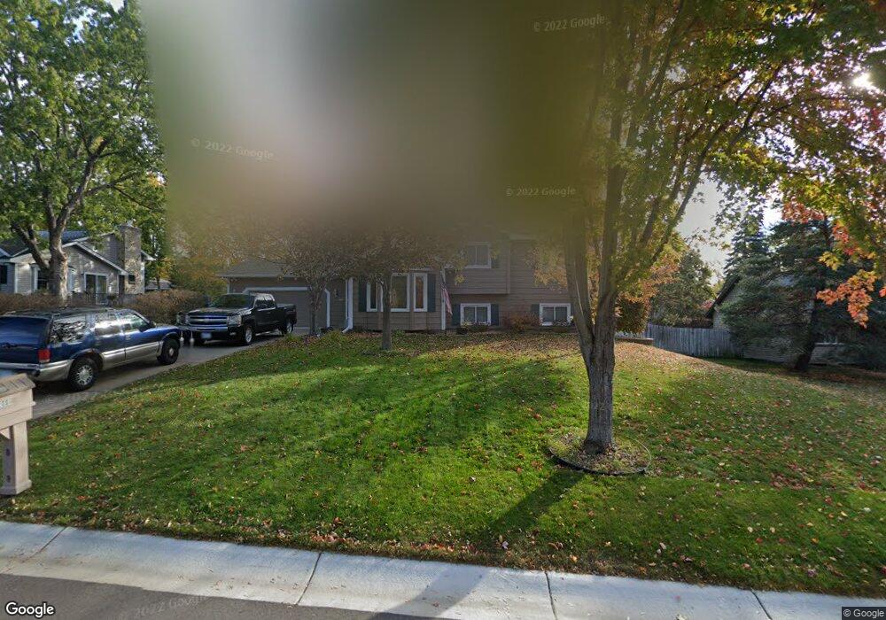
12999 Jay St NW Coon Rapids, MN 55448
Estimated Value: $373,463 - $404,000
4
Beds
2
Baths
1,222
Sq Ft
$315/Sq Ft
Est. Value
About This Home
This home is located at 12999 Jay St NW, Coon Rapids, MN 55448 and is currently estimated at $385,366, approximately $315 per square foot. 12999 Jay St NW is a home located in Anoka County with nearby schools including Lucile Bruner Elementary School, Morris Bye Elementary School, and Laughlin Junior/Senior High School.
Ownership History
Date
Name
Owned For
Owner Type
Purchase Details
Closed on
Mar 20, 2020
Sold by
Langerman David J and Langerman Karen E
Bought by
Marnich Rolf and Marnich Sherri
Current Estimated Value
Home Financials for this Owner
Home Financials are based on the most recent Mortgage that was taken out on this home.
Original Mortgage
$310,800
Interest Rate
3.3%
Mortgage Type
VA
Create a Home Valuation Report for This Property
The Home Valuation Report is an in-depth analysis detailing your home's value as well as a comparison with similar homes in the area
Home Values in the Area
Average Home Value in this Area
Purchase History
| Date | Buyer | Sale Price | Title Company |
|---|---|---|---|
| Marnich Rolf | $300,000 | Titlesmart Inc |
Source: Public Records
Mortgage History
| Date | Status | Borrower | Loan Amount |
|---|---|---|---|
| Previous Owner | Marnich Rolf | $310,800 |
Source: Public Records
Tax History Compared to Growth
Tax History
| Year | Tax Paid | Tax Assessment Tax Assessment Total Assessment is a certain percentage of the fair market value that is determined by local assessors to be the total taxable value of land and additions on the property. | Land | Improvement |
|---|---|---|---|---|
| 2025 | $3,814 | $345,700 | $94,500 | $251,200 |
| 2024 | $3,814 | $341,300 | $91,400 | $249,900 |
| 2023 | $3,600 | $331,000 | $75,600 | $255,400 |
| 2022 | $3,226 | $342,500 | $75,600 | $266,900 |
| 2021 | $2,931 | $274,000 | $58,800 | $215,200 |
| 2020 | $4,052 | $263,900 | $58,800 | $205,100 |
| 2019 | $3,674 | $252,900 | $58,800 | $194,100 |
| 2018 | $3,294 | $237,300 | $0 | $0 |
| 2017 | $2,971 | $220,200 | $0 | $0 |
| 2016 | $3,099 | $192,800 | $0 | $0 |
| 2015 | $2,647 | $192,800 | $52,500 | $140,300 |
| 2014 | -- | $159,700 | $37,200 | $122,500 |
Source: Public Records
Map
Nearby Homes
- 1687 131st Ln NW
- 1520 129th Ave NW
- 1776 133rd Ave NW
- 1930 127th Cir NW
- 12796 Bluebird St NW
- 12554 Grouse St NW
- 1593 126th Ln NW
- 1450 126th Ln NW
- 12760 Raven St NW
- 1234 128th Cir NW
- 13416 Swallow St NW
- 12365 Jay St NW
- 1625 124th Ave NW
- 2147 125th Ln NW
- 13519 Partridge Cir NW
- 12463 Drake St NW
- 2068 124th Ln NW
- 1727 121st Ln NW
- 13182 Zion St NW
- 12488 Unity St NW
- 13017 Jay St NW
- 12985 Jay St NW
- 12974 Ibis St NW
- 12982 Ibis St NW
- 12966 Ibis St NW
- 13031 Jay St NW
- 13006 Jay St NW
- 12992 Jay St NW
- 13020 Jay St NW
- 1773 129th Ln NW
- 1757 129th Ln NW
- 1753 129th Ln NW
- 1741 129th Ln NW
- 1745 129th Ln NW
- 12978 Jay St NW
- 12990 Ibis St NW
- 1733 129th Ln NW
- 1725 129th Ln NW
- 13045 Jay St NW
- 12964 Jay St NW