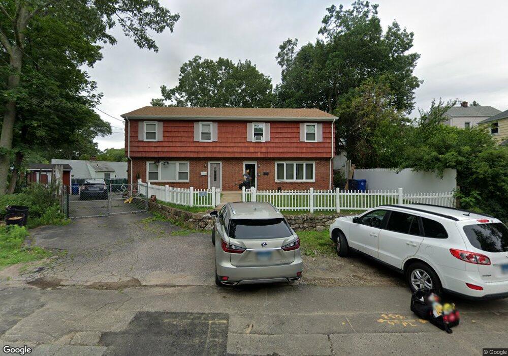
13 1/2 Keith St Unit 13 Norwalk, CT 06854
Brookside NeighborhoodEstimated Value: $385,699 - $500,000
3
Beds
2
Baths
1,536
Sq Ft
$282/Sq Ft
Est. Value
About This Home
This home is located at 13 1/2 Keith St Unit 13, Norwalk, CT 06854 and is currently estimated at $432,925, approximately $281 per square foot. 13 1/2 Keith St Unit 13 is a home located in Fairfield County with nearby schools including Brookside Elementary School, Roton Middle School, and Brien Mcmahon High School.
Ownership History
Date
Name
Owned For
Owner Type
Purchase Details
Closed on
Aug 16, 2004
Sold by
Tangarife Jorge A
Bought by
Exume Varda
Current Estimated Value
Home Financials for this Owner
Home Financials are based on the most recent Mortgage that was taken out on this home.
Original Mortgage
$292,600
Outstanding Balance
$146,635
Interest Rate
6.16%
Estimated Equity
$286,290
Create a Home Valuation Report for This Property
The Home Valuation Report is an in-depth analysis detailing your home's value as well as a comparison with similar homes in the area
Home Values in the Area
Average Home Value in this Area
Purchase History
| Date | Buyer | Sale Price | Title Company |
|---|---|---|---|
| Exume Varda | $308,000 | -- | |
| Exume Varda | $308,000 | -- |
Source: Public Records
Mortgage History
| Date | Status | Borrower | Loan Amount |
|---|---|---|---|
| Open | Exume Varda | $292,600 | |
| Closed | Exume Varda | $292,600 |
Source: Public Records
Tax History Compared to Growth
Tax History
| Year | Tax Paid | Tax Assessment Tax Assessment Total Assessment is a certain percentage of the fair market value that is determined by local assessors to be the total taxable value of land and additions on the property. | Land | Improvement |
|---|---|---|---|---|
| 2025 | $4,088 | $171,050 | $0 | $171,050 |
| 2024 | $4,027 | $171,050 | $0 | $171,050 |
| 2023 | $2,838 | $113,140 | $0 | $113,140 |
| 2022 | $2,777 | $113,140 | $0 | $113,140 |
| 2021 | $2,712 | $113,140 | $0 | $113,140 |
| 2020 | $2,710 | $113,140 | $0 | $113,140 |
| 2019 | $2,638 | $113,140 | $0 | $113,140 |
| 2018 | $2,858 | $107,440 | $0 | $107,440 |
| 2017 | $2,759 | $107,440 | $0 | $107,440 |
| 2016 | $2,733 | $107,440 | $0 | $107,440 |
| 2015 | $2,726 | $107,440 | $0 | $107,440 |
| 2014 | $2,690 | $107,440 | $0 | $107,440 |
Source: Public Records
Map
Nearby Homes
- 6 W Couch St
- 47 Taylor Ave
- 59 Taylor Ave
- 8 Crown Ave
- 187 Flax Hill Rd Unit A4
- 187 Flax Hill Rd Unit D5
- 17 Woodlawn Ave
- 1 Horizon Dr Unit 2
- 7 Hamilton Ave Unit 32
- 18 Soundview Ave
- 15 Madison St Unit F9
- 15 Madison St Unit G11
- 39 Chatham Dr
- 22 Dr Martin Luther King Blvd Unit C6
- 14 Ferris Ave Unit 9
- 25 Chestnut St Unit 1-I
- 10 Ann St Unit 206
- 42 S Main St Unit 202
- 28 Chestnut St
- 94 Washington St Unit 20