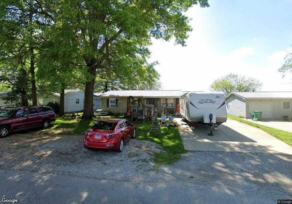
13 Apple Dr Mattoon, IL 61938
Estimated Value: $99,781 - $144,000
3
Beds
1
Bath
1,248
Sq Ft
$97/Sq Ft
Est. Value
About This Home
This home is located at 13 Apple Dr, Mattoon, IL 61938 and is currently estimated at $121,195, approximately $97 per square foot. 13 Apple Dr is a home located in Coles County with nearby schools including Mattoon High School and St Mary School.
Create a Home Valuation Report for This Property
The Home Valuation Report is an in-depth analysis detailing your home's value as well as a comparison with similar homes in the area
Tax History
| Year | Tax Paid | Tax Assessment Tax Assessment Total Assessment is a certain percentage of the fair market value that is determined by local assessors to be the total taxable value of land and additions on the property. | Land | Improvement |
|---|---|---|---|---|
| 2024 | $1,532 | $30,061 | $3,048 | $27,013 |
| 2023 | $1,547 | $27,328 | $2,771 | $24,557 |
| 2022 | $1,495 | $26,876 | $2,725 | $24,151 |
| 2021 | $1,462 | $24,448 | $2,479 | $21,969 |
| 2020 | $1,446 | $25,330 | $2,568 | $22,762 |
| 2019 | $1,403 | $24,448 | $2,479 | $21,969 |
| 2018 | $1,389 | $24,448 | $2,479 | $21,969 |
| 2017 | $1,397 | $24,448 | $2,479 | $21,969 |
| 2016 | $1,383 | $24,448 | $2,479 | $21,969 |
| 2015 | $1,410 | $24,448 | $2,479 | $21,969 |
| 2014 | $1,410 | $24,448 | $2,479 | $21,969 |
| 2013 | $1,410 | $24,448 | $2,479 | $21,969 |
Source: Public Records
Map
Nearby Homes
- 3 Apple Dr
- 1401 N 10th St
- 812 N 8th St Unit 64
- 812 N 8th St Unit 36
- 916 Piatt Ave
- 421 Dewitt Ave
- 1 Brown Ct
- 1800 Piatt Ave
- 1905 Dewitt Ave
- 1412 Champaign Ave
- 1117 N 32nd St
- 1104 N 32nd St
- 1612 Richmond Ave
- 2413 Moultrie Ave
- 2305 Shelby Ave
- 420 Crestview Dr
- 2317 Shelby Ave
- 2800 Shelby Ave
- 2305 Richmond Ave
- 2720 Champaign Ave
Your Personal Tour Guide
Ask me questions while you tour the home.