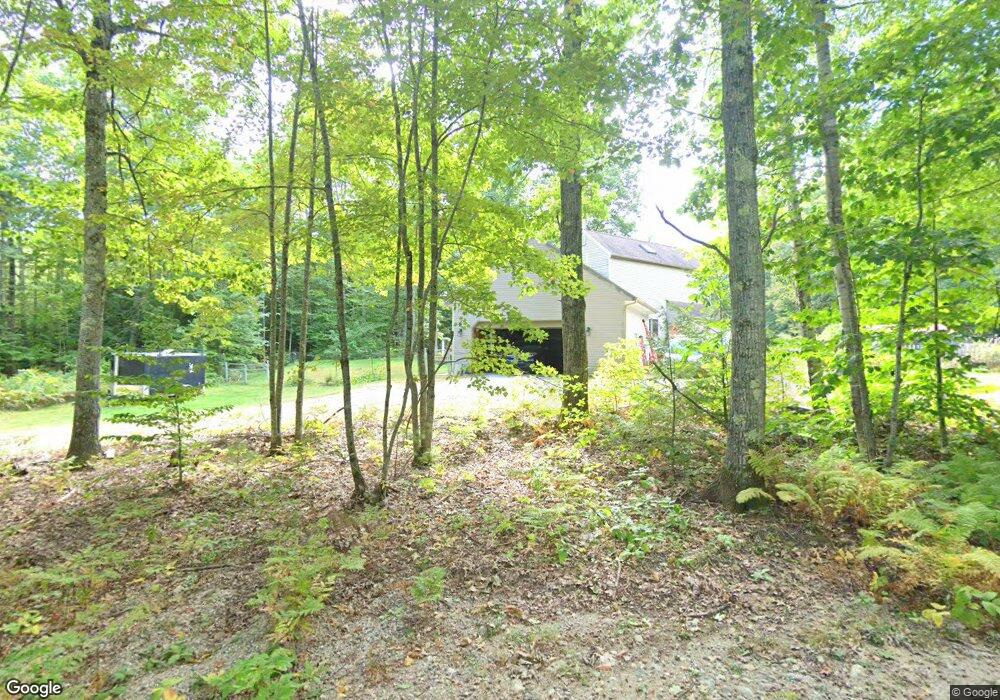
13 Birchwood Acres New Gloucester, ME 04260
Estimated Value: $407,189 - $529,000
2
Beds
2
Baths
1,491
Sq Ft
$309/Sq Ft
Est. Value
About This Home
This home is located at 13 Birchwood Acres, New Gloucester, ME 04260 and is currently estimated at $460,547, approximately $308 per square foot. 13 Birchwood Acres is a home located in Cumberland County with nearby schools including Gray-New Gloucester High School.
Ownership History
Date
Name
Owned For
Owner Type
Purchase Details
Closed on
Nov 20, 2008
Sold by
Liberty Linda E
Bought by
Browning Richard D and West Sara C
Current Estimated Value
Home Financials for this Owner
Home Financials are based on the most recent Mortgage that was taken out on this home.
Original Mortgage
$170,000
Outstanding Balance
$110,387
Interest Rate
6.03%
Mortgage Type
Unknown
Estimated Equity
$350,160
Create a Home Valuation Report for This Property
The Home Valuation Report is an in-depth analysis detailing your home's value as well as a comparison with similar homes in the area
Home Values in the Area
Average Home Value in this Area
Purchase History
| Date | Buyer | Sale Price | Title Company |
|---|---|---|---|
| Browning Richard D | -- | -- |
Source: Public Records
Mortgage History
| Date | Status | Borrower | Loan Amount |
|---|---|---|---|
| Open | Browning Richard D | $170,000 | |
| Previous Owner | Browning Richard D | $55,000 |
Source: Public Records
Tax History Compared to Growth
Tax History
| Year | Tax Paid | Tax Assessment Tax Assessment Total Assessment is a certain percentage of the fair market value that is determined by local assessors to be the total taxable value of land and additions on the property. | Land | Improvement |
|---|---|---|---|---|
| 2025 | $4,055 | $262,114 | $97,254 | $164,860 |
| 2024 | $3,903 | $262,114 | $97,254 | $164,860 |
| 2023 | $3,746 | $262,114 | $97,254 | $164,860 |
| 2022 | $3,617 | $262,114 | $97,254 | $164,860 |
| 2021 | $3,617 | $262,114 | $97,254 | $164,860 |
| 2020 | $3,578 | $262,114 | $97,254 | $164,860 |
| 2019 | $3,421 | $202,400 | $61,400 | $141,000 |
| 2018 | $2,882 | $202,400 | $61,400 | $141,000 |
| 2017 | $3,157 | $202,400 | $61,400 | $141,000 |
| 2016 | $10,111 | $202,400 | $61,400 | $141,000 |
| 2015 | $2,965 | $202,400 | $61,400 | $141,000 |
| 2014 | $2,935 | $202,400 | $61,400 | $141,000 |
| 2013 | $2,722 | $202,400 | $61,400 | $141,000 |
Source: Public Records
Map
Nearby Homes
- 160 Gloucester Hill Rd
- 22 Shaw Rd
- 10 Cobbs Bridge Rd
- 155 & 151 Gloucester Hill Rd
- 0018-C Gloucester Hill Rd
- 271 Bennett Rd
- 164 Intervale Rd
- 24 Swamp Rd
- 29 Rockwood Dr
- TBD Targett Rd
- 12 Country Charm Ln
- 200 Woodman Rd
- 14 Golden Way
- 10-56 C&E Bowdoin Way
- 423 Sabbathday Rd
- 161 Beaver Dam Dr
- 343 Shaker Rd
- 0 Mayall
- 4 Chelsey Ln
- 10 Spring Valley Ln
- 17 Birchwood Acres
- 17 Birchwood Acres
- 17 Bryana Way
- 13 Bryana Way
- 14 Bryana Way
- 9 Bryana Way
- 4 Bryana Way
- 7 Bryana Way
- 8 Birchwood Dr
- 8 Birchwood Acres
- 27 Birchwood Acres
- 28 Birchwood Acres
- 612 Lewiston Rd
- Lot 1 Maine 100
- 639 Lewiston Rd
- 0 Bryana Way Lot 19
- 0 Bryana Way Lot 12
- 0 Bryana Way Lot 5
- 6 Bryana Way
- 616 Lewiston Rd