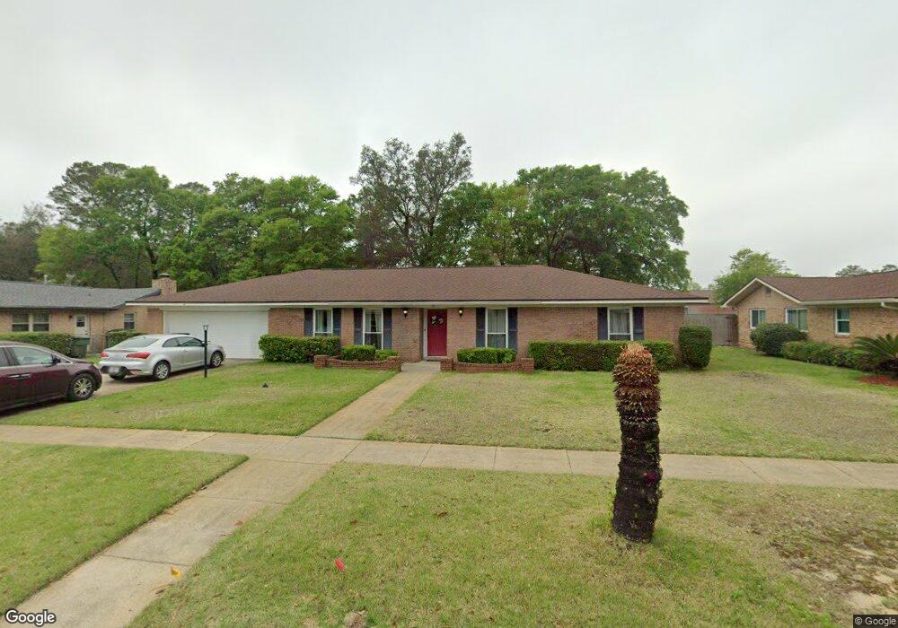
13 Cambridge Ave NE Fort Walton Beach, FL 32547
Estimated Value: $425,000 - $488,000
5
Beds
2
Baths
2,141
Sq Ft
$210/Sq Ft
Est. Value
About This Home
This home is located at 13 Cambridge Ave NE, Fort Walton Beach, FL 32547 and is currently estimated at $449,145, approximately $209 per square foot. 13 Cambridge Ave NE is a home located in Okaloosa County with nearby schools including Kenwood Elementary School, W.C. Pryor Middle School, and Choctawhatchee Senior High School.
Ownership History
Date
Name
Owned For
Owner Type
Purchase Details
Closed on
Mar 12, 2012
Sold by
Strickland Bunyan David and Strickland Jane C
Bought by
Browning Diana L and Browning Robert S
Current Estimated Value
Home Financials for this Owner
Home Financials are based on the most recent Mortgage that was taken out on this home.
Original Mortgage
$193,536
Outstanding Balance
$133,767
Interest Rate
4%
Mortgage Type
VA
Estimated Equity
$315,378
Create a Home Valuation Report for This Property
The Home Valuation Report is an in-depth analysis detailing your home's value as well as a comparison with similar homes in the area
Home Values in the Area
Average Home Value in this Area
Purchase History
| Date | Buyer | Sale Price | Title Company |
|---|---|---|---|
| Browning Diana L | $189,000 | Mti Title Ins Agency Inc |
Source: Public Records
Mortgage History
| Date | Status | Borrower | Loan Amount |
|---|---|---|---|
| Open | Browning Diana L | $193,536 |
Source: Public Records
Tax History Compared to Growth
Tax History
| Year | Tax Paid | Tax Assessment Tax Assessment Total Assessment is a certain percentage of the fair market value that is determined by local assessors to be the total taxable value of land and additions on the property. | Land | Improvement |
|---|---|---|---|---|
| 2024 | $1,831 | $176,637 | -- | -- |
| 2023 | $1,831 | $171,492 | $0 | $0 |
| 2022 | $1,906 | $166,497 | $0 | $0 |
| 2021 | $1,923 | $161,648 | $0 | $0 |
| 2020 | $1,897 | $159,416 | $0 | $0 |
| 2019 | $1,818 | $155,832 | $0 | $0 |
| 2018 | $1,805 | $152,926 | $0 | $0 |
| 2017 | $1,784 | $149,781 | $0 | $0 |
| 2016 | $1,734 | $146,700 | $0 | $0 |
| 2015 | $1,762 | $145,680 | $0 | $0 |
| 2014 | $1,763 | $144,524 | $0 | $0 |
Source: Public Records
Map
Nearby Homes
- 629 Merioneth Dr NE
- 8 Carlyle Ct NE
- 614 Merioneth Dr NE
- 606 Merioneth Dr NE
- 603 Merioneth Dr NE
- 229 Mooney Rd NE
- 604 Powell Dr NE
- 603 Golf Course Dr NE
- 16 Wedgewood Ln NE
- 631 Country Club Ave NE
- 111 Troy Cir
- 60 Linwood Rd NW
- xx NW Mooney Rd
- 123 Star Dr
- 20 Linwood Rd NW
- 528 Cheshire Ave NW
- 926 Lois St
- 526 Cheshire Ave NW
- 106 Star Dr Unit A,B, & C
- 118 Pamela Ann Dr
- 11 Cambridge Ave NE
- 15 Cambridge Ave NE
- 17 Cambridge Ave NE
- 12 Cambridge Ave NE
- 14 Cambridge Ave NE
- 9 Cambridge Ave NE
- 10 Cambridge Ave NE
- 16 Cambridge Ave NE
- 19 Cambridge Ave NE
- 8 Cambridge Ave NE
- 18 Cambridge Ave NE
- 657 Merioneth Dr NE
- 655 Merioneth Dr NE
- 6 Cambridge Ave NE
- 21 Cambridge Ave NE
- 659 Merioneth Dr NE
- 4 Cambridge Ave NE
- 20 Cambridge Ave NE
- 653 Merioneth Dr NE
- 641 Merioneth Ct NE