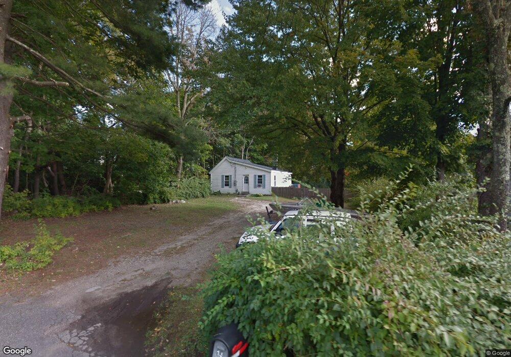
13 Community Rd Harwinton, CT 06791
Estimated Value: $245,426 - $282,000
2
Beds
1
Bath
808
Sq Ft
$319/Sq Ft
Est. Value
About This Home
This home is located at 13 Community Rd, Harwinton, CT 06791 and is currently estimated at $258,107, approximately $319 per square foot. 13 Community Rd is a home located in Litchfield County with nearby schools including Harwinton Consolidated School, Har-Bur Middle School, and Lewis S. Mills High School.
Ownership History
Date
Name
Owned For
Owner Type
Purchase Details
Closed on
Sep 3, 2004
Sold by
Marchell Henry Joseph
Bought by
Matarese Kay
Current Estimated Value
Home Financials for this Owner
Home Financials are based on the most recent Mortgage that was taken out on this home.
Original Mortgage
$95,000
Interest Rate
5.12%
Purchase Details
Closed on
Jan 31, 2002
Sold by
Wortman Lowell K and Wortman Sarah D
Bought by
Murchell Henry J
Create a Home Valuation Report for This Property
The Home Valuation Report is an in-depth analysis detailing your home's value as well as a comparison with similar homes in the area
Home Values in the Area
Average Home Value in this Area
Purchase History
| Date | Buyer | Sale Price | Title Company |
|---|---|---|---|
| Matarese Kay | $119,000 | -- | |
| Matarese Kay | $119,000 | -- | |
| Murchell Henry J | $32,500 | -- | |
| Murchell Henry J | $32,500 | -- |
Source: Public Records
Mortgage History
| Date | Status | Borrower | Loan Amount |
|---|---|---|---|
| Closed | Murchell Henry J | $95,000 |
Source: Public Records
Tax History Compared to Growth
Tax History
| Year | Tax Paid | Tax Assessment Tax Assessment Total Assessment is a certain percentage of the fair market value that is determined by local assessors to be the total taxable value of land and additions on the property. | Land | Improvement |
|---|---|---|---|---|
| 2025 | $2,964 | $128,850 | $47,780 | $81,070 |
| 2024 | $2,951 | $128,850 | $47,780 | $81,070 |
| 2023 | $2,663 | $91,200 | $34,130 | $57,070 |
| 2022 | $2,599 | $91,200 | $34,130 | $57,070 |
| 2021 | $2,617 | $91,200 | $34,130 | $57,070 |
| 2020 | $2,554 | $91,200 | $34,130 | $57,070 |
| 2019 | $2,554 | $91,200 | $34,130 | $57,070 |
| 2018 | $2,311 | $82,520 | $32,460 | $50,060 |
| 2017 | $2,294 | $82,520 | $32,460 | $50,060 |
| 2016 | $2,294 | $82,520 | $32,460 | $50,060 |
| 2015 | $2,253 | $82,520 | $32,460 | $50,060 |
| 2014 | $2,220 | $82,520 | $32,460 | $50,060 |
Source: Public Records
Map
Nearby Homes
- 29 Branch Rd
- 615 S Main St
- 50 Fowler Ave
- 448 Litchfield Rd
- 544 Litchfield Rd
- 390 Park Ave
- 364 Park Ave
- 35 Calli St
- 37 Linden St
- 160 Laurel Hill Rd
- 29 Hannah Way
- 84 Wilmot St
- 119 Tognalli Dr
- 165 Birchwood Dr
- 333 Hillside Ave Unit 10
- 108 Breezy Hill Rd
- 250 Clearview Ave
- 67 E Litchfield Rd S
- 125 Birchwood Dr
- 238 Barton St
- 14 Community Rd
- 11 Community Rd
- 12 Community Rd
- 246 Scoville Hill Rd
- 248 Scoville Hill Rd
- 238 Scoville Hill Rd
- 96 Upper Bogue Rd
- 234 Scoville Hill Rd
- 254 Scoville Hill Rd
- 240 Scoville Hill Rd
- 243 Scoville Hill Rd
- 239 Scoville Hill Rd
- 92 Upper Bogue Rd
- 106 Upper Bogue Rd
- 106 Bogue Rd
- 233 Scoville Hill Rd
- 99 Upper Bogue Rd
- 99 Bogue Rd
- 47 24 Bumper Rd
- 53 24 Bumper Rd
