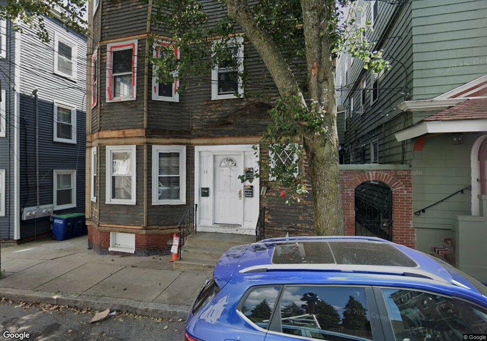
13 Langmaid Ave Somerville, MA 02145
Ten Hills NeighborhoodEstimated Value: $1,162,066 - $1,287,000
6
Beds
3
Baths
3,867
Sq Ft
$316/Sq Ft
Est. Value
About This Home
This home is located at 13 Langmaid Ave, Somerville, MA 02145 and is currently estimated at $1,222,267, approximately $316 per square foot. 13 Langmaid Ave is a home located in Middlesex County with nearby schools including Somerville High School, Prospect Hill Academy Upper Elementary Campus, and Bright Future Educare Center.
Ownership History
Date
Name
Owned For
Owner Type
Purchase Details
Closed on
Dec 20, 2023
Sold by
13 Langmaid Llc
Bought by
13 Langmaid Avenue Llc
Current Estimated Value
Home Financials for this Owner
Home Financials are based on the most recent Mortgage that was taken out on this home.
Original Mortgage
$740,000
Outstanding Balance
$726,461
Interest Rate
7.5%
Mortgage Type
Purchase Money Mortgage
Estimated Equity
$495,806
Purchase Details
Closed on
Feb 2, 2022
Sold by
Pellegrini Gina and Pellegrini James L
Bought by
13 Langmaid Llc
Purchase Details
Closed on
Nov 24, 2021
Sold by
S Calisi Family 2011 Irt and Calisi
Bought by
Pellegrini Gina and Pellegrini James L
Purchase Details
Closed on
Jul 14, 2011
Sold by
Calisi Stella
Bought by
2011 Stella Calisi Ft and Calisi
Purchase Details
Closed on
Jan 19, 1963
Create a Home Valuation Report for This Property
The Home Valuation Report is an in-depth analysis detailing your home's value as well as a comparison with similar homes in the area
Home Values in the Area
Average Home Value in this Area
Purchase History
| Date | Buyer | Sale Price | Title Company |
|---|---|---|---|
| 13 Langmaid Avenue Llc | $1,100,000 | None Available | |
| 13 Langmaid Llc | -- | None Available | |
| Pellegrini Gina | -- | None Available | |
| 2011 Stella Calisi Ft | -- | -- | |
| 2011 Stella Calisi Ft | -- | -- | |
| -- | -- | -- |
Source: Public Records
Mortgage History
| Date | Status | Borrower | Loan Amount |
|---|---|---|---|
| Open | 13 Langmaid Avenue Llc | $740,000 |
Source: Public Records
Tax History Compared to Growth
Tax History
| Year | Tax Paid | Tax Assessment Tax Assessment Total Assessment is a certain percentage of the fair market value that is determined by local assessors to be the total taxable value of land and additions on the property. | Land | Improvement |
|---|---|---|---|---|
| 2025 | $12,725 | $1,166,400 | $292,600 | $873,800 |
| 2024 | $11,868 | $1,128,100 | $292,600 | $835,500 |
| 2023 | $11,566 | $1,118,600 | $292,600 | $826,000 |
| 2022 | $11,082 | $1,088,600 | $278,600 | $810,000 |
| 2021 | $10,541 | $1,034,400 | $253,100 | $781,300 |
| 2020 | $10,339 | $1,024,700 | $243,400 | $781,300 |
| 2019 | $9,581 | $890,400 | $204,800 | $685,600 |
| 2018 | $7,419 | $656,000 | $186,200 | $469,800 |
| 2017 | $7,255 | $621,700 | $175,700 | $446,000 |
| 2016 | $6,631 | $529,200 | $142,600 | $386,600 |
| 2015 | $6,289 | $498,700 | $141,900 | $356,800 |
Source: Public Records
Map
Nearby Homes
- 176-182 Broadway
- 94 Jaques St Unit B
- 59 Dartmouth St Unit A
- 13 Sargent Ave Unit 2
- 19 Fenwick St Unit 4
- 29 Fenwick St
- 115 Thurston St Unit I
- 115 Thurston St Unit B
- 7 Jaques St
- 84 Grant St Unit 7
- 30A Summer
- 7 Bond St
- 77 Wheatland St Unit 2
- 71 Thurston St
- 89 Heath St
- 73 Bonair St
- 51 Edgar Ave
- 41 Bailey Rd
- 31 Thurston St Unit 6
- 72 Governor Winthrop Rd Unit 2
- 13 Langmaid Ave Unit 1
- 13 Langmaid Ave Unit 3
- 17 Langmaid Ave Unit 3
- 17 Langmaid Ave Unit 2
- 17 Langmaid Ave Unit 17
- 11 Langmaid Ave
- 11 Langmaid Ave
- 11 Langmaid Ave Unit 11
- 11 Langmaid Ave Unit 1
- 11 Langmaid Ave Unit C3
- 11 Langmaid Ave Unit 2
- 15 Langmaid Ave Unit 2
- 15 Langmaid Ave Unit 1
- 15 Langmaid Ave Unit 15
- 19 Langmaid Ave
- 19 Langmaid Ave Unit 19
- 21 Langmaid Ave Unit 21
- 19 Langmaid Ave Unit 1
- 14 Langmaid Ave
- 14 Langmaid Ave Unit 14