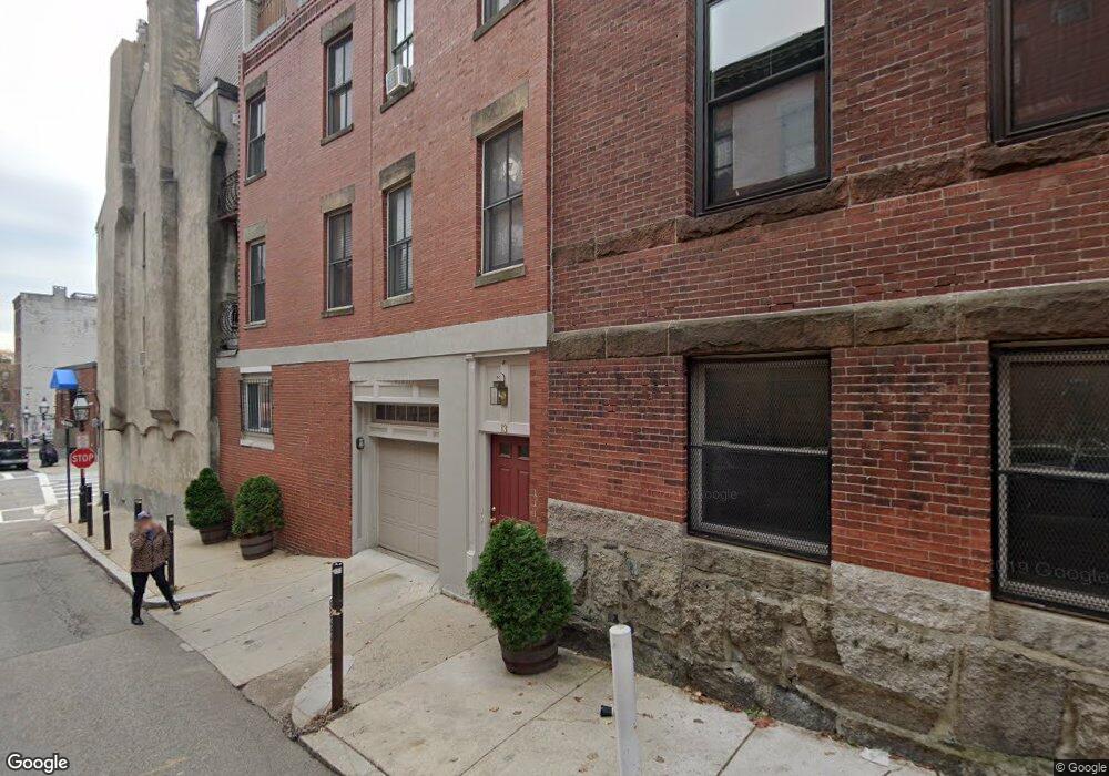
13 Lewis St Boston, MA 02113
North End NeighborhoodEstimated Value: $825,297
1
Bed
--
Bath
9,999
Sq Ft
$83/Sq Ft
Est. Value
About This Home
This home is located at 13 Lewis St, Boston, MA 02113 and is currently estimated at $825,297, approximately $82 per square foot. 13 Lewis St is a home located in Suffolk County with nearby schools including St John School, Boston Children's School, and Torit Montessori School.
Ownership History
Date
Name
Owned For
Owner Type
Purchase Details
Closed on
Dec 21, 1993
Sold by
Campo Frank S and Campo Jean A
Bought by
Campo Rt
Current Estimated Value
Home Financials for this Owner
Home Financials are based on the most recent Mortgage that was taken out on this home.
Original Mortgage
$125,000
Interest Rate
7.03%
Mortgage Type
Commercial
Create a Home Valuation Report for This Property
The Home Valuation Report is an in-depth analysis detailing your home's value as well as a comparison with similar homes in the area
Home Values in the Area
Average Home Value in this Area
Purchase History
| Date | Buyer | Sale Price | Title Company |
|---|---|---|---|
| Campo Rt | $197,500 | -- | |
| Campo Rt | $197,500 | -- |
Source: Public Records
Mortgage History
| Date | Status | Borrower | Loan Amount |
|---|---|---|---|
| Closed | Campo Rt | $125,000 | |
| Previous Owner | Campo Rt | $150,000 |
Source: Public Records
Tax History Compared to Growth
Tax History
| Year | Tax Paid | Tax Assessment Tax Assessment Total Assessment is a certain percentage of the fair market value that is determined by local assessors to be the total taxable value of land and additions on the property. | Land | Improvement |
|---|---|---|---|---|
| 2025 | $13,375 | $1,155,000 | $395,100 | $759,900 |
| 2024 | -- | $1,203,400 | $395,100 | $808,300 |
| 2023 | $0 | $1,248,800 | $395,100 | $853,700 |
| 2022 | $0 | $1,217,500 | $395,100 | $822,400 |
| 2021 | $0 | $1,186,600 | $390,100 | $796,500 |
| 2020 | $0 | $1,156,200 | $390,100 | $766,100 |
| 2019 | $0 | $1,134,000 | $390,000 | $744,000 |
| 2018 | $0 | $1,087,500 | $374,900 | $712,600 |
| 2017 | $0 | $1,047,000 | $356,400 | $690,600 |
| 2016 | -- | $978,500 | $329,500 | $649,000 |
| 2015 | -- | $873,500 | $294,200 | $579,300 |
| 2014 | -- | $814,000 | $252,200 | $561,800 |
Source: Public Records
Map
Nearby Homes
- 220 Commercial St Unit 5A
- 63 Atlantic Ave Unit 9B
- 63 Atlantic Ave Unit 7E
- 290 North St Unit 4
- 130 Fulton St Unit 16
- 1 Lewis Wharf
- 122-130 Fulton Unit 13
- 21 Moon St Unit 2
- 120 Fulton St Unit DE
- 120 Fulton St Unit 5 C&D
- 170 Commercial St Unit 4
- 28 Atlantic Ave Unit 638
- 28 Atlantic Ave Unit 424
- 28 Atlantic Ave Unit 534
- 142 Commercial St Unit 503
- 342-344 North St Unit 1A
- 59 Commercial Wharf Unit 1
- 110-112 Commercial St Unit 2
- 110-112 Commercial St Unit 5
- 343 Commercial St Unit 212
- 13 Lewis St
- 13 Lewis St Unit 2
- 258 North St Unit 5
- 258 North St Unit 4
- 258 North St Unit 3
- 258 North St Unit 2
- 258 North St Unit North St
- 258 North St Unit 2,258
- 258 North St Unit 258
- 262 North St Unit 2
- 248 North St Unit 254
- 248 North St Unit 254
- 248 North St Unit 254
- 248 North St Unit 254
- 248 North St Unit 254
- 248 North St Unit 254
- 248 North St Unit 254
- 248 North St Unit 254
- 248 North St Unit 254
- 248 North St Unit 254