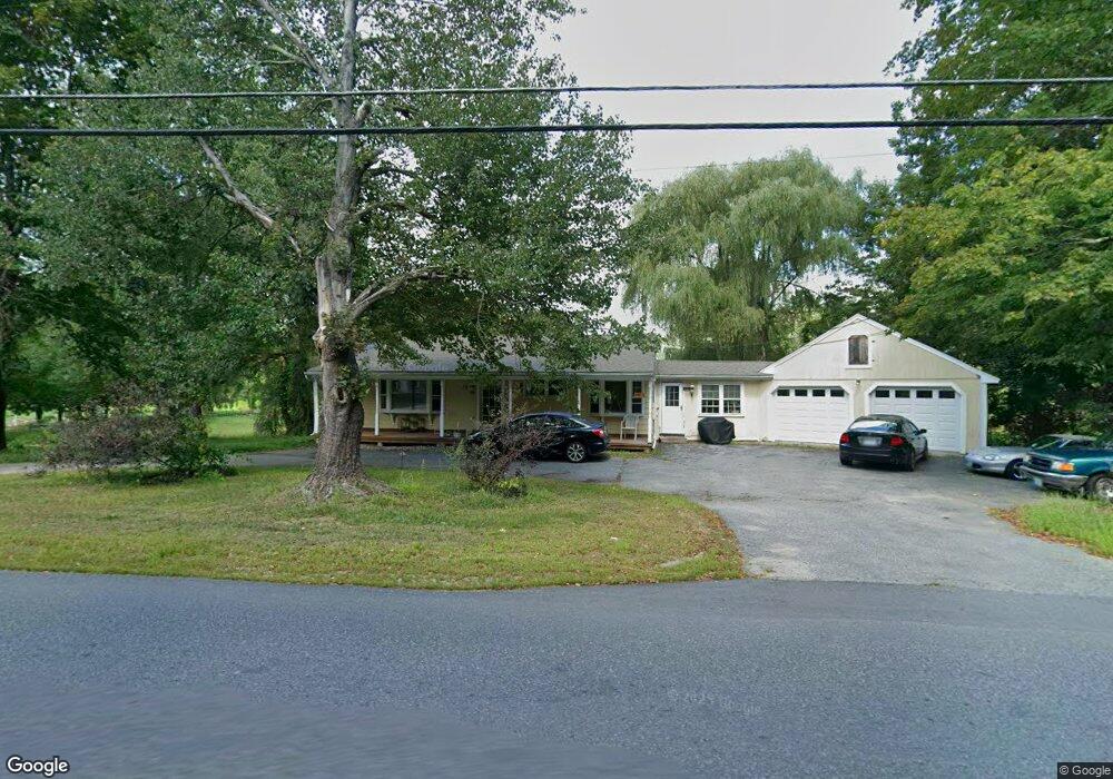
13 Mason Rd Brookline, NH 03033
Estimated Value: $623,000 - $693,000
3
Beds
2
Baths
2,218
Sq Ft
$296/Sq Ft
Est. Value
About This Home
This home is located at 13 Mason Rd, Brookline, NH 03033 and is currently estimated at $656,857, approximately $296 per square foot. 13 Mason Rd is a home with nearby schools including Richard Maghakian Memorial School, Captain Samuel Douglass Academy, and Hollis-Brookline Middle School.
Ownership History
Date
Name
Owned For
Owner Type
Purchase Details
Closed on
Nov 20, 2019
Sold by
Goguen Daniel A
Bought by
Ltd 13 Farm Llc
Current Estimated Value
Purchase Details
Closed on
Sep 29, 2017
Sold by
Macdonald Gail M and Macdonald Macdonald-Stunge L
Bought by
Goguen Daniel
Purchase Details
Closed on
Jan 27, 2017
Sold by
Walts Ryan A and Macdonald Gail M
Bought by
Macdonald Macdonald-Stunger L and Macdonald Gail M
Purchase Details
Closed on
Jun 30, 2009
Sold by
Welts Ryan A and Welts Corinne
Bought by
Janik David M
Create a Home Valuation Report for This Property
The Home Valuation Report is an in-depth analysis detailing your home's value as well as a comparison with similar homes in the area
Home Values in the Area
Average Home Value in this Area
Purchase History
| Date | Buyer | Sale Price | Title Company |
|---|---|---|---|
| Ltd 13 Farm Llc | -- | -- | |
| Goguen Daniel | $375,000 | -- | |
| Macdonald Macdonald-Stunger L | $336,500 | -- | |
| Janik David M | $350,000 | -- |
Source: Public Records
Mortgage History
| Date | Status | Borrower | Loan Amount |
|---|---|---|---|
| Previous Owner | Janik David M | $53,000 |
Source: Public Records
Tax History Compared to Growth
Tax History
| Year | Tax Paid | Tax Assessment Tax Assessment Total Assessment is a certain percentage of the fair market value that is determined by local assessors to be the total taxable value of land and additions on the property. | Land | Improvement |
|---|---|---|---|---|
| 2024 | $13,962 | $617,500 | $245,700 | $371,800 |
| 2023 | $12,832 | $617,500 | $245,700 | $371,800 |
| 2022 | $12,967 | $436,300 | $180,900 | $255,400 |
| 2021 | $12,469 | $436,300 | $180,900 | $255,400 |
| 2020 | $12,129 | $436,300 | $180,900 | $255,400 |
| 2019 | $13,032 | $436,300 | $180,900 | $255,400 |
| 2018 | $12,897 | $436,300 | $180,900 | $255,400 |
| 2017 | $11,914 | $361,700 | $156,100 | $205,600 |
| 2016 | $11,777 | $361,700 | $156,100 | $205,600 |
| 2015 | $11,231 | $361,700 | $156,100 | $205,600 |
| 2014 | $11,882 | $361,700 | $156,100 | $205,600 |
| 2013 | $11,441 | $361,700 | $156,100 | $205,600 |
Source: Public Records
Map
Nearby Homes
- 12 Old Milford Rd
- 2 Corey Hill Rd
- 59 Cleveland Hill Rd
- 22 Hobart Hill Rd
- 9 Marjorie Dr
- 25 Rocky Pond Rd
- 5 Carons Way
- 42 Pepperell Rd
- 18 Sawtelle Rd
- 26 Ben Farnsworth Rd
- 47 Pepperell Rd
- 6 Laurelcrest Dr
- 6 Flint Meadow Dr
- 55 Oak Hill Rd
- 3 Ben Farnsworth Rd
- 104 N Mason Rd
- 38 Countryside Dr
- 8 Colburn Rd
- 6 High Oaks Path
- 23 Austin Ln