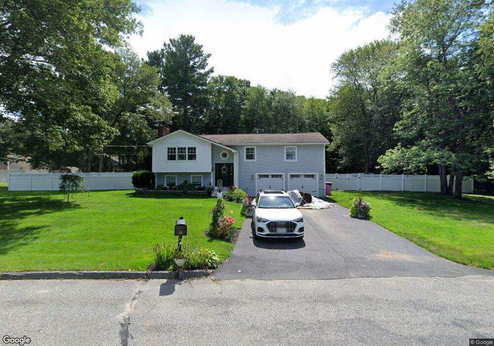
13 Mcgovern Ln Webster, MA 01570
Estimated Value: $439,857 - $503,000
3
Beds
3
Baths
2,168
Sq Ft
$215/Sq Ft
Est. Value
About This Home
This home is located at 13 Mcgovern Ln, Webster, MA 01570 and is currently estimated at $466,714, approximately $215 per square foot. 13 Mcgovern Ln is a home located in Worcester County with nearby schools including Park Avenue Elementary School, Webster Middle School, and Bartlett High School.
Ownership History
Date
Name
Owned For
Owner Type
Purchase Details
Closed on
Nov 5, 2021
Sold by
Ciabaszewski Mary A and Napomiceno Elizabeth J
Bought by
Mikucka Nicole
Current Estimated Value
Home Financials for this Owner
Home Financials are based on the most recent Mortgage that was taken out on this home.
Original Mortgage
$288,000
Outstanding Balance
$263,496
Interest Rate
2.88%
Mortgage Type
Purchase Money Mortgage
Estimated Equity
$203,218
Purchase Details
Closed on
Nov 18, 1998
Sold by
Mcfadden Robert J and Mcfadden Brenda E
Bought by
Ciabaszewski William and Ciabaszewski Mary Ann
Purchase Details
Closed on
Aug 25, 1997
Sold by
Scanlon Patrick T and Beland Maureen E
Bought by
Mcfadden Robert J and Nolle Brenda E
Home Financials for this Owner
Home Financials are based on the most recent Mortgage that was taken out on this home.
Original Mortgage
$123,190
Interest Rate
7.42%
Mortgage Type
Purchase Money Mortgage
Purchase Details
Closed on
Jul 13, 1993
Sold by
Beland Eric J and Beland Deneen
Bought by
Scanlon Patrick and Beland Maureen
Home Financials for this Owner
Home Financials are based on the most recent Mortgage that was taken out on this home.
Original Mortgage
$100,000
Interest Rate
7.43%
Mortgage Type
Purchase Money Mortgage
Purchase Details
Closed on
Aug 28, 1989
Sold by
Barre Sophie
Bought by
Beland Eric
Home Financials for this Owner
Home Financials are based on the most recent Mortgage that was taken out on this home.
Original Mortgage
$85,000
Interest Rate
9.67%
Mortgage Type
Purchase Money Mortgage
Create a Home Valuation Report for This Property
The Home Valuation Report is an in-depth analysis detailing your home's value as well as a comparison with similar homes in the area
Home Values in the Area
Average Home Value in this Area
Purchase History
| Date | Buyer | Sale Price | Title Company |
|---|---|---|---|
| Mikucka Nicole | $320,000 | None Available | |
| Ciabaszewski William | $153,000 | -- | |
| Mcfadden Robert J | $127,000 | -- | |
| Scanlon Patrick | $125,000 | -- | |
| Beland Eric | $146,000 | -- |
Source: Public Records
Mortgage History
| Date | Status | Borrower | Loan Amount |
|---|---|---|---|
| Open | Mikucka Nicole | $288,000 | |
| Previous Owner | Beland Eric | $123,190 | |
| Previous Owner | Beland Eric | $100,000 | |
| Previous Owner | Beland Eric | $85,000 |
Source: Public Records
Tax History Compared to Growth
Tax History
| Year | Tax Paid | Tax Assessment Tax Assessment Total Assessment is a certain percentage of the fair market value that is determined by local assessors to be the total taxable value of land and additions on the property. | Land | Improvement |
|---|---|---|---|---|
| 2025 | $4,968 | $418,200 | $64,700 | $353,500 |
| 2024 | $4,954 | $406,700 | $62,200 | $344,500 |
| 2023 | $4,285 | $342,800 | $59,300 | $283,500 |
| 2022 | $4,311 | $308,800 | $57,600 | $251,200 |
| 2021 | $4,311 | $285,500 | $57,600 | $227,900 |
| 2020 | $4,185 | $277,900 | $57,600 | $220,300 |
| 2019 | $3,909 | $255,000 | $57,600 | $197,400 |
| 2018 | $3,751 | $243,700 | $57,600 | $186,100 |
| 2017 | $3,442 | $227,500 | $56,400 | $171,100 |
| 2016 | $3,335 | $220,300 | $56,400 | $163,900 |
| 2015 | $3,183 | $216,800 | $63,100 | $153,700 |
Source: Public Records
Map
Nearby Homes
- 1 Ernest St
- 0 Thompson Rd
- 13 S Point Rd
- 303 Treasure Island Rd
- 14 Colonial Rd
- 38 Colonial Rd
- 125 Birch Island Rd
- 6 Henry Rd
- 11 Denis Dr
- 194 Killdeer Rd
- 00 Juniper Ln
- 26 Wakefield Ave
- 51 &52 lot Oscar Rd
- 215 Sand Dam Rd
- 133 Thompson Rd
- 9 Scenic Ave
- 17 Liberty Ln
- 24 Cooper Rd
- 0 Porter Plain Rd
- 107 Lake St Unit B