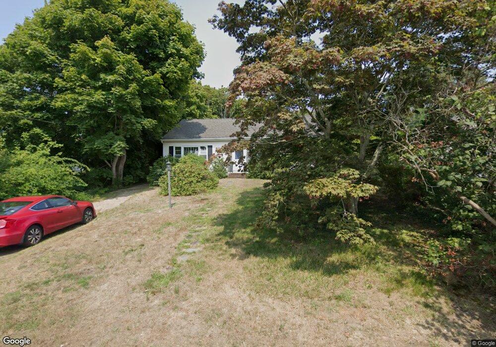
13 Miller Hill Rd Provincetown, MA 02657
Estimated Value: $1,128,623 - $1,692,000
2
Beds
1
Bath
960
Sq Ft
$1,484/Sq Ft
Est. Value
About This Home
This home is located at 13 Miller Hill Rd, Provincetown, MA 02657 and is currently estimated at $1,424,656, approximately $1,484 per square foot. 13 Miller Hill Rd is a home located in Barnstable County with nearby schools including Provincetown Schools.
Ownership History
Date
Name
Owned For
Owner Type
Purchase Details
Closed on
Mar 2, 2001
Sold by
Goveia Carl R and Goveia Stephen C
Bought by
Giles Linda E
Current Estimated Value
Home Financials for this Owner
Home Financials are based on the most recent Mortgage that was taken out on this home.
Original Mortgage
$250,000
Interest Rate
7%
Mortgage Type
Purchase Money Mortgage
Create a Home Valuation Report for This Property
The Home Valuation Report is an in-depth analysis detailing your home's value as well as a comparison with similar homes in the area
Home Values in the Area
Average Home Value in this Area
Purchase History
| Date | Buyer | Sale Price | Title Company |
|---|---|---|---|
| Giles Linda E | $375,000 | -- | |
| Giles Linda E | $375,000 | -- |
Source: Public Records
Mortgage History
| Date | Status | Borrower | Loan Amount |
|---|---|---|---|
| Open | Giles Linda E | $275,000 | |
| Closed | Giles Linda E | $250,000 | |
| Closed | Giles Linda E | $126,600 |
Source: Public Records
Tax History Compared to Growth
Tax History
| Year | Tax Paid | Tax Assessment Tax Assessment Total Assessment is a certain percentage of the fair market value that is determined by local assessors to be the total taxable value of land and additions on the property. | Land | Improvement |
|---|---|---|---|---|
| 2025 | $5,216 | $931,400 | $483,800 | $447,600 |
| 2024 | $4,982 | $892,900 | $461,000 | $431,900 |
| 2023 | $4,627 | $773,800 | $401,000 | $372,800 |
| 2022 | $4,533 | $680,700 | $374,700 | $306,000 |
| 2021 | $4,436 | $626,600 | $340,700 | $285,900 |
| 2020 | $4,026 | $608,100 | $336,500 | $271,600 |
| 2019 | $4,095 | $580,000 | $326,700 | $253,300 |
| 2018 | $4,027 | $540,600 | $323,300 | $217,300 |
| 2017 | $4,010 | $520,100 | $317,000 | $203,100 |
| 2016 | $3,948 | $506,200 | $307,700 | $198,500 |
| 2015 | $3,587 | $486,000 | $301,600 | $184,400 |
Source: Public Records
Map
Nearby Homes
- 184 Bradford St Unit 1
- 5 Kiley Ct Unit 2
- 441 Commercial St Unit B
- 452 Commercial St Unit 3
- 167 Bradford St Unit B
- 37 Pearl St
- 404 Commercial St Unit 1
- 404 Commercial St Unit 2
- 405 Commercial St Unit 5
- 36 Pearl St Unit 2
- 36 Pearl St Unit 3
- 495 Commercial St Unit 6
- 495 Commercial St Unit 9
- 495 Commercial St Unit 11
- 46 Harry Kemp Way Unit 2
- 501 Commercial St Unit 17
- 6 Daggett Ln
- 15 Center St
- 361b Commercial St Unit U3
- 16 Off Conwell St
- 11 Miller Hill Rd
- 15 Miller Hill Rd Unit 4
- 15 Miller Hill Rd Unit 3
- 15 Miller Hill Rd Unit 2
- 15 Miller Hill Rd Unit 1
- 15 Miller Hill Rd Unit UB
- 15 Miller Hill Rd Unit A
- 15 Miller Hill Rd Unit D
- 15 Miller Hill Rd Unit A
- 15 Miller Hill Rd Unit C
- 15 Miller Hill Rd Unit B
- 0 Miller Hill Rd
- 7 Upper Miller Hill Rd Unit 1
- 7 Upper Miller Hill Rd
- 4 Upper Miller Rd Unit 2
- 6-12 Miller Hill Rd
- 14 Miller Hill Rd
- 17 Miller Hill Rd
- 5 Upper Miller Hill Rd
- 18 Miller Hill Rd Unit 13