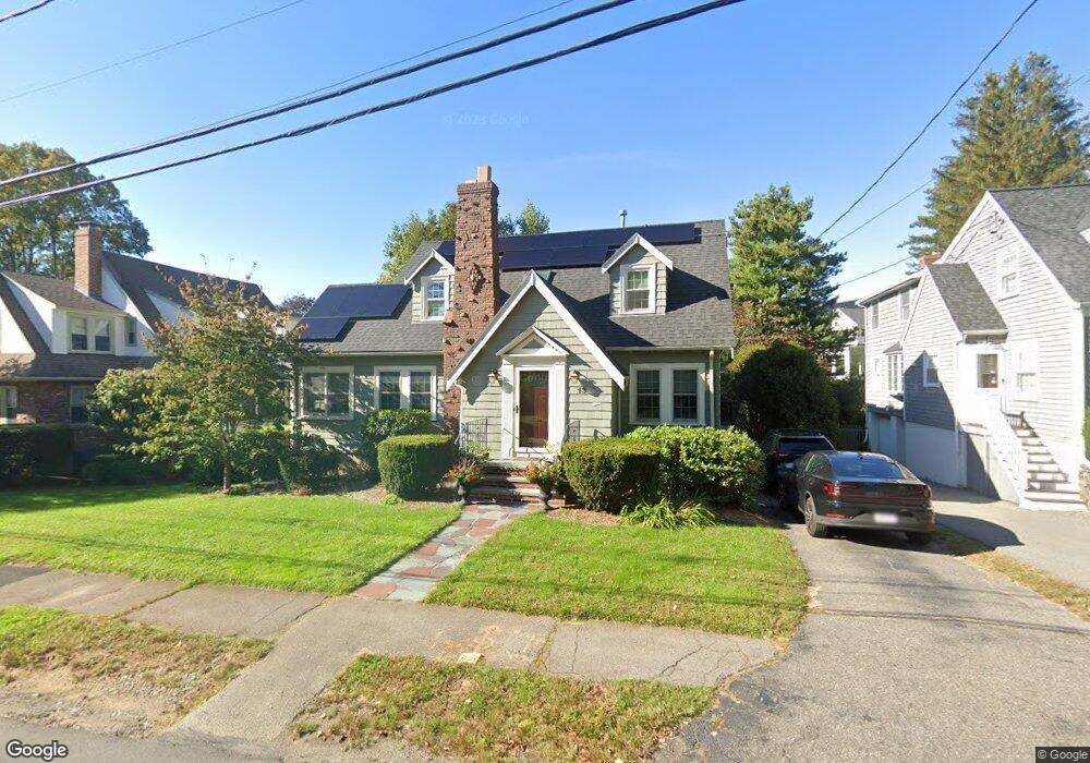
13 Nichols Rd Needham, MA 02492
Estimated Value: $1,115,000 - $1,413,000
3
Beds
2
Baths
1,568
Sq Ft
$820/Sq Ft
Est. Value
About This Home
This home is located at 13 Nichols Rd, Needham, MA 02492 and is currently estimated at $1,286,085, approximately $820 per square foot. 13 Nichols Rd is a home located in Norfolk County with nearby schools including Mitchell Elementary School, High Rock Middle School, and Pollard Middle School.
Ownership History
Date
Name
Owned For
Owner Type
Purchase Details
Closed on
Sep 16, 2002
Sold by
Snyder Ben M and Snyder Sarah D
Bought by
Boni Rafal K and Boni Jacqueline
Current Estimated Value
Home Financials for this Owner
Home Financials are based on the most recent Mortgage that was taken out on this home.
Original Mortgage
$250,000
Interest Rate
6.48%
Mortgage Type
Purchase Money Mortgage
Purchase Details
Closed on
Feb 26, 1990
Sold by
Gerth Godrerd O
Bought by
Snyder Ben M
Home Financials for this Owner
Home Financials are based on the most recent Mortgage that was taken out on this home.
Original Mortgage
$132,000
Interest Rate
9.7%
Mortgage Type
Purchase Money Mortgage
Create a Home Valuation Report for This Property
The Home Valuation Report is an in-depth analysis detailing your home's value as well as a comparison with similar homes in the area
Home Values in the Area
Average Home Value in this Area
Purchase History
| Date | Buyer | Sale Price | Title Company |
|---|---|---|---|
| Boni Rafal K | $505,000 | -- | |
| Snyder Ben M | $222,000 | -- |
Source: Public Records
Mortgage History
| Date | Status | Borrower | Loan Amount |
|---|---|---|---|
| Open | Snyder Ben M | $242,000 | |
| Closed | Boni Rafal K | $250,000 | |
| Previous Owner | Snyder Ben M | $130,000 | |
| Previous Owner | Snyder Ben M | $132,000 |
Source: Public Records
Tax History Compared to Growth
Tax History
| Year | Tax Paid | Tax Assessment Tax Assessment Total Assessment is a certain percentage of the fair market value that is determined by local assessors to be the total taxable value of land and additions on the property. | Land | Improvement |
|---|---|---|---|---|
| 2025 | $11,590 | $1,093,400 | $767,700 | $325,700 |
| 2024 | $11,694 | $934,000 | $565,100 | $368,900 |
| 2023 | $11,832 | $907,400 | $565,100 | $342,300 |
| 2022 | $11,092 | $829,600 | $500,100 | $329,500 |
| 2021 | $10,810 | $829,600 | $500,100 | $329,500 |
| 2020 | $10,393 | $832,100 | $502,300 | $329,800 |
| 2019 | $9,652 | $779,000 | $456,600 | $322,400 |
| 2018 | $8,417 | $708,500 | $456,600 | $251,900 |
| 2017 | $8,086 | $680,100 | $456,600 | $223,500 |
| 2016 | $7,848 | $680,100 | $456,600 | $223,500 |
| 2015 | $7,678 | $680,100 | $456,600 | $223,500 |
| 2014 | $6,759 | $580,700 | $380,500 | $200,200 |
Source: Public Records
Map
Nearby Homes
- 62 Washington Ave
- 332 Hillcrest Rd
- 8 Wilshire Park
- 190 Brookline St
- 26 Pinewood Rd
- 40 Otis St Unit L
- 42 Otis St Unit R
- 701 Greendale Ave
- 247 Broad Meadow Rd
- 556 Webster St
- 23 Cheney St
- 154 Warren St
- 883 Greendale Ave
- 233 Warren St
- 71 School St
- 1011 Webster St
- 9 Jayne Rd
- 193 Garden St
- 143 Hunting Rd
- 39 Mark Lee Rd
- 72 Beaufort Ave
- 7 Nichols Rd
- 62 Beaufort Ave
- 47 Hazelton Ave
- 14 Nichols Rd
- 120 Wyoming Ave
- 10 Nichols Rd
- 58 Beaufort Ave
- 82 Beaufort Ave
- 4 Nichols Rd
- 65 Beaufort Ave
- 126 Wyoming Ave
- 27 Nichols Rd
- 59 Beaufort Ave
- 52 Beaufort Ave
- 81 Beaufort Ave
- 43 Hazelton Ave
- 256 Hillcrest Rd
- 102 Wyoming Ave
- 35 Nichols Rd