Estimated Value: $127,328 - $167,000
Studio
1
Bath
1,175
Sq Ft
$126/Sq Ft
Est. Value
About This Home
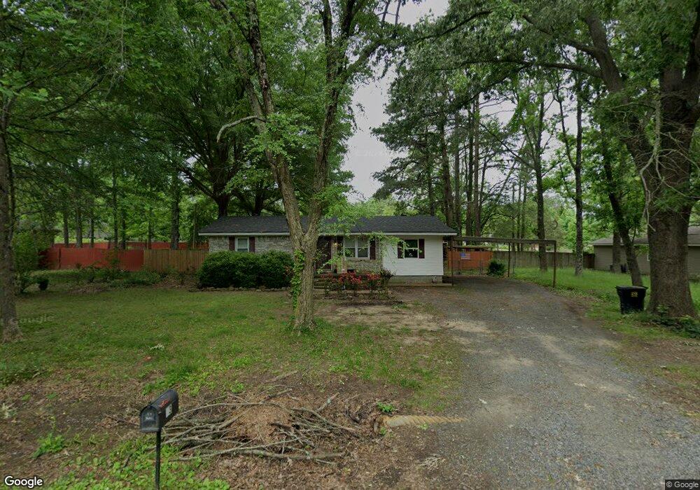
This home is located at 13 Opal St, Ward, AR 72176 and is currently estimated at $147,832, approximately $125 per square foot. 13 Opal St is a home located in Lonoke County with nearby schools including Ward Central Elementary School, Cabot Middle School North, and Cabot Junior High North.
Ownership History
Date
Name
Owned For
Owner Type
Purchase Details
Closed on
Aug 10, 2015
Sold by
Daugherty Lauren A
Bought by
Daugherty Kevin P and Daugherty Lauren A
Current Estimated Value
Purchase Details
Closed on
Feb 22, 2006
Bought by
Daugherty
Purchase Details
Closed on
Feb 16, 2006
Bought by
Daugherty
Purchase Details
Closed on
Jun 16, 2005
Bought by
Davis
Purchase Details
Closed on
Jun 8, 2005
Bought by
Davis
Purchase Details
Closed on
Dec 16, 2004
Bought by
City Of Ward
Purchase Details
Closed on
Sep 18, 1997
Bought by
King
Purchase Details
Closed on
May 30, 1996
Bought by
Hearn and Hearn Wife
Create a Home Valuation Report for This Property
The Home Valuation Report is an in-depth analysis detailing your home's value as well as a comparison with similar homes in the area
Home Values in the Area
Average Home Value in this Area
Purchase History
| Date | Buyer | Sale Price | Title Company |
|---|---|---|---|
| Daugherty Kevin P | -- | None Available | |
| Daugherty | $79,000 | -- | |
| Daugherty | $79,000 | -- | |
| Davis | -- | -- | |
| Davis | -- | -- | |
| City Of Ward | -- | -- | |
| King | $55,000 | -- | |
| Hearn | $45,000 | -- |
Source: Public Records
Tax History
| Year | Tax Paid | Tax Assessment Tax Assessment Total Assessment is a certain percentage of the fair market value that is determined by local assessors to be the total taxable value of land and additions on the property. | Land | Improvement |
|---|---|---|---|---|
| 2025 | $409 | $16,380 | $2,200 | $14,180 |
| 2024 | $409 | $16,380 | $2,200 | $14,180 |
| 2023 | $409 | $16,380 | $2,200 | $14,180 |
| 2022 | $459 | $16,380 | $2,200 | $14,180 |
| 2021 | $459 | $16,380 | $2,200 | $14,180 |
| 2020 | $435 | $15,910 | $2,200 | $13,710 |
| 2019 | $435 | $15,910 | $2,200 | $13,710 |
| 2018 | $460 | $15,910 | $2,200 | $13,710 |
| 2017 | $697 | $15,910 | $2,200 | $13,710 |
| 2016 | $398 | $15,910 | $2,200 | $13,710 |
| 2015 | $660 | $13,920 | $2,200 | $11,720 |
| 2014 | $359 | $13,920 | $2,200 | $11,720 |
Source: Public Records
Map
Nearby Homes
- 19 Opal St
- 11 Erwin Dr
- 57 Willow Lake Dr
- 30 Willard St
- 22 Willard St
- 761 Peyton St
- 35 Green Apple
- 30 Doe Run Dr
- 17 S Shamsie Dr
- 46 Remington Ln
- 34 Fawn Dr
- 35 Wilson Loop
- 24 Whitetail Dr
- 405 N Scott St
- 105 Walker St
- 21 Center St
- 51 Center St
- 208 Moore St
- RC Carnegie II Plan at Deerfield
- RC Magnolia Plan at Deerfield
Your Personal Tour Guide
Ask me questions while you tour the home.