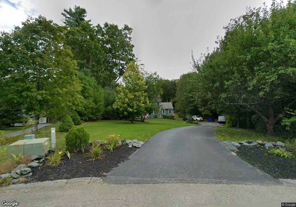
13 Pumpkin Brook Rd Shirley, MA 01464
Estimated Value: $592,000 - $673,000
4
Beds
2
Baths
2,072
Sq Ft
$306/Sq Ft
Est. Value
About This Home
This home is located at 13 Pumpkin Brook Rd, Shirley, MA 01464 and is currently estimated at $634,652, approximately $306 per square foot. 13 Pumpkin Brook Rd is a home located in Middlesex County with nearby schools including Page Hilltop School, Lura A. White Elementary School, and Ayer Shirley Regional Middle School.
Ownership History
Date
Name
Owned For
Owner Type
Purchase Details
Closed on
Sep 13, 2023
Sold by
Brady Samuel W and Brady Kaitlyn W
Bought by
Chamberland Joseph and Burlingame Christine
Current Estimated Value
Home Financials for this Owner
Home Financials are based on the most recent Mortgage that was taken out on this home.
Original Mortgage
$480,000
Outstanding Balance
$467,376
Interest Rate
6.9%
Mortgage Type
Purchase Money Mortgage
Estimated Equity
$167,276
Purchase Details
Closed on
Apr 20, 2022
Sold by
Davis Paul A and Davis Tamara L
Bought by
Brady Samuel W and White-Brady Kaitlyn
Home Financials for this Owner
Home Financials are based on the most recent Mortgage that was taken out on this home.
Original Mortgage
$525,350
Interest Rate
3.85%
Mortgage Type
Purchase Money Mortgage
Purchase Details
Closed on
Dec 1, 1999
Sold by
Lanigan Brian D and Lanigan Nancy B
Bought by
Davis Paul A and Davis Tamara L
Home Financials for this Owner
Home Financials are based on the most recent Mortgage that was taken out on this home.
Original Mortgage
$178,300
Interest Rate
7.86%
Mortgage Type
Purchase Money Mortgage
Create a Home Valuation Report for This Property
The Home Valuation Report is an in-depth analysis detailing your home's value as well as a comparison with similar homes in the area
Home Values in the Area
Average Home Value in this Area
Purchase History
| Date | Buyer | Sale Price | Title Company |
|---|---|---|---|
| Chamberland Joseph | $600,000 | None Available | |
| Brady Samuel W | $572,000 | None Available | |
| Davis Paul A | $222,900 | -- |
Source: Public Records
Mortgage History
| Date | Status | Borrower | Loan Amount |
|---|---|---|---|
| Open | Chamberland Joseph | $480,000 | |
| Previous Owner | Brady Samuel W | $525,350 | |
| Previous Owner | Davis Paul A | $178,300 | |
| Previous Owner | Davis Paul A | $139,900 |
Source: Public Records
Tax History
| Year | Tax Paid | Tax Assessment Tax Assessment Total Assessment is a certain percentage of the fair market value that is determined by local assessors to be the total taxable value of land and additions on the property. | Land | Improvement |
|---|---|---|---|---|
| 2025 | $70 | $537,700 | $141,500 | $396,200 |
| 2024 | $6,813 | $502,100 | $129,300 | $372,800 |
| 2023 | $6,390 | $450,600 | $129,300 | $321,300 |
| 2022 | $5,989 | $386,900 | $125,300 | $261,600 |
| 2021 | $5,845 | $353,600 | $113,300 | $240,300 |
| 2020 | $5,581 | $346,400 | $113,300 | $233,100 |
| 2019 | $5,459 | $339,500 | $113,300 | $226,200 |
| 2018 | $5,428 | $330,600 | $108,500 | $222,100 |
| 2017 | $5,316 | $321,800 | $105,300 | $216,500 |
| 2016 | $5,097 | $308,700 | $105,300 | $203,400 |
| 2015 | $5,214 | $301,200 | $103,700 | $197,500 |
Source: Public Records
Map
Nearby Homes
- Lot 10 Christian Cir
- 26 Bluebird Ln
- 111 Squannacook Rd
- 21 Magnolia Ln
- 105 Townsend Rd Unit 1
- 92 Squannacook Rd
- 45 Maplewood Dr
- 7 Balsam Dr
- 11 Maplewood Dr
- 18 Beech St
- 26 Bradley Dr Unit D
- 367 Mulpus Rd
- 44 Squannacook Rd
- 53 Throne Hill Rd
- 43 Shattuck St
- 167 S Row Rd
- 24 Townsend Rd
- 15 Hayes Woods Ln
- 22 Townsend Rd
- Lot 3 Maple Ave
- 13 Pumpkin Brook Rd
- 13 Pumpkin Brook Rd Unit TEMP
- 13 Pumpkin Brook-Cancelled
- 16 Pumpkin Brook Rd
- 11 Pumpkin Brook Rd
- 14 Pumpkin Brook Rd
- 12 Pumpkin Brook Rd
- 9 Pumpkin Brook Rd
- 10 Pumpkin Brook Rd
- 7 Pumpkin Brook Rd
- 8 Pumpkin Brook Rd
- 5 Pumpkin Brook Rd
- 6 Pumpkin Brook Rd
- 6 Pumpkin Brook Rd
- 3 Pumpkin Brook Rd
- 1 Pumpkin Ct
- 1 Pumpkin Brook Rd
- 4 Pumpkin Ct
- 2 Pumpkin Ct
- 2 Pumpkin Brook Rd
Your Personal Tour Guide
Ask me questions while you tour the home.