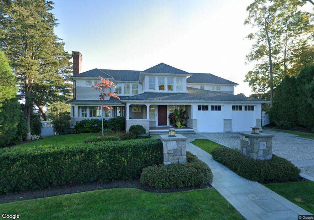
13 Rockyledge Rd Swampscott, MA 01907
Estimated Value: $2,891,000 - $4,701,000
2
Beds
6
Baths
5,583
Sq Ft
$679/Sq Ft
Est. Value
About This Home
This home is located at 13 Rockyledge Rd, Swampscott, MA 01907 and is currently estimated at $3,789,008, approximately $678 per square foot. 13 Rockyledge Rd is a home located in Essex County with nearby schools including Swampscott Middle School, Swampscott High School, and Epstein Hillel School.
Ownership History
Date
Name
Owned For
Owner Type
Purchase Details
Closed on
Jun 29, 1992
Sold by
Bohnert Deborah and Merrigan Robert
Bought by
Manning Robert J and Manning Donna M
Current Estimated Value
Home Financials for this Owner
Home Financials are based on the most recent Mortgage that was taken out on this home.
Original Mortgage
$350,000
Interest Rate
8.57%
Mortgage Type
Purchase Money Mortgage
Create a Home Valuation Report for This Property
The Home Valuation Report is an in-depth analysis detailing your home's value as well as a comparison with similar homes in the area
Home Values in the Area
Average Home Value in this Area
Purchase History
| Date | Buyer | Sale Price | Title Company |
|---|---|---|---|
| Manning Robert J | $746,500 | -- | |
| Manning Robert J | $746,500 | -- |
Source: Public Records
Mortgage History
| Date | Status | Borrower | Loan Amount |
|---|---|---|---|
| Closed | Manning Robert J | $550,000 | |
| Closed | Manning Robert J | $350,000 |
Source: Public Records
Tax History Compared to Growth
Tax History
| Year | Tax Paid | Tax Assessment Tax Assessment Total Assessment is a certain percentage of the fair market value that is determined by local assessors to be the total taxable value of land and additions on the property. | Land | Improvement |
|---|---|---|---|---|
| 2025 | $45,958 | $4,006,800 | $1,720,200 | $2,286,600 |
| 2024 | $44,359 | $3,860,700 | $1,638,300 | $2,222,400 |
| 2023 | $43,566 | $3,710,900 | $1,638,300 | $2,072,600 |
| 2022 | $43,968 | $3,427,000 | $1,570,100 | $1,856,900 |
| 2021 | $43,193 | $3,129,900 | $1,433,500 | $1,696,400 |
| 2020 | $44,200 | $3,090,900 | $1,433,500 | $1,657,400 |
| 2019 | $44,978 | $2,959,100 | $1,297,000 | $1,662,100 |
| 2018 | $45,254 | $2,828,400 | $1,228,700 | $1,599,700 |
| 2017 | $47,677 | $2,732,200 | $1,228,700 | $1,503,500 |
| 2016 | $47,349 | $2,732,200 | $1,228,700 | $1,503,500 |
| 2015 | $45,382 | $2,646,200 | $1,228,700 | $1,417,500 |
| 2014 | $49,316 | $2,637,200 | $955,700 | $1,681,500 |
Source: Public Records
Map
Nearby Homes
- 110 Galloupes Point Rd
- 35 Littles Point Rd Unit S201
- 35 Alden Rd
- 24 Orchard Cir
- 8 Ocean View Rd
- 21 Bay View Dr
- 13 Cedar Hill Terrace Unit 2
- 75 Bay View Dr
- 71 Walnut Rd
- 71 Greenwood Ave Unit 207
- 25 Manton Rd
- 179 Beach Bluff Ave
- 37 Stanley Rd
- 48 Bellevue Rd
- 140 Elmwood Rd
- 309 Paradise Rd
- 306 Paradise Rd
- 212 Humphrey St Unit 205
- 98 Paradise Rd
- 28 Claremont Terrace Unit 4