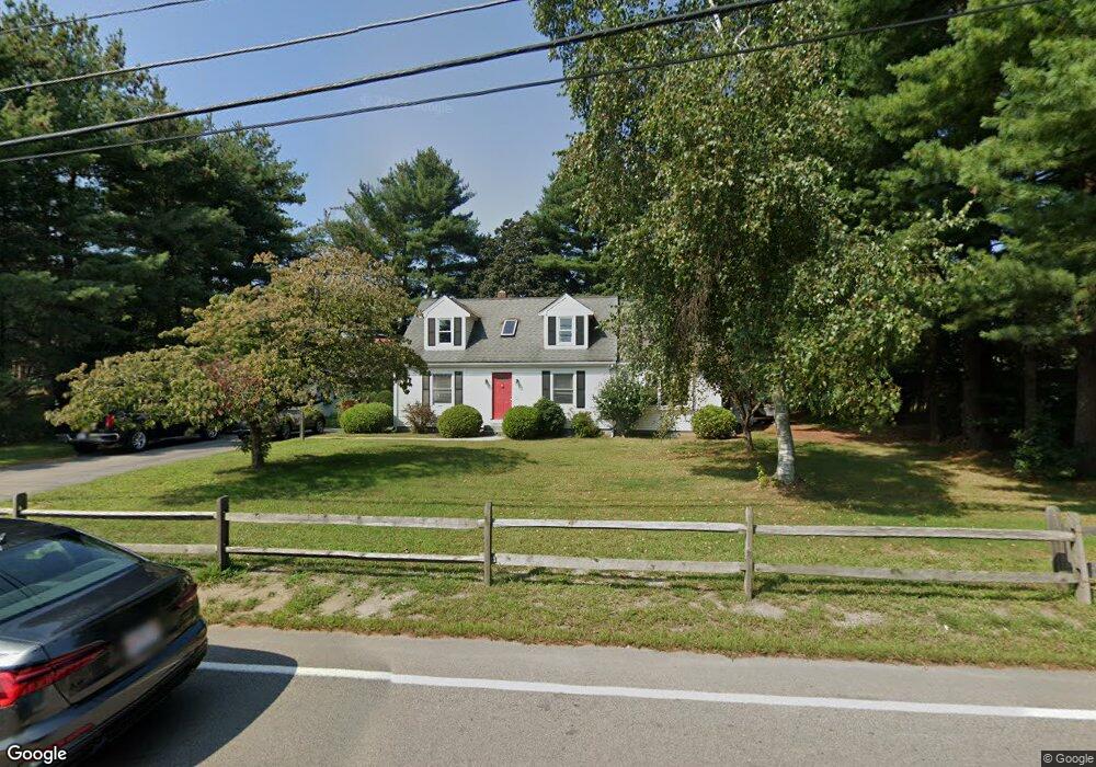
13 S Maple St Bellingham, MA 02019
Estimated Value: $452,687 - $557,000
3
Beds
1
Bath
1,474
Sq Ft
$339/Sq Ft
Est. Value
About This Home
This home is located at 13 S Maple St, Bellingham, MA 02019 and is currently estimated at $500,172, approximately $339 per square foot. 13 S Maple St is a home located in Norfolk County with nearby schools including Stall Brook Elementary School, Bellingham High School, and Mendon Mennonite School.
Ownership History
Date
Name
Owned For
Owner Type
Purchase Details
Closed on
Oct 8, 2025
Sold by
Boudreau Gary S and Boudreau Joann
Bought by
2025 Boudreau Ft and Boudreau
Current Estimated Value
Purchase Details
Closed on
Jul 19, 1982
Bought by
Boudreau Gary S and Boudreau Jo Ann
Create a Home Valuation Report for This Property
The Home Valuation Report is an in-depth analysis detailing your home's value as well as a comparison with similar homes in the area
Home Values in the Area
Average Home Value in this Area
Purchase History
| Date | Buyer | Sale Price | Title Company |
|---|---|---|---|
| 2025 Boudreau Ft | -- | -- | |
| Boudreau Gary S | $42,900 | -- |
Source: Public Records
Mortgage History
| Date | Status | Borrower | Loan Amount |
|---|---|---|---|
| Previous Owner | Boudreau Gary S | $55,000 |
Source: Public Records
Tax History Compared to Growth
Tax History
| Year | Tax Paid | Tax Assessment Tax Assessment Total Assessment is a certain percentage of the fair market value that is determined by local assessors to be the total taxable value of land and additions on the property. | Land | Improvement |
|---|---|---|---|---|
| 2025 | $4,390 | $349,500 | $130,500 | $219,000 |
| 2024 | $4,222 | $328,300 | $119,200 | $209,100 |
| 2023 | $4,069 | $311,800 | $113,500 | $198,300 |
| 2022 | $3,997 | $283,900 | $94,700 | $189,200 |
| 2021 | $3,858 | $267,700 | $94,700 | $173,000 |
| 2020 | $3,697 | $260,000 | $94,700 | $165,300 |
| 2019 | $3,615 | $254,400 | $94,700 | $159,700 |
| 2018 | $3,438 | $238,600 | $95,500 | $143,100 |
| 2017 | $3,347 | $233,400 | $95,500 | $137,900 |
| 2016 | $3,261 | $228,200 | $99,300 | $128,900 |
| 2015 | $3,126 | $219,400 | $95,500 | $123,900 |
| 2014 | $3,117 | $212,600 | $92,100 | $120,500 |
Source: Public Records
Map
Nearby Homes
- 1501 Old Bridge Ln Unit 1501
- 1303 Old Bridge Ln Unit 1303
- 501 Old Bridge Ln Unit 501
- 5-9 Debra Ln
- 151 Stone Ridge Rd
- 33 Stone Ridge Rd Unit 33
- 125 Blackstone St
- 1099 S Main St
- 109 Stone Ridge Rd Unit 109
- 89 Lakeview Ave
- 16 Danforth Way
- 11 Silver Ave
- 19 Geordan Ave
- 46 Douglas Dr
- 0 Prospect St
- 975 S Main St
- 222 Blackstone St
- 49 Horseshoe Dr
- 1 Clover Dr
- 123-125 Mendon St
- 19 S Maple St Unit 2 (2nd Flr)
- 19 S Maple St Unit 2nd flr/2
- 19 S Maple St Unit 2nd flr/1
- 19 S Maple St
- 8 S Maple St
- 8 S Maple St
- 191 Mechanic St
- 191 Mechanic St Unit 2
- 191 Mechanic St
- 2 S Maple (Lot 2)
- 2 S Maple St
- 32 S Maple St
- 0 S Maple St Unit 70776292
- 0 S Maple St Unit 70825766
- 0 S Maple St Unit 70880886
- 0 S Maple St Unit 71040038
- 0 S Maple St Unit 71074486
- 0 S Maple St Unit 71114289
- 0 S Maple St Unit 71241200
- 0 S Maple St Unit 71746447