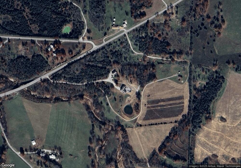
13 Secluded Buffalo, MO 65622
Estimated Value: $287,000 - $616,027
3
Beds
2
Baths
2,065
Sq Ft
$219/Sq Ft
Est. Value
About This Home
This home is located at 13 Secluded, Buffalo, MO 65622 and is currently estimated at $453,007, approximately $219 per square foot. 13 Secluded is a home located in Dallas County with nearby schools including Buffalo High School.
Ownership History
Date
Name
Owned For
Owner Type
Purchase Details
Closed on
Jan 22, 2026
Sold by
Brown Steven Russell and Brown Carre Anne
Bought by
Parrish Jeremy F
Current Estimated Value
Purchase Details
Closed on
Jun 11, 2018
Sold by
Brown Steven Russell and Brown Carre Anne
Bought by
Brown Steven R and Brown Carre
Purchase Details
Closed on
Oct 18, 2016
Sold by
Clift Tommy and Clift Cherie
Bought by
Brown Steven R and Brown Carre
Home Financials for this Owner
Home Financials are based on the most recent Mortgage that was taken out on this home.
Original Mortgage
$94,026
Interest Rate
3.46%
Mortgage Type
Commercial
Purchase Details
Closed on
Apr 23, 2007
Sold by
Brown Stephen R and Brown Carre
Bought by
Brown Steven R and Brown Carre
Create a Home Valuation Report for This Property
The Home Valuation Report is an in-depth analysis detailing your home's value as well as a comparison with similar homes in the area
Purchase History
| Date | Buyer | Sale Price | Title Company |
|---|---|---|---|
| Parrish Jeremy F | -- | None Listed On Document | |
| Brown Steven R | -- | None Available | |
| Brown Steven R | -- | None Available | |
| Brown Steven R | -- | Hogan Land Title Co |
Source: Public Records
Mortgage History
| Date | Status | Borrower | Loan Amount |
|---|---|---|---|
| Previous Owner | Brown Steven R | $94,026 |
Source: Public Records
Tax History
| Year | Tax Paid | Tax Assessment Tax Assessment Total Assessment is a certain percentage of the fair market value that is determined by local assessors to be the total taxable value of land and additions on the property. | Land | Improvement |
|---|---|---|---|---|
| 2025 | $3,106 | $64,540 | $0 | $0 |
| 2024 | $2,891 | $64,540 | $0 | $0 |
| 2023 | $2,860 | $59,540 | $0 | $0 |
| 2022 | $2,155 | $49,350 | $0 | $0 |
| 2021 | $2,156 | $44,430 | $0 | $0 |
| 2020 | $2,158 | $44,430 | $0 | $0 |
| 2019 | $2,111 | $44,430 | $0 | $0 |
| 2018 | $1,061 | $28,280 | $0 | $0 |
| 2017 | $1,061 | $24,910 | $0 | $0 |
| 2016 | $1,027 | $26,650 | $0 | $0 |
| 2015 | -- | $24,040 | $0 | $0 |
| 2014 | -- | $24,040 | $0 | $0 |
Source: Public Records
Map
Nearby Homes
- 000 Sterling Ln
- 447 Cumberland Rd
- 621 State Highway F
- 000 Ricky Rd
- 494 Red Top Rd
- 205 Red Top Rd
- 90 Twin Creek Trail
- TBD State Highway F
- 626 Red Top Rd
- 96 Alamo Dr
- 0 Cumberland Rd Unit 60313599
- 128 Somerset Rd
- 1992 S Ash St
- 0000 State Highway 38
- 318 Junior Ln
- 0000 Junior Ln
- 1257 State Road Aa
- 9 Golf Course Rd
- 1236 State Road Aa
- 64 State Highway 215
- 14 Secluded
- 611 Springfield Rd
- 10196 State Highway 38
- 10181 State Highway 38
- 16 Olive Rd
- 10218 State Highway 38
- 30 Olive Rd
- 48 Olive Rd
- 10224 State Highway 38
- 18 Country Ridge Ln
- 10219 State Highway 38
- 10226 State Highway 38
- 577 Springfield Rd
- 57 Olive Rd
- 10122 State Highway 38
- 2 White Ln
- 10258 State Highway 38
- 25 Country Ridge Ln
- 10243 State Highway 38
- 10238 State Highway 38
