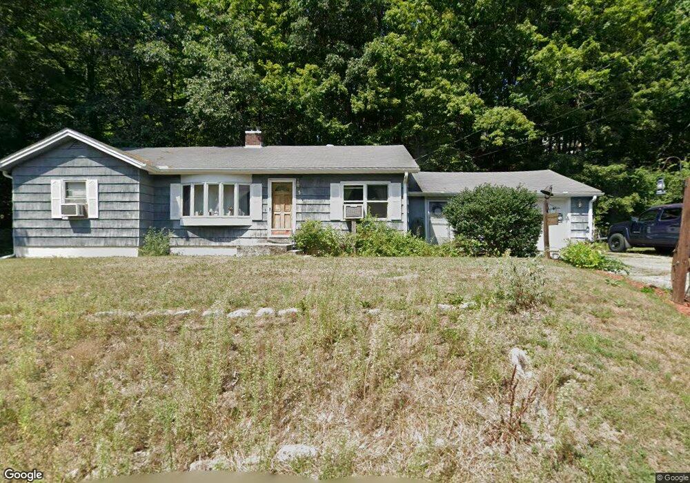
13 Shelter St Orange, MA 01364
Estimated Value: $272,000 - $328,000
3
Beds
1
Bath
1,260
Sq Ft
$233/Sq Ft
Est. Value
About This Home
This home is located at 13 Shelter St, Orange, MA 01364 and is currently estimated at $293,560, approximately $232 per square foot. 13 Shelter St is a home located in Franklin County with nearby schools including Fisher Hill and Ralph C Mahar Regional School.
Ownership History
Date
Name
Owned For
Owner Type
Purchase Details
Closed on
Aug 20, 2004
Sold by
Dike James E
Bought by
Phillips Nathan D and Phillips Lori B
Current Estimated Value
Home Financials for this Owner
Home Financials are based on the most recent Mortgage that was taken out on this home.
Original Mortgage
$127,200
Outstanding Balance
$63,202
Interest Rate
6.03%
Mortgage Type
Purchase Money Mortgage
Estimated Equity
$230,358
Purchase Details
Closed on
Nov 5, 1990
Sold by
Witty Virginia S
Bought by
Dike James E
Create a Home Valuation Report for This Property
The Home Valuation Report is an in-depth analysis detailing your home's value as well as a comparison with similar homes in the area
Home Values in the Area
Average Home Value in this Area
Purchase History
| Date | Buyer | Sale Price | Title Company |
|---|---|---|---|
| Phillips Nathan D | $159,000 | -- | |
| Dike James E | $2,000 | -- | |
| Dike James E | $2,000 | -- |
Source: Public Records
Mortgage History
| Date | Status | Borrower | Loan Amount |
|---|---|---|---|
| Open | Dike James E | $127,200 | |
| Closed | Dike James E | $23,850 | |
| Previous Owner | Dike James E | $50,000 |
Source: Public Records
Tax History Compared to Growth
Tax History
| Year | Tax Paid | Tax Assessment Tax Assessment Total Assessment is a certain percentage of the fair market value that is determined by local assessors to be the total taxable value of land and additions on the property. | Land | Improvement |
|---|---|---|---|---|
| 2025 | $41 | $246,900 | $24,100 | $222,800 |
| 2024 | $3,765 | $215,900 | $24,100 | $191,800 |
| 2023 | $3,558 | $198,100 | $21,700 | $176,400 |
| 2022 | $3,292 | $172,200 | $21,700 | $150,500 |
| 2021 | $3,022 | $150,700 | $42,200 | $108,500 |
| 2020 | $2,903 | $142,800 | $38,500 | $104,300 |
| 2019 | $2,651 | $117,700 | $33,300 | $84,400 |
| 2018 | $2,495 | $113,700 | $31,100 | $82,600 |
| 2017 | $2,414 | $113,700 | $31,100 | $82,600 |
| 2016 | $2,309 | $106,400 | $27,800 | $78,600 |
| 2015 | $2,305 | $111,000 | $29,600 | $81,400 |
| 2014 | $2,231 | $113,000 | $29,600 | $83,400 |
Source: Public Records
Map
Nearby Homes
- 166-168 W Main St
- 89 W Main St
- 222 W River St
- 43 W Main St
- 36 Summit St Unit A
- 36 Summit St Unit B
- 27 Chase St
- 12-14 E Main St
- 35 W River St
- 50 E Main St
- 114 S Main St
- 52 Mechanic St
- 102 Mechanic St
- 140 Mechanic St
- 121 Pleasant St
- 257 S Main St
- 295 S Main St
- 0 Oxbow Unit 73446570
- 490 S Main St
- 248 Holtshire Rd Unit Lot 2