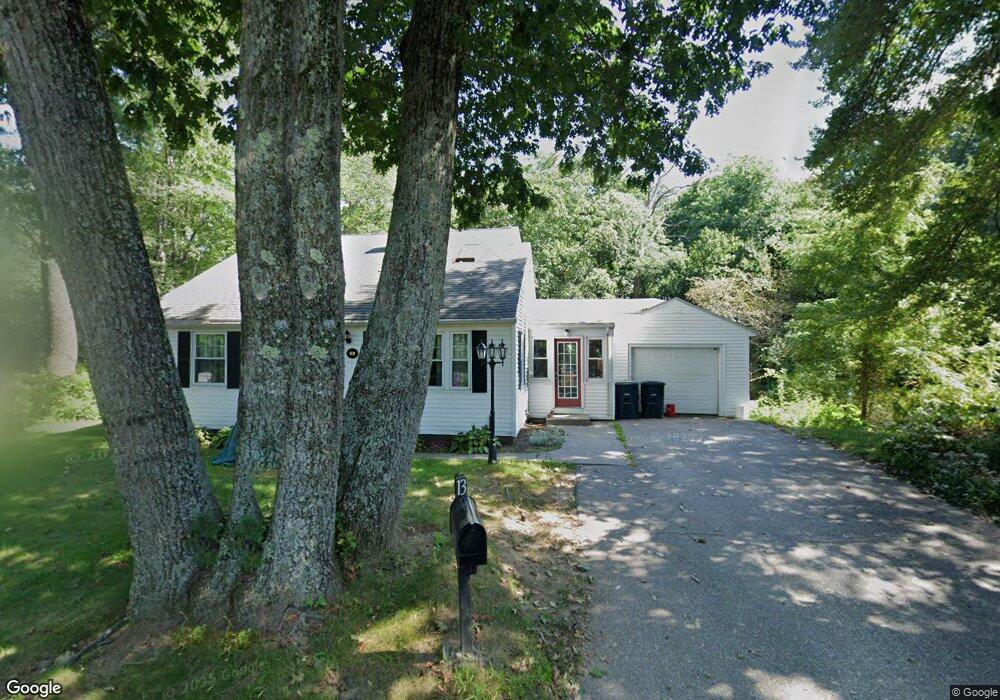
13 Shepard Rd Sturbridge, MA 01566
Estimated Value: $412,040 - $431,000
3
Beds
2
Baths
1,451
Sq Ft
$292/Sq Ft
Est. Value
About This Home
This home is located at 13 Shepard Rd, Sturbridge, MA 01566 and is currently estimated at $424,010, approximately $292 per square foot. 13 Shepard Rd is a home located in Worcester County with nearby schools including Burgess Elementary School, Tantasqua Regional Junior High School, and Tantasqua Regional High School.
Ownership History
Date
Name
Owned For
Owner Type
Purchase Details
Closed on
Mar 12, 1993
Sold by
Mayers Robert A and Mayers Tami
Bought by
Patridge Brian D and Partridge Diane
Current Estimated Value
Purchase Details
Closed on
Jun 27, 1990
Sold by
Mochi Marie J
Bought by
Mayers Robert A
Create a Home Valuation Report for This Property
The Home Valuation Report is an in-depth analysis detailing your home's value as well as a comparison with similar homes in the area
Home Values in the Area
Average Home Value in this Area
Purchase History
| Date | Buyer | Sale Price | Title Company |
|---|---|---|---|
| Patridge Brian D | $85,000 | -- | |
| Mayers Robert A | $90,000 | -- |
Source: Public Records
Mortgage History
| Date | Status | Borrower | Loan Amount |
|---|---|---|---|
| Open | Mayers Robert A | $90,000 | |
| Closed | Mayers Robert A | $25,000 | |
| Closed | Mayers Robert A | $20,000 |
Source: Public Records
Tax History
| Year | Tax Paid | Tax Assessment Tax Assessment Total Assessment is a certain percentage of the fair market value that is determined by local assessors to be the total taxable value of land and additions on the property. | Land | Improvement |
|---|---|---|---|---|
| 2025 | $5,493 | $344,800 | $80,400 | $264,400 |
| 2024 | $5,280 | $320,200 | $78,800 | $241,400 |
| 2023 | $4,976 | $275,400 | $68,600 | $206,800 |
| 2022 | $4,795 | $250,400 | $62,300 | $188,100 |
| 2021 | $4,281 | $225,100 | $59,400 | $165,700 |
| 2020 | $4,281 | $225,100 | $59,400 | $165,700 |
| 2019 | $4,014 | $209,600 | $61,200 | $148,400 |
| 2018 | $3,855 | $198,300 | $58,200 | $140,100 |
| 2017 | $3,669 | $189,100 | $55,900 | $133,200 |
| 2016 | $3,523 | $183,400 | $54,300 | $129,100 |
| 2015 | $3,475 | $180,600 | $54,300 | $126,300 |
Source: Public Records
Map
Nearby Homes
- 8 Blueberry Ln
- 74 Fairview Park Rd
- 69 Farquhar Rd
- Lot 1 Berry Farms Road-2 Acre
- Lot B-6 River Rd
- 3 Berry Farms Road - Jv
- 74 River Rd
- 6 Berry Farms Rd Unit 3
- 6 Berry Farms Rd Unit 63
- 6 Berry Farms Rd Unit 64
- 6 Berry Farms Rd Unit 6
- 85 Idlewood St
- 170 Shepard Rd
- 0 Fiske Hill Rd
- 9 Haynes St
- 57 Old Sturbridge Rd
- 39 Park Ave
- 43 Park Ave
- 83 Plimpton St
- 402 Pleasant Pkwy
Your Personal Tour Guide
Ask me questions while you tour the home.