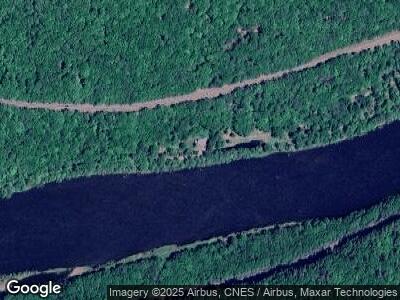
13 Tow Path Rd Pond Eddy, NY 12770
Estimated Value: $313,000 - $530,000
4
Beds
3
Baths
2,320
Sq Ft
$194/Sq Ft
Est. Value
About This Home
This home is located at 13 Tow Path Rd, Pond Eddy, NY 12770 and is currently estimated at $449,487, approximately $193 per square foot. 13 Tow Path Rd is a home located in Sullivan County.
Ownership History
Date
Name
Owned For
Owner Type
Purchase Details
Closed on
Oct 21, 2005
Sold by
Wilson Henry
Bought by
Wilson-Moran Alaska Comm Property Trust
Current Estimated Value
Purchase Details
Closed on
Apr 9, 2005
Sold by
Reed Susan
Bought by
Wilson Henry
Purchase Details
Closed on
Oct 18, 2004
Sold by
Fedasiuk Bohdan D
Bought by
Fini Aldo
Purchase Details
Closed on
Aug 26, 2002
Sold by
Kennedy Lawrence X
Bought by
Gurda Andrew P
Purchase Details
Closed on
Jul 20, 2001
Sold by
Wilson Stephanie P
Bought by
Reed Susan
Create a Home Valuation Report for This Property
The Home Valuation Report is an in-depth analysis detailing your home's value as well as a comparison with similar homes in the area
Home Values in the Area
Average Home Value in this Area
Purchase History
| Date | Buyer | Sale Price | Title Company |
|---|---|---|---|
| Wilson-Moran Alaska Comm Property Trust | -- | William D. Bavoso | |
| Wilson Henry | $150,000 | William D. Bavoso | |
| Fini Aldo | $149,000 | Robert Green | |
| Gurda Andrew P | $50,000 | Martin Kennedy | |
| Reed Susan | -- | Edward M Cooke |
Source: Public Records
Tax History Compared to Growth
Tax History
| Year | Tax Paid | Tax Assessment Tax Assessment Total Assessment is a certain percentage of the fair market value that is determined by local assessors to be the total taxable value of land and additions on the property. | Land | Improvement |
|---|---|---|---|---|
| 2024 | $6,990 | $219,000 | $67,600 | $151,400 |
| 2023 | $6,990 | $219,000 | $67,600 | $151,400 |
| 2022 | $7,198 | $219,000 | $67,600 | $151,400 |
| 2021 | $7,215 | $219,000 | $67,600 | $151,400 |
| 2020 | $7,036 | $219,000 | $67,600 | $151,400 |
| 2019 | $6,949 | $219,000 | $67,600 | $151,400 |
| 2018 | $6,979 | $219,000 | $67,600 | $151,400 |
| 2017 | $6,949 | $219,000 | $67,600 | $151,400 |
| 2016 | $6,865 | $219,000 | $67,600 | $151,400 |
| 2015 | -- | $219,000 | $67,600 | $151,400 |
| 2014 | -- | $219,000 | $67,600 | $151,400 |
Source: Public Records
Map
Nearby Homes
- 00 Tuthill Rd
- 0 Parkers Glen Rd Unit PWBPW250224
- 2383 State Route 97
- 29 Bloom Rd
- Lot 1 Van Tuyl Rd
- 0 Van Tuyl Rd
- 0 New York 97
- 575 Parkers Glen Rd
- 136 Happy Hollow Dr
- Lot 75 Happy Hollow Dr
- 174 Lee Rd
- 110 Happy Hollow Dr
- 0 Erie Rd Unit 22-148
- Lots 16-19 Cree Rd
- 0 Cree Rd
- 144 Onandaga Rd
- 0 Oneida Rd Unit PWBPW250533
- 125 Mapes Rd
- 0 Neversink Rd
- 0 Delaware Rd
- 13 Tow Path Rd
- 2632 State Route 97
- 2661 State Route 97
- 2680 State Route 97
- 142 Tuthill Rd
- 96 Tow Path Rd
- 2702 State Route 97
- 2700 State Route 97
- 70 Tuthill Rd
- 48 Tuthill Rd
- 21 Tuthill Rd
- 173 Tuthill Rd
- 0 Tuthill Rd Unit ONEH6325224
- 0 Tuthill Rd Unit 4849805
- 0 Tuthill Rd
- 45 Tuthill Rd
- 134 Tow Path Rd
- 175 Tow Path Rd
- 13 Parkers Glen Rd
- 142 Tow Path Rd
