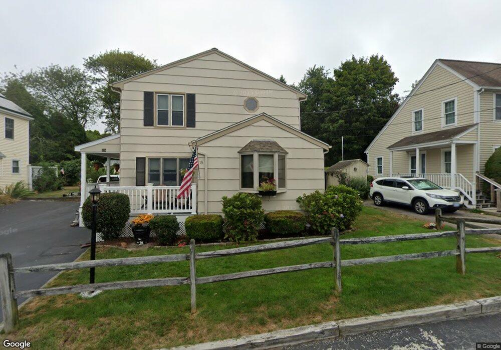
13 Westside Rd Wakefield, RI 02879
Estimated Value: $747,909 - $980,000
2
Beds
2
Baths
1,552
Sq Ft
$572/Sq Ft
Est. Value
About This Home
This home is located at 13 Westside Rd, Wakefield, RI 02879 and is currently estimated at $887,227, approximately $571 per square foot. 13 Westside Rd is a home located in Washington County with nearby schools including South Kingstown High School.
Ownership History
Date
Name
Owned For
Owner Type
Purchase Details
Closed on
Oct 25, 2022
Sold by
Littlefield Maureen E and Littlefield Robert E
Bought by
R E & M E Littlefield Lt
Current Estimated Value
Purchase Details
Closed on
Sep 15, 1977
Bought by
Littlefield Maureen E
Create a Home Valuation Report for This Property
The Home Valuation Report is an in-depth analysis detailing your home's value as well as a comparison with similar homes in the area
Home Values in the Area
Average Home Value in this Area
Purchase History
| Date | Buyer | Sale Price | Title Company |
|---|---|---|---|
| R E & M E Littlefield Lt | -- | None Available | |
| Littlefield Maureen E | -- | -- |
Source: Public Records
Mortgage History
| Date | Status | Borrower | Loan Amount |
|---|---|---|---|
| Previous Owner | Littlefield Maureen E | $115,000 | |
| Previous Owner | Littlefield Maureen E | $153,000 | |
| Previous Owner | Littlefield Maureen E | $150,000 |
Source: Public Records
Tax History
| Year | Tax Paid | Tax Assessment Tax Assessment Total Assessment is a certain percentage of the fair market value that is determined by local assessors to be the total taxable value of land and additions on the property. | Land | Improvement |
|---|---|---|---|---|
| 2025 | $5,260 | $588,400 | $351,400 | $237,000 |
| 2024 | $5,432 | $491,600 | $288,200 | $203,400 |
| 2023 | $5,432 | $491,600 | $288,200 | $203,400 |
| 2022 | $5,383 | $491,600 | $288,200 | $203,400 |
| 2021 | $4,787 | $331,300 | $177,500 | $153,800 |
| 2020 | $4,787 | $331,300 | $177,500 | $153,800 |
| 2019 | $4,787 | $331,300 | $177,500 | $153,800 |
| 2018 | $4,797 | $305,900 | $167,100 | $138,800 |
| 2017 | $4,683 | $305,900 | $167,100 | $138,800 |
| 2016 | $4,616 | $305,900 | $167,100 | $138,800 |
| 2015 | $4,451 | $286,800 | $151,900 | $134,900 |
| 2014 | $4,440 | $286,800 | $151,900 | $134,900 |
Source: Public Records
Map
Nearby Homes
- 14 E Pointe Ct Unit 14
- 210 Washington St
- 6 MacAlder St
- 1185 Succotash Rd
- 1138 Succotash Rd
- 1140 Succotash Rd
- 27 Holden Rd
- 975 Matunuck Beach Rd
- 17 Goose Island Rd
- 62 Flintstone Rd
- 2321 Post Rd
- 0 Hemlock Ave
- 0 Point Judith Rd
- 550 Cards Pond Rd
- 262 Wood Hill Rd
- 120 Chestnut Ave
- 100 Spartina Cove Way
- 28 Palm Beach Ave
- 47 Saint James Rd
- 609 Point Judith Rd
- 17 Westside Rd
- 5 Westside Rd
- 16 Westside Rd
- 25 Westside Rd
- 393 Succotash Rd
- 393 Succotash Rd Unit 4
- 29 Windswept Dr
- 24 Westside Rd
- 33 Windswept Dr
- 374 Succotash Rd
- 399 Succotash Rd
- 0 Windswept Dr
- 351 Succotash Rd
- 396 Succotash Rd
- 401 Succotash Rd
- 401 Succotash Rd Unit 2
- 21 Windswept Dr
- 35 Prospect Rd Unit 37
- 35 Prospect Rd
- 45 Old Succotash Rd
Your Personal Tour Guide
Ask me questions while you tour the home.