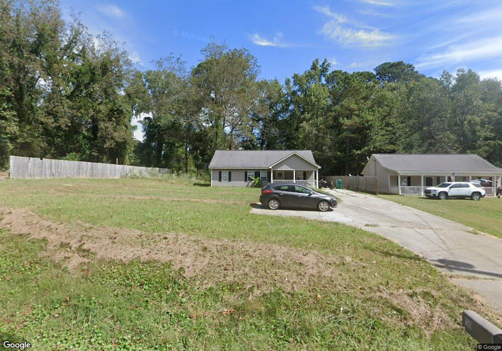
130 3rd St W Fruithurst, AL 36262
Estimated Value: $126,000 - $192,000
Studio
--
Bath
1,232
Sq Ft
$130/Sq Ft
Est. Value
About This Home
This home is located at 130 3rd St W, Fruithurst, AL 36262 and is currently estimated at $160,744, approximately $130 per square foot. 130 3rd St W is a home.
Ownership History
Date
Name
Owned For
Owner Type
Purchase Details
Closed on
Sep 29, 2021
Sold by
Teresa Harlan
Bought by
Harland Teresa and Harlan Brandon
Current Estimated Value
Purchase Details
Closed on
Mar 14, 2021
Sold by
Joe Harlan Erby and Joe Teresa
Bought by
Hunt Jennifer L
Home Financials for this Owner
Home Financials are based on the most recent Mortgage that was taken out on this home.
Original Mortgage
$116,181
Interest Rate
2.7%
Mortgage Type
New Conventional
Purchase Details
Closed on
Feb 8, 2011
Sold by
Knowlton Karen G
Bought by
Harlan Erby Joe and Harlan Teresa
Create a Home Valuation Report for This Property
The Home Valuation Report is an in-depth analysis detailing your home's value as well as a comparison with similar homes in the area
Purchase History
| Date | Buyer | Sale Price | Title Company |
|---|---|---|---|
| Harland Teresa | -- | None Listed On Document | |
| Hunt Jennifer L | $115,000 | Tinney John A | |
| Hunt Jennifer L | $115,000 | None Listed On Document | |
| Harlan Erby Joe | $28,626 | -- |
Source: Public Records
Mortgage History
| Date | Status | Borrower | Loan Amount |
|---|---|---|---|
| Previous Owner | Hunt Jennifer L | $116,181 |
Source: Public Records
Tax History
| Year | Tax Paid | Tax Assessment Tax Assessment Total Assessment is a certain percentage of the fair market value that is determined by local assessors to be the total taxable value of land and additions on the property. | Land | Improvement |
|---|---|---|---|---|
| 2024 | $407 | $17,560 | $1,080 | $16,480 |
| 2023 | $430 | $15,980 | $1,000 | $14,980 |
| 2022 | $392 | $15,980 | $1,000 | $14,980 |
| 2021 | $745 | $15,200 | $1,000 | $14,200 |
| 2020 | $711 | $14,500 | $1,000 | $13,500 |
| 2019 | $711 | $14,500 | $1,000 | $13,500 |
| 2018 | $740 | $15,100 | $1,000 | $14,100 |
| 2017 | $740 | $15,100 | $1,000 | $14,100 |
| 2016 | $740 | $15,100 | $0 | $0 |
| 2015 | $715 | $75,500 | $0 | $0 |
| 2014 | $715 | $75,500 | $0 | $0 |
| 2013 | $715 | $76,200 | $0 | $0 |
Source: Public Records
Map
Nearby Homes
- 285 3rd St E
- 17438 Highway 78
- 17438 U S 78
- 42 County Road 82
- 0 County Road 49 Unit 10505681
- 220224 County Road 49 Unit 1
- 0 County Road 49 Unit 21416550
- 22024 County Road 49
- 0 County Road 65 Unit 24627633
- 264 County Road 267
- 0 County Road 66 Unit 413 Ac
- 0 Old Georgia Rd
- 1365 County Road 290
- 0 County Road 492 Unit 1 21400533
- 0 County Road 492 Unit 26114166
- 12891 County Road 66
- TRACT 1 County Road 408
- 0 Frances Rd Unit 10674656
- 7016 County Road 65
- 11386 U S 78
- 186 3rd St W
- 15948 Highway 78
- 201-269 3rd St W
- 161 1st St W
- 253 School St
- 355 County Road 449
- 355 County Road 449
- 151 4th St W
- 125 4th St W
- 0 4th St W Unit 7 LOTS 523169
- 0 4th St W Unit 3188451
- 141 1st St W
- 120 W 1st Ave
- 120 1st Ave W
- 133 1st St W
- 285 3rd St W
- 116 5th St W
- 16194 Highway 78
- 51 1st St W
- 165 County Road 33
Your Personal Tour Guide
Ask me questions while you tour the home.