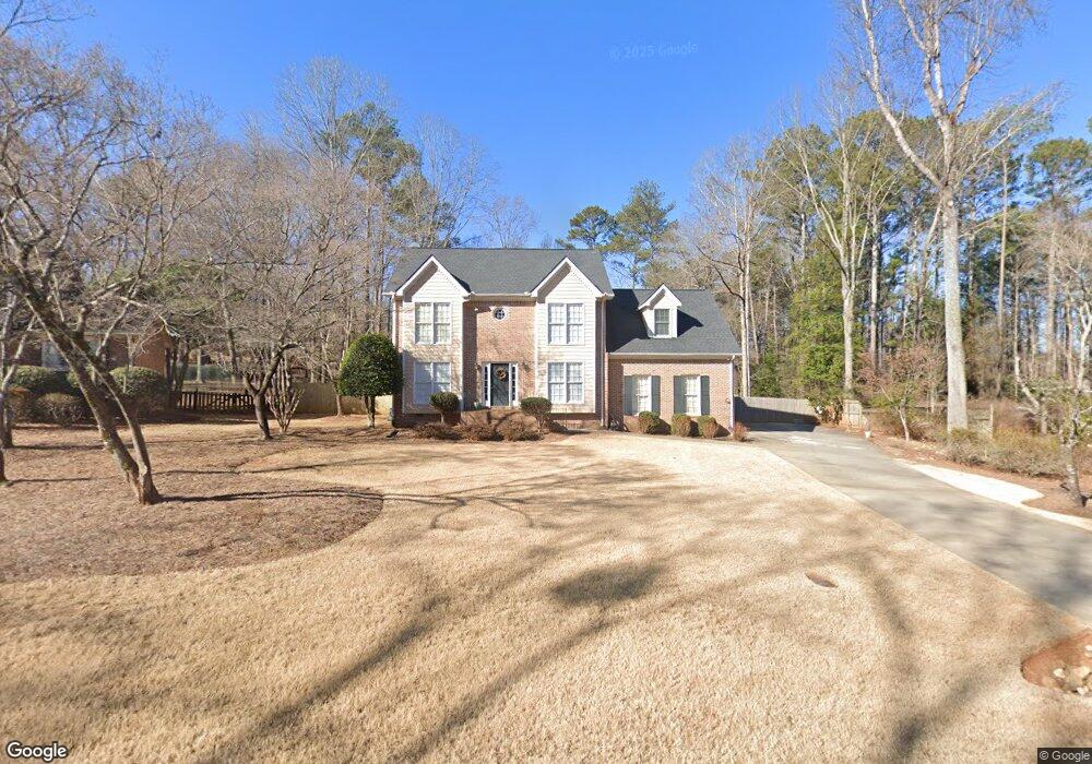
130 Carlisle Ct Bogart, GA 30622
Estimated Value: $426,894 - $453,000
--
Bed
1
Bath
2,931
Sq Ft
$149/Sq Ft
Est. Value
About This Home
This home is located at 130 Carlisle Ct, Bogart, GA 30622 and is currently estimated at $436,974, approximately $149 per square foot. 130 Carlisle Ct is a home located in Clarke County with nearby schools including Cleveland Road Elementary School, Burney-Harris-Lyons Middle School, and Clarke Central High School.
Ownership History
Date
Name
Owned For
Owner Type
Purchase Details
Closed on
Jun 30, 1997
Sold by
Drake Darryl Drake and Drake Sheila R
Bought by
Wilder Margaret A
Current Estimated Value
Purchase Details
Closed on
Mar 29, 1993
Sold by
Gay Jimmy A
Bought by
Drake Darryl Drake and Drake Sheila R
Purchase Details
Closed on
May 31, 1991
Sold by
Trust Company Bank Of Northeast
Bought by
Gay Jimmy A
Purchase Details
Closed on
Jan 26, 1991
Sold by
Eagleton John W
Bought by
Trust Company Bank Of Northeast
Create a Home Valuation Report for This Property
The Home Valuation Report is an in-depth analysis detailing your home's value as well as a comparison with similar homes in the area
Home Values in the Area
Average Home Value in this Area
Purchase History
| Date | Buyer | Sale Price | Title Company |
|---|---|---|---|
| Wilder Margaret A | $147,500 | -- | |
| Drake Darryl Drake | $144,000 | -- | |
| Gay Jimmy A | $12,000 | -- | |
| Trust Company Bank Of Northeast | $20,000 | -- |
Source: Public Records
Tax History Compared to Growth
Tax History
| Year | Tax Paid | Tax Assessment Tax Assessment Total Assessment is a certain percentage of the fair market value that is determined by local assessors to be the total taxable value of land and additions on the property. | Land | Improvement |
|---|---|---|---|---|
| 2025 | $2,459 | $135,908 | $18,000 | $117,908 |
| 2024 | $2,459 | $128,716 | $18,000 | $110,716 |
| 2023 | $1,195 | $119,348 | $18,000 | $101,348 |
| 2022 | $2,443 | $105,732 | $18,000 | $87,732 |
| 2021 | $2,345 | $88,854 | $16,000 | $72,854 |
| 2020 | $2,312 | $86,437 | $16,000 | $70,437 |
| 2019 | $2,243 | $80,114 | $16,000 | $64,114 |
| 2018 | $2,211 | $77,825 | $16,000 | $61,825 |
| 2017 | $2,149 | $73,365 | $16,000 | $57,365 |
| 2016 | $2,098 | $71,793 | $16,000 | $55,793 |
| 2015 | $2,053 | $70,476 | $16,000 | $54,476 |
| 2014 | $2,154 | $73,238 | $16,000 | $57,238 |
Source: Public Records
Map
Nearby Homes
- 190 W Huntington Rd
- 240 W Huntington Rd
- 682 Chesterfield Rd
- 241 Meeler Cir
- 212 Huntington Shoals Dr
- 637 Huntington Rd Unit B1
- 141 Huntington Shoals Dr
- 470 Huntington Rd Unit 5
- 532 Huntington Rd Unit 7
- 100 Hanover Dr
- 150 Callaway Dr
- 256 Cherokee Ridge
- 178 Ben Burton Cir
- 211 Littleton Way
- 240 Cleveland Rd Unit 105
- 170 Huntington Ct
- 450 River Bottom Rd
- 120 Carlisle Ct
- 140 Carlisle Ct
- 0 Carlisle Ct Unit 8395233
- 0 Carlisle Ct Unit 8619627
- 0 Carlisle Ct
- 131 Chesterfield Rd
- 121 Chesterfield Rd
- 141 Chesterfield Rd
- 125 Chesterfield Rd
- 135 Carlisle Ct
- 150 Carlisle Ct
- 210 W Huntington Rd
- 220 W Huntington Rd
- 151 Chesterfield Rd
- 111 Chesterfield Rd
- 161 Chesterfield Rd
- 155 Carlisle Ct
- 160 Carlisle Ct
- 250 W Huntington Rd
- 171 Chesterfield Rd