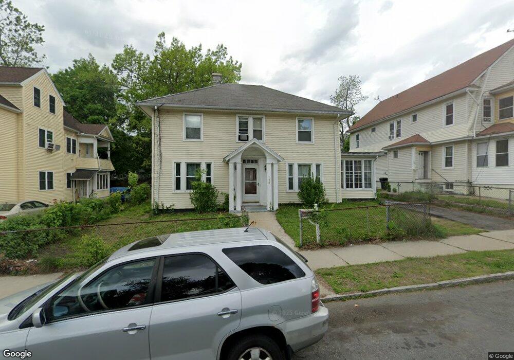
130 Dunmoreland St Springfield, MA 01109
Upper Hill NeighborhoodEstimated Value: $276,000 - $310,000
4
Beds
2
Baths
1,821
Sq Ft
$159/Sq Ft
Est. Value
About This Home
This home is located at 130 Dunmoreland St, Springfield, MA 01109 and is currently estimated at $290,262, approximately $159 per square foot. 130 Dunmoreland St is a home located in Hampden County with nearby schools including Mary M. Walsh Elementary School, M Marcus Kiley Middle, and Springfield High School of Science and Technology.
Ownership History
Date
Name
Owned For
Owner Type
Purchase Details
Closed on
Sep 23, 2016
Sold by
Washington Robert K
Bought by
Watson Meggan M
Current Estimated Value
Create a Home Valuation Report for This Property
The Home Valuation Report is an in-depth analysis detailing your home's value as well as a comparison with similar homes in the area
Home Values in the Area
Average Home Value in this Area
Purchase History
| Date | Buyer | Sale Price | Title Company |
|---|---|---|---|
| Watson Meggan M | $47,500 | -- |
Source: Public Records
Tax History Compared to Growth
Tax History
| Year | Tax Paid | Tax Assessment Tax Assessment Total Assessment is a certain percentage of the fair market value that is determined by local assessors to be the total taxable value of land and additions on the property. | Land | Improvement |
|---|---|---|---|---|
| 2025 | $3,663 | $233,600 | $31,100 | $202,500 |
| 2024 | $3,567 | $222,100 | $31,100 | $191,000 |
| 2023 | $3,463 | $203,100 | $28,300 | $174,800 |
| 2022 | $3,054 | $162,300 | $26,400 | $135,900 |
| 2021 | $3,079 | $162,900 | $18,700 | $144,200 |
| 2020 | $2,951 | $151,100 | $18,700 | $132,400 |
| 2019 | $2,944 | $149,600 | $16,000 | $133,600 |
| 2018 | $2,795 | $142,000 | $16,000 | $126,000 |
| 2017 | $2,634 | $134,000 | $15,000 | $119,000 |
| 2016 | $2,522 | $128,300 | $15,000 | $113,300 |
| 2015 | $2,502 | $127,200 | $15,000 | $112,200 |
Source: Public Records
Map
Nearby Homes
- 88 Dunmoreland St
- 21 Westford Cir
- 179 Albemarle St
- 124-126 Westford Cir
- 140 Northampton Ave
- 162 Northampton Ave
- 19 Westford Ave
- 135-137 Suffolk St
- 290 Quincy St
- 62-64 Bristol St
- 129 Eastern Ave
- 158 Norfolk St
- 0 NS (24) Alden St
- 111 Marlborough St
- 43 Colonial Ave
- 52-56 Andrew St
- 65 Montrose St
- 67 Carlisle St
- 705-707 Union St
- 58 Willard Ave
- 136 Dunmoreland St Unit 138
- 124 Dunmoreland St Unit 126
- 127 Massachusetts Ave
- 121-123 Massachusetts Ave
- 133 Massachusetts Ave
- 116 Dunmoreland St Unit 118
- 121 Massachusetts Ave Unit 123
- 121 Massachusetts Ave Unit 3
- 121 Massachusetts Ave Unit 2
- 123 Massachusetts Ave Unit 1
- 52 Westford Cir Unit 54
- 46 Westford Cir Unit 48
- 137 Massachusetts Ave
- 129 Dunmoreland St
- 133 Dunmoreland St Unit 135
- 123 Dunmoreland St
- 119 Massachusetts Ave
- 111-113 Massachusetts Ave
- 110 Dunmoreland St Unit 112
- 110 Dunmoreland St Unit 1