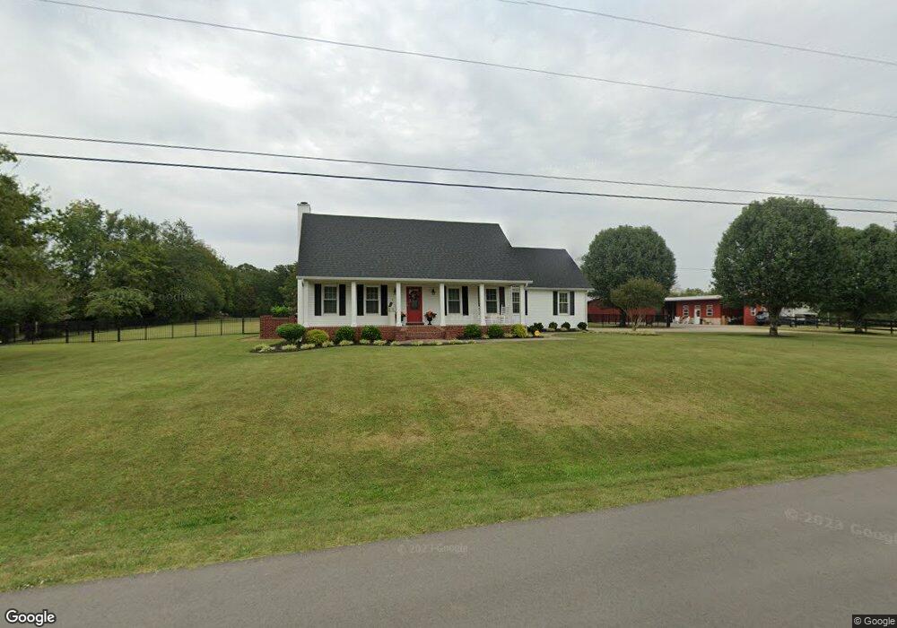
130 Elmhurst Dr Murfreesboro, TN 37129
Estimated Value: $335,000 - $588,834
Studio
3
Baths
1,479
Sq Ft
$308/Sq Ft
Est. Value
About This Home
This home is located at 130 Elmhurst Dr, Murfreesboro, TN 37129 and is currently estimated at $456,209, approximately $308 per square foot. 130 Elmhurst Dr is a home located in Rutherford County with nearby schools including Walter Hill Elementary School, Siegel Middle School, and Siegel High School.
Ownership History
Date
Name
Owned For
Owner Type
Purchase Details
Closed on
Jan 3, 2012
Sold by
Armstrong Scott Wayne
Bought by
Armstrong Scott Wayne
Current Estimated Value
Purchase Details
Closed on
Jan 15, 2010
Sold by
Armstrong Kelly Ann
Bought by
Armstrong Scott Wayne
Purchase Details
Closed on
Sep 21, 2009
Sold by
Armstrong Scott W
Bought by
Armstrong Scott Wayne
Home Financials for this Owner
Home Financials are based on the most recent Mortgage that was taken out on this home.
Original Mortgage
$170,000
Interest Rate
5.11%
Create a Home Valuation Report for This Property
The Home Valuation Report is an in-depth analysis detailing your home's value as well as a comparison with similar homes in the area
Home Values in the Area
Average Home Value in this Area
Purchase History
| Date | Buyer | Sale Price | Title Company |
|---|---|---|---|
| Armstrong Scott Wayne | -- | -- | |
| Armstrong Scott Wayne | -- | -- | |
| Armstrong Scott Wayne | -- | -- |
Source: Public Records
Mortgage History
| Date | Status | Borrower | Loan Amount |
|---|---|---|---|
| Previous Owner | Armstrong Scott Wayne | $170,000 |
Source: Public Records
Tax History
| Year | Tax Paid | Tax Assessment Tax Assessment Total Assessment is a certain percentage of the fair market value that is determined by local assessors to be the total taxable value of land and additions on the property. | Land | Improvement |
|---|---|---|---|---|
| 2025 | $2,292 | $122,150 | $31,650 | $90,500 |
| 2024 | $2,292 | $122,150 | $31,650 | $90,500 |
| 2023 | $2,198 | $117,150 | $31,650 | $85,500 |
| 2022 | $1,893 | $117,150 | $31,650 | $85,500 |
| 2021 | $1,828 | $82,350 | $17,550 | $64,800 |
| 2020 | $1,828 | $82,350 | $17,550 | $64,800 |
| 2019 | $1,828 | $82,350 | $17,550 | $64,800 |
Source: Public Records
Map
Nearby Homes
- 0 Leanna Rd
- 4025 Leanna Rd
- 4030 Sulphur Springs Rd
- 0 Leanna Swamp Road Trac 13
- 4204 Leanna Rd
- 1123 Bramble Trail
- 3543 John Richards Dr
- 3533 John Richards Dr
- 3811 Acorn Ave
- 1908 Pennington Dr
- 3523 John Richards Dr
- 3521 John Richards Dr
- 3505 Chianti Cir
- 3433 Cortona Way
- 3538 Winterfell Dr
- 1113 Dunkirk Ln
- 3518 Winterfell Dr
- 3509 Winterfell Dr
- 3187 N Thompson Ln
- 3514 Winterfell Dr
- 136 Elmhurst Dr
- 129 Elmhurst Dr
- 140 Elmhurst Dr
- 133 Elmhurst Dr
- 135 Wyndham Cove
- 125 Wyndham Cove
- 137 Elmhurst Dr
- 110 Overcast Ct
- 141 Elmhurst Dr
- 144 Elmhurst Dr
- 114 Overcast Ct
- 106 Overcast Ct
- 145 Elmhurst Dr
- 2206 Hollow Tree Way
- 134 Wyndham Cove
- 130 Wyndham Cove
- 102 Overcast Ct
- 113 Overcast Ct
- 124 Wyndham Cove
- 946 Allen Rd
Your Personal Tour Guide
Ask me questions while you tour the home.